A four-mile hike to place two more caches in Jamul
I haven't been feeling well lately, but I've gotten out of the house the last two days to take long hikes. Thursday, I hiked part of the way up Mt. McGinty to replace a muggled cache. It was so well-hidden, I don't know how someone found it, unless it was simply by accident as they tried to scramble up or down the steep embankment near the lonely tree.
While I was up there, I put a travel bug I intended to drop somewhere during the Death Valley adventure into one of my ammo can caches.
Finally, on the way down the hill, I checked one of my containers, and discovered the latch was broken, preventing it from sealing tight. I replaced it with a pill container hidden in another one of my rusty cans.
- - - - - - - - - - - - -
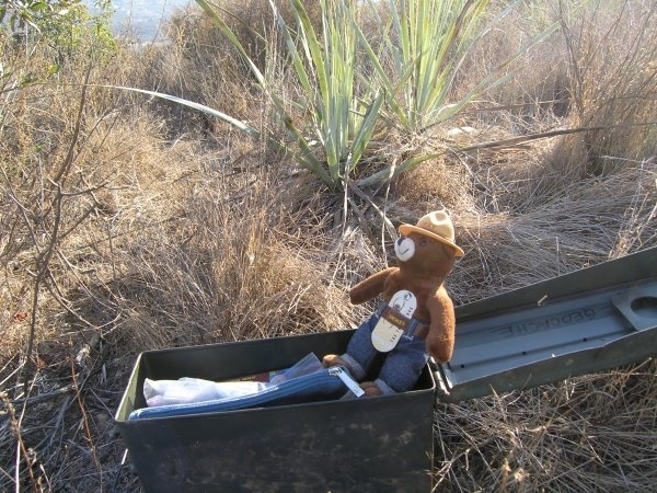
Since my gas gauge is showing only a quarter of a tank of gas, and because I really couldn't spend money on gas right now, after looking at the credit card balance after my Christmas purchases, I decided to go to another nearby location Friday. I put three ready-to-go caches in my daypack, including a magnetic keyholder and a well-stocked ammo can, and took off for the Hollenbeck Canyon area.
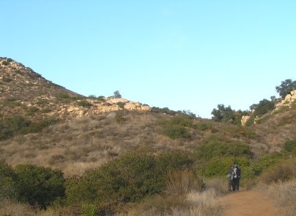
When I got to the trailhead, which is only about three miles from my house, I reset the trip odometer on the GPSr before starting out.
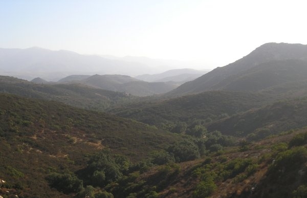
The day was warm and beautiful, although the air was hazy so the spectacular views that can be seen along the trail were diffused.
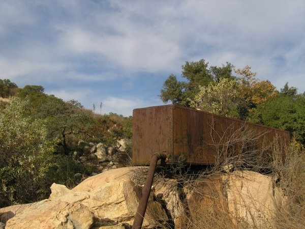
After walking more than a mile and a half, I came upon a "Little Rusty Box." Actually, it is big, but not like Night Hunter's BRB (Big Rusty Box).
There were piles of rocks nearby where I could have hidden the ammo can, but I thought the key holder would be better because it will force people to find their way around it and really look at this relic from a bygone day way out in the "wilderness."
I did feel guilty about placing the Micro there because it is a long walk from any of the trailheads, so I walked a bit further and put out the ammo can. Just afer confirming the coordinates, I heard voices. Off in the distance, I saw two men. There are many criss-crossing paths through this area, probably created by all the illegal alien traffic. These two young men were very likely illegals. We spoke broken English and broken Spanish to each other and they went on their way in front of me.
The sun was getting low in the sky, so I started back up the trail. It was easier going now that the weight of the ammo can was out of my day pack.
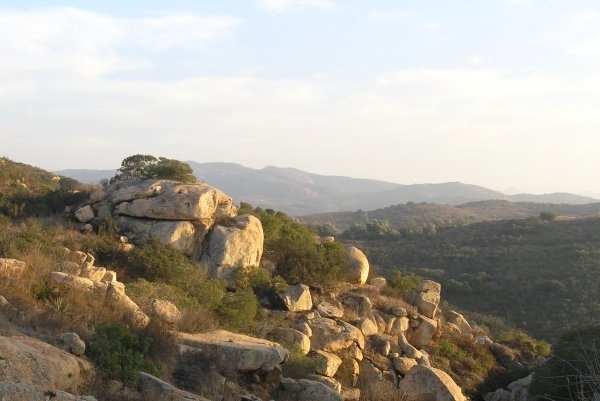
At the very top, near my "Canyon View," I took some pictures of the late afternoon light.
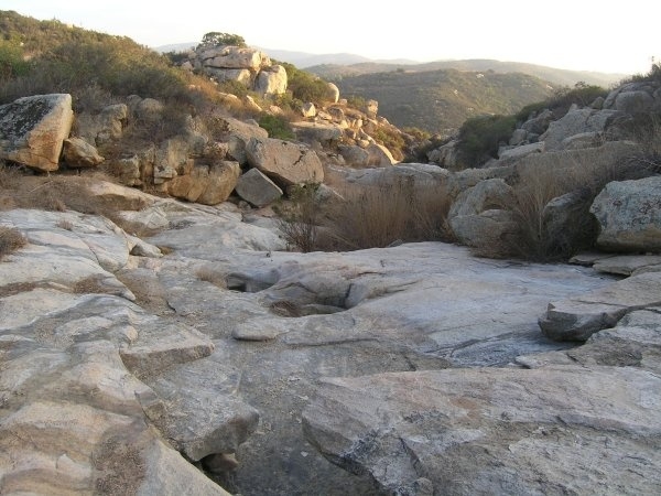
As I looked around, I noticed what looked like one of NightHunter's "Stone Ruinations." It was a rock wall at the top of the canyon. I walked around the trail and made my way down to the remains of a dam. At one time, it might have held water, but behind the dam now, it is full of sandy sediment.
I took a picture of the water-smoothed rocks below The "Stone Ruination" dam.
It was an absolutely beautiful day and I was glad I got out to see it. I still didn't feel well, but it was good to get physical exercise during the day instead of just sitting at home looking at the computer monitor.
When I got back to the car and looked at the trip odometer, it reported a distance of four miles. The elevation change was almost 500 feet to the location of the ammo can cache which I named, "Elevation 999."
While I was up there, I put a travel bug I intended to drop somewhere during the Death Valley adventure into one of my ammo can caches.
Finally, on the way down the hill, I checked one of my containers, and discovered the latch was broken, preventing it from sealing tight. I replaced it with a pill container hidden in another one of my rusty cans.
Since my gas gauge is showing only a quarter of a tank of gas, and because I really couldn't spend money on gas right now, after looking at the credit card balance after my Christmas purchases, I decided to go to another nearby location Friday. I put three ready-to-go caches in my daypack, including a magnetic keyholder and a well-stocked ammo can, and took off for the Hollenbeck Canyon area.
When I got to the trailhead, which is only about three miles from my house, I reset the trip odometer on the GPSr before starting out.
The day was warm and beautiful, although the air was hazy so the spectacular views that can be seen along the trail were diffused.
After walking more than a mile and a half, I came upon a "Little Rusty Box." Actually, it is big, but not like Night Hunter's BRB (Big Rusty Box).
There were piles of rocks nearby where I could have hidden the ammo can, but I thought the key holder would be better because it will force people to find their way around it and really look at this relic from a bygone day way out in the "wilderness."
I did feel guilty about placing the Micro there because it is a long walk from any of the trailheads, so I walked a bit further and put out the ammo can. Just afer confirming the coordinates, I heard voices. Off in the distance, I saw two men. There are many criss-crossing paths through this area, probably created by all the illegal alien traffic. These two young men were very likely illegals. We spoke broken English and broken Spanish to each other and they went on their way in front of me.
The sun was getting low in the sky, so I started back up the trail. It was easier going now that the weight of the ammo can was out of my day pack.
At the very top, near my "Canyon View," I took some pictures of the late afternoon light.
As I looked around, I noticed what looked like one of NightHunter's "Stone Ruinations." It was a rock wall at the top of the canyon. I walked around the trail and made my way down to the remains of a dam. At one time, it might have held water, but behind the dam now, it is full of sandy sediment.
I took a picture of the water-smoothed rocks below The "Stone Ruination" dam.
It was an absolutely beautiful day and I was glad I got out to see it. I still didn't feel well, but it was good to get physical exercise during the day instead of just sitting at home looking at the computer monitor.
When I got back to the car and looked at the trip odometer, it reported a distance of four miles. The elevation change was almost 500 feet to the location of the ammo can cache which I named, "Elevation 999."
posted by Miragee at
8:56:00 AM
![]()
![]()

 10-Day Forecast


0 Comments:
Post a Comment
<< Home