Another great day of hiking with 3cds
For the past few weeks, I have missed hiking with 3cds. It was great to get out with him and his friend, and it was a perfect day for our assault on a long and challenging Terracache Multi placed by Travelita. We parked on Old Highway 80 where the Pacific Crest Trail and started up, up, up, stopping to find the "Sandy Creek Cowboy Cache #1" on the way.
3cds didn't have the coordinates in his GPSr, so I hoped I would remember the location. I thought I recognized the location and a bit of a Geo-trail. I was mumbling about how Princess Toadstool and I had a bit of a hard time finding it when, without the aid of his GPSr, 3cds said, "Is is large, and round, and painted to look like the rocks . . . ?" He had to pound the end of it to get it open, not once, but twice, because I was still holding something that had been in the cache when he closed it up and returned it to its hiding place . . .
Along the trail, there were the most astonishing, ancient Manzanita bushes.
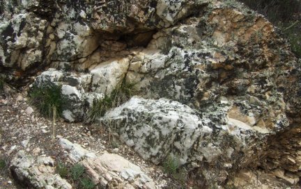
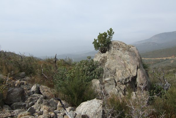
There were also interesting rock formations and outcrops of quartz. It was a long, meandering hike, but offered interesting things to look at all along the way.
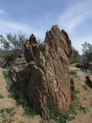
There were some rocks like those we saw on the other portion of the PCT, near the "Double D's" cache, that could be petrified redwood trees.
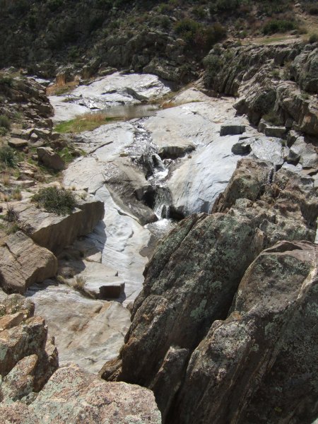
Near that "tree trunk rock" is where we missed the more direct trail to the second waypoint. It looked like we were going to really have an adventure making our way down to the creek from the PCT high above it, but the place we scouted turned out to actually be a trail, so it wasn't as bad a descent as we anticipated.
We climbed up a hill and then made our way towards the third waypoint. I walked up to a highpoint and was surprised to see it was the exact spot where 3cds and I were a few weeks ago. Until I looked down, I didn't recognize it was the same place since we approached from the creek levelon that previous visit.
High on that rocky outcrop, 3cds left a Terracache in honor of his brother who passed away recently.
To get to the fourth waypoint, Travelita made us climb up, up, up to another rocky crag. As I entered the coordinates in my GPSr, I was sure hoping the location would be back in the direction of the truck, and it was. The final location turned out to be not very far away from the "Sandy Creek Cowboy Cache #1."
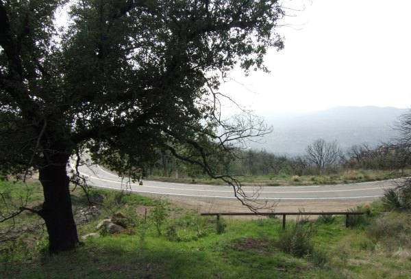
Both 3cds and his friend had commitments that afternoon, so when I got back to my car, there was still a lot of time left in the day. Since I was relatively close to the Boulder Creek Road, I took a drive down it to retrieve and replace a cache of 3cds. On my way back, I placed another cache of my own near this switchback. It was a location I scouted when I placed my "BCR series," but I think I got tired that day, and it got late—and dark—so I did not put a container in this spot back then.
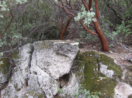
3cds new cache is near this interesting little Manzanita that is somehow growing out of the rock.
It was a really fun day, during which I walked more than eight miles. That makes more than 18 miles in three days . . . not bad for someone of my "advanced age . . . "
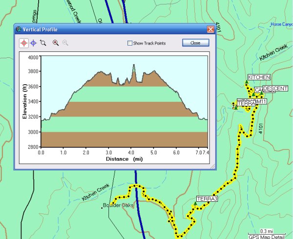
Here is what today's track and profile looks like:
3cds didn't have the coordinates in his GPSr, so I hoped I would remember the location. I thought I recognized the location and a bit of a Geo-trail. I was mumbling about how Princess Toadstool and I had a bit of a hard time finding it when, without the aid of his GPSr, 3cds said, "Is is large, and round, and painted to look like the rocks . . . ?" He had to pound the end of it to get it open, not once, but twice, because I was still holding something that had been in the cache when he closed it up and returned it to its hiding place . . .
Along the trail, there were the most astonishing, ancient Manzanita bushes.
There were also interesting rock formations and outcrops of quartz. It was a long, meandering hike, but offered interesting things to look at all along the way.
There were some rocks like those we saw on the other portion of the PCT, near the "Double D's" cache, that could be petrified redwood trees.
Near that "tree trunk rock" is where we missed the more direct trail to the second waypoint. It looked like we were going to really have an adventure making our way down to the creek from the PCT high above it, but the place we scouted turned out to actually be a trail, so it wasn't as bad a descent as we anticipated.
We climbed up a hill and then made our way towards the third waypoint. I walked up to a highpoint and was surprised to see it was the exact spot where 3cds and I were a few weeks ago. Until I looked down, I didn't recognize it was the same place since we approached from the creek levelon that previous visit.
High on that rocky outcrop, 3cds left a Terracache in honor of his brother who passed away recently.
To get to the fourth waypoint, Travelita made us climb up, up, up to another rocky crag. As I entered the coordinates in my GPSr, I was sure hoping the location would be back in the direction of the truck, and it was. The final location turned out to be not very far away from the "Sandy Creek Cowboy Cache #1."
Both 3cds and his friend had commitments that afternoon, so when I got back to my car, there was still a lot of time left in the day. Since I was relatively close to the Boulder Creek Road, I took a drive down it to retrieve and replace a cache of 3cds. On my way back, I placed another cache of my own near this switchback. It was a location I scouted when I placed my "BCR series," but I think I got tired that day, and it got late—and dark—so I did not put a container in this spot back then.
3cds new cache is near this interesting little Manzanita that is somehow growing out of the rock.
It was a really fun day, during which I walked more than eight miles. That makes more than 18 miles in three days . . . not bad for someone of my "advanced age . . . "
Here is what today's track and profile looks like:
posted by Miragee at
7:42:00 PM
![]()
![]()

 10-Day Forecast


0 Comments:
Post a Comment
<< Home