Some pictures from a hike yesterday
I had not planned on driving into town, but dillweed suggested meeting for a short hike in the morning, so I left the bright sunshine at this elevation and drove down the hill into the overcast and fog to meet at a Health Food Store in El Cajon. I loaded my stuff into her vehicle and she drove the rest of the way to the trailhead for "Golden Hammer" and several other caches.
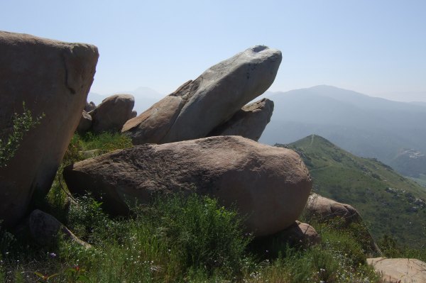
"Golden Hammer" is an elusive cache I had to return to twice in order to finally find it. This is what that challenging rockpile looked like before the morning mist lifted.

I let dillweed climb around on the rocks and search for the cache on her own. I took a few pictures of the graffiti-painted rocks, and then finally gave dillweed a hint that enabled her to find the ammo can.
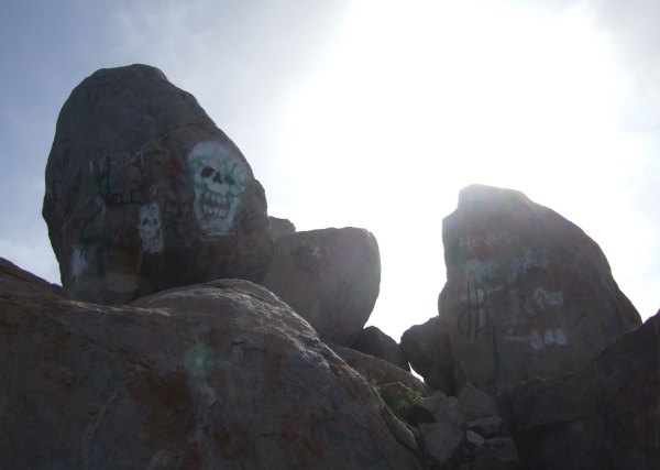
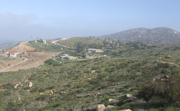
The view from up there is spectacular, on a clear day. Today, as the overcast burned off, we could see some of the very large houses built on view lots to the northwest.
From "Golden Hammer," we continued down the trail to a couple of other caches before finally climbing up a hill to a cache that has been in my GSAK database for more than three years, "In-spire-ational." What a fantastic cache location, and what a lonely cache. It only gets found a couple of times a year, which is too bad, because it really isn't a very long hike, and it isn't a long drive to the trailhead either, compared to how far people have to drive to get to some of my caches.
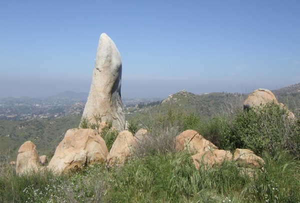
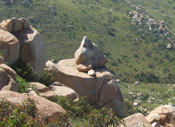
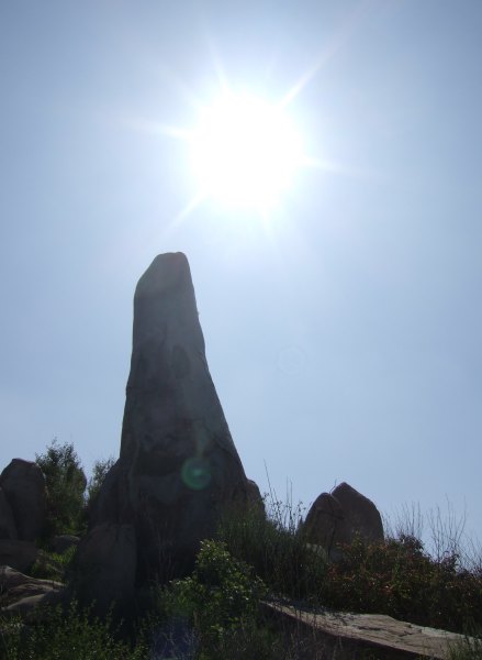
This interesting, and whimsical, rock formation could be seen from the cache location.
However, I didn't notice it until we were packing up to head back down. Until then, we had been busy doing some cache maintenance. The container is a plastic file box, and it was full of water . . . It took a while to dry off the little army men and other swag that survived the immersion. We "trashed out" several other items that didn't survive the flood . . . Fortunately, the logbook was protected by its ziplock bag.
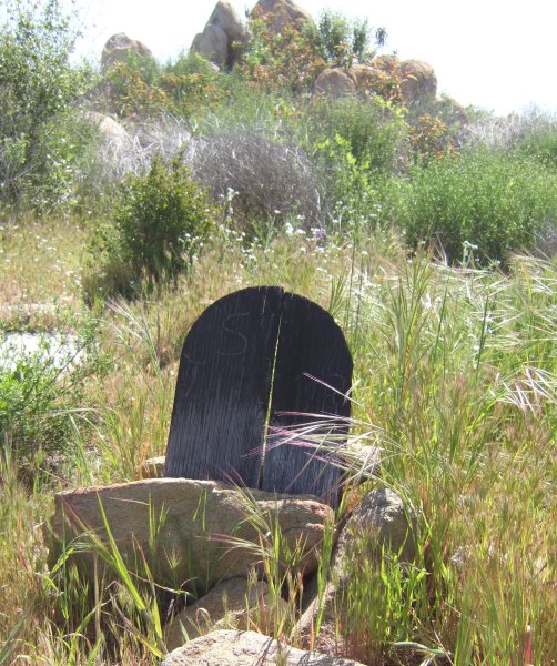
As we walked back up the hill, we saw this old tombstone that probably marks someone's favorite dog that accompanied its owner on hikes to this vantage point on many occasions.
From this angle, the rock formation framed a faint Lyons Peak to the east and Otay Mountain to the south.
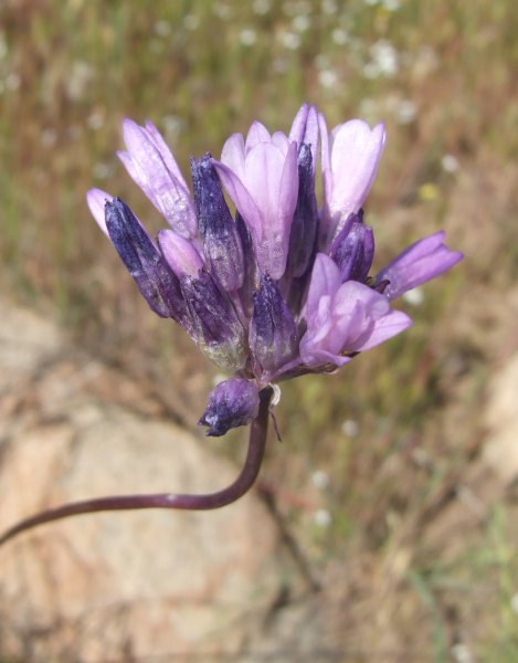
There were quite a few wildflowers blooming, and in the next few weeks, a profusion of flowers, unlike what has occurred after recent, drier years, should occur.

There are still more unfound caches along the trails in that area, so I hope to get back out there soon to get more pictures of the different flowers including daisies of other colors, lupines with tall purple spikes of flowers, and droopy-headed peonies.
"Golden Hammer" is an elusive cache I had to return to twice in order to finally find it. This is what that challenging rockpile looked like before the morning mist lifted.
I let dillweed climb around on the rocks and search for the cache on her own. I took a few pictures of the graffiti-painted rocks, and then finally gave dillweed a hint that enabled her to find the ammo can.
The view from up there is spectacular, on a clear day. Today, as the overcast burned off, we could see some of the very large houses built on view lots to the northwest.
From "Golden Hammer," we continued down the trail to a couple of other caches before finally climbing up a hill to a cache that has been in my GSAK database for more than three years, "In-spire-ational." What a fantastic cache location, and what a lonely cache. It only gets found a couple of times a year, which is too bad, because it really isn't a very long hike, and it isn't a long drive to the trailhead either, compared to how far people have to drive to get to some of my caches.
This interesting, and whimsical, rock formation could be seen from the cache location.
However, I didn't notice it until we were packing up to head back down. Until then, we had been busy doing some cache maintenance. The container is a plastic file box, and it was full of water . . . It took a while to dry off the little army men and other swag that survived the immersion. We "trashed out" several other items that didn't survive the flood . . . Fortunately, the logbook was protected by its ziplock bag.
As we walked back up the hill, we saw this old tombstone that probably marks someone's favorite dog that accompanied its owner on hikes to this vantage point on many occasions.
From this angle, the rock formation framed a faint Lyons Peak to the east and Otay Mountain to the south.
There were quite a few wildflowers blooming, and in the next few weeks, a profusion of flowers, unlike what has occurred after recent, drier years, should occur.
There are still more unfound caches along the trails in that area, so I hope to get back out there soon to get more pictures of the different flowers including daisies of other colors, lupines with tall purple spikes of flowers, and droopy-headed peonies.
posted by Miragee at
3:48:00 PM
![]()
![]()

 10-Day Forecast


2 Comments:
The spire is spectacular. I need to go check that area out. I keep saying that don't I? ;) I ad plans to visit MTRP tomorrow but they fell through this morning. Oh well, hopefully soon. Great photos. As always!
Geocaching With Team Hick@Heart
By Josh, at 7:02 PM
When I see where someone has spray painted a beautiful place it makes me sad. Do they not know what a waste?
By rakethetable, at 6:53 PM
Post a Comment
<< Home