A long drive to place the final container for the "Virtual"
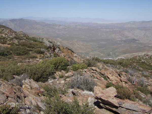
While on my little drive to place the final container for the "Virtual Tour," I took some pictures from a great viewpoint off of Sunrise Highway. I have been in that location when the blue of the Salton Sea is as blue as the sky. Today, smoke, and haze made the sea indistiguishable from surrounding desert landscape.
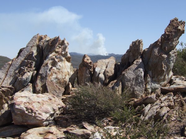
The smoke messing with my pictures was from a "prescribed burn" the Forest Service was conducting near the Laguna Campground.
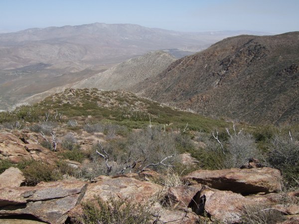
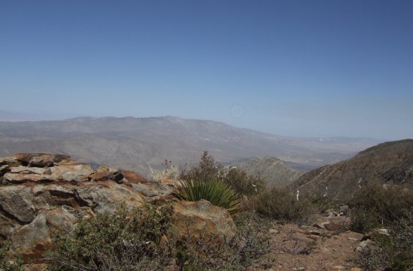
On my way back down the hill, I stopped to check on a cache that has this view of the desert.
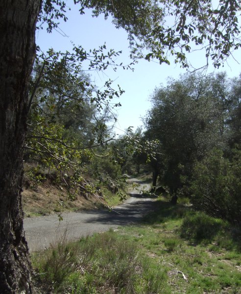
To return home, I took the Old Burma Road, a wonderful, single-lane, paved road that descends sharply and directly from Sunrise Highway to the north side of the little town of Pine Valley. My GPSr was turned off during the drive, so I don't have a track to show from that portion of my afternoon, but it would make an interesting profile because of the steepness of some of the grades. I only saw three other vehicles along the 10-mile stretch of road.
In the middle, I stopped at the parking for my "Historic Cache Adventure -- Version 1.0" and walked the half mile down to the container. Even as I walked, I didn't feel any better. Sometimes when I am not doing well, getting out in fresh air, and getting some exercise helps. Today, it didn't . . .
At the cache location, I smelled death and after looking around for a while, saw the copper-hued coat of a dead fox on top of a huge packrat nest. Poor little guy . . .
I opened up the ammo can and just for fun took pictures of the logbook pages where GeckoDad, FlagMan, and LLOT had signed the pages.
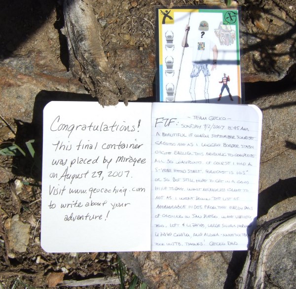
I also took pictures of the U-Design it card that has been sitting there for months. I wonder who will be the next person to find the container and pick up the card? The Yrium Cards were all the rage in 2005 when Nancy and I were caching together. The craze really dies down when no new cards are created . . .
Near the bottom of the Old Burma Road, I stopped to take a few pictures.
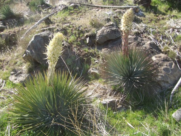
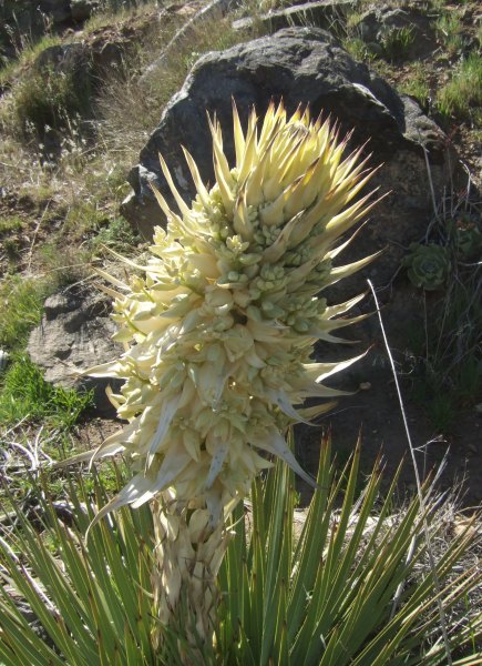
Near there I saw these amazing Nolina plants.
When I turned on the GPSr and saw there was a cache less than two miles away, I forced myself to shake off the oppression of my illness long enough to find the container and sign the log. It was an easy find, although, as is typical of that hider's coordinates, they were off by about 20 feet. Knowing that helps when looking for his other caches where there are many more hiding places than where this one was hidden in a hollow beneath the concrete bridge abutment.
Further down the road, I made myself stop again to walk to two other caches located off the Forest Service Road that goes above Secret Canyon. One had been in my "Nearest Cache List" for more than a year. The other one is one Princess Toadstool hid when I was with her in the fall of 2005. I was her "Beta Tester" but forgot to sign the cache log before she hid it . . .
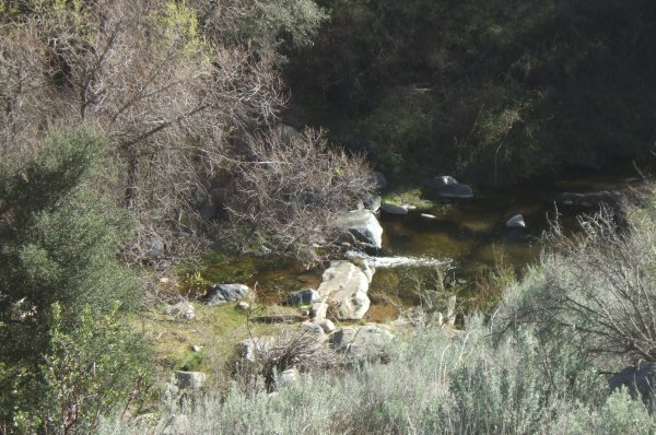
From that location, I could hear the sound of the creek far below where it falls over a man-made obstruction in the creek.
The mid-afternoon light did not make the tall Pine Valley Bridge photogenic, although that particular location offers a great view of the bridge, the tallest one in San Diego County, if I remember correctly.
Finally, as if in a daze, I walked back down the road and back to my car. I drove back home, not seeing the scenery on this beautiful day, although I did glance over at the peak where my "Elevation 3000" cache resides. As I looked at it, I thought that could be my goal for another day when I felt this bad . . . a challenging hike to hopefully clear my head . . . I have two caches along the trail that need maintenance. One is a bison tube in a pine cone that is no longer waterproof. The other is a hockey-puck-sized container that Ikes DNF'd the other day. I'm sure the cache is still there, but that cache now has two DNF's in a row . . .
When I got home, I got right to work on the cache page, a project that took more than an hour because of all the HTML links that were included, and the eleven sets of coordinates I had to enter as "Additional Waypoints." I also had to figure out the "formula" for the location of the final container. Since I am terrible at math, that little project alone seemed like it took a long, long time . . . Finally, I submitted it for Review.
It is interesting how much I actually got done on a day when I really didn't feel like getting out of bed . . .
And, it is a good thing I took pictures along the way . . . otherwise I would have no memory of where I went, or what I did, today . . .
The smoke messing with my pictures was from a "prescribed burn" the Forest Service was conducting near the Laguna Campground.
On my way back down the hill, I stopped to check on a cache that has this view of the desert.
To return home, I took the Old Burma Road, a wonderful, single-lane, paved road that descends sharply and directly from Sunrise Highway to the north side of the little town of Pine Valley. My GPSr was turned off during the drive, so I don't have a track to show from that portion of my afternoon, but it would make an interesting profile because of the steepness of some of the grades. I only saw three other vehicles along the 10-mile stretch of road.
In the middle, I stopped at the parking for my "Historic Cache Adventure -- Version 1.0" and walked the half mile down to the container. Even as I walked, I didn't feel any better. Sometimes when I am not doing well, getting out in fresh air, and getting some exercise helps. Today, it didn't . . .
At the cache location, I smelled death and after looking around for a while, saw the copper-hued coat of a dead fox on top of a huge packrat nest. Poor little guy . . .
I opened up the ammo can and just for fun took pictures of the logbook pages where GeckoDad, FlagMan, and LLOT had signed the pages.
I also took pictures of the U-Design it card that has been sitting there for months. I wonder who will be the next person to find the container and pick up the card? The Yrium Cards were all the rage in 2005 when Nancy and I were caching together. The craze really dies down when no new cards are created . . .
Near the bottom of the Old Burma Road, I stopped to take a few pictures.
Near there I saw these amazing Nolina plants.
When I turned on the GPSr and saw there was a cache less than two miles away, I forced myself to shake off the oppression of my illness long enough to find the container and sign the log. It was an easy find, although, as is typical of that hider's coordinates, they were off by about 20 feet. Knowing that helps when looking for his other caches where there are many more hiding places than where this one was hidden in a hollow beneath the concrete bridge abutment.
Further down the road, I made myself stop again to walk to two other caches located off the Forest Service Road that goes above Secret Canyon. One had been in my "Nearest Cache List" for more than a year. The other one is one Princess Toadstool hid when I was with her in the fall of 2005. I was her "Beta Tester" but forgot to sign the cache log before she hid it . . .
From that location, I could hear the sound of the creek far below where it falls over a man-made obstruction in the creek.
The mid-afternoon light did not make the tall Pine Valley Bridge photogenic, although that particular location offers a great view of the bridge, the tallest one in San Diego County, if I remember correctly.
Finally, as if in a daze, I walked back down the road and back to my car. I drove back home, not seeing the scenery on this beautiful day, although I did glance over at the peak where my "Elevation 3000" cache resides. As I looked at it, I thought that could be my goal for another day when I felt this bad . . . a challenging hike to hopefully clear my head . . . I have two caches along the trail that need maintenance. One is a bison tube in a pine cone that is no longer waterproof. The other is a hockey-puck-sized container that Ikes DNF'd the other day. I'm sure the cache is still there, but that cache now has two DNF's in a row . . .
When I got home, I got right to work on the cache page, a project that took more than an hour because of all the HTML links that were included, and the eleven sets of coordinates I had to enter as "Additional Waypoints." I also had to figure out the "formula" for the location of the final container. Since I am terrible at math, that little project alone seemed like it took a long, long time . . . Finally, I submitted it for Review.
It is interesting how much I actually got done on a day when I really didn't feel like getting out of bed . . .
And, it is a good thing I took pictures along the way . . . otherwise I would have no memory of where I went, or what I did, today . . .
posted by Miragee at
8:02:00 PM
![]()
![]()

 10-Day Forecast


0 Comments:
Post a Comment
<< Home