A more than 12-mile hike through MTRP
I had not planned to join the cachers who were meeting for a hike in Mission Trails Regional Park at 6:00 a.m., but when I woke up at 4:55, I thought about it for a while, then got up and rushed out of the house to meet the group. I was a bit late since I had trouble scraping the ice off the windshield of my car . . .
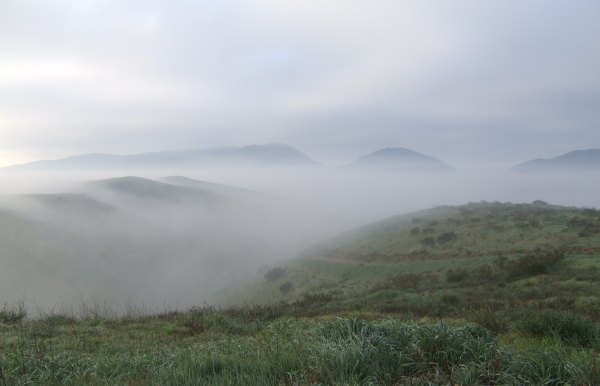
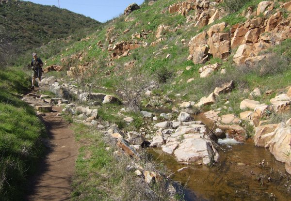
I thought there would be more people there, but was happy to see The Polar Bear and Eric and Hill and Blonds Run Amuck waiting when I arrived. Once we made it up to the ridge, the fog was burning off and I got some great pictures from there.
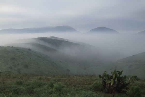
A bit further down the trail there was a prickly pear cactus to add a bit of interest to the picture's foreground.
Jahoadi and John placed a cache called "This is Why We Recycle!" above this operation.
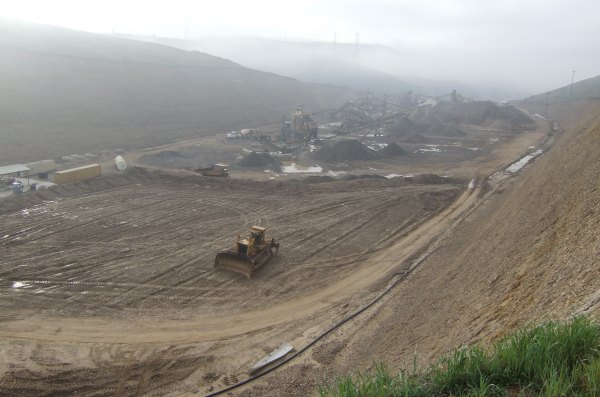
This was a cache we hoped to get FTF on, but just before we started towards it, we saw Toby's Gang on the trail. He had ridden his mountain bike and was splattered with mud from the wet trails. Looking at the size of that operation below us, I was sure glad we were there on a Sunday when it was quiet. I bet that is an obnoxiously-noisy place when it is open and working.
After finding that cache, while my companions followed the normal route, I took a little shortcut in order to get over to the other ridge. I got to the next cache before my companions and dropped off a Kansas Sunshine Geocoin I picked up over in Yuma at the big Event last weekend.
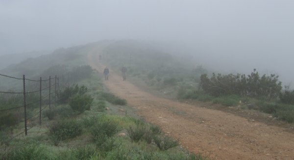
Then I walked back to see my companions emerging out of the mist . . .
From there, we continued further out on the ridge where I dropped off one of the coolest TBs I have ever had in my possession. It is called "[url=http://www.geocaching.com/track/details.aspx?guid=3528b541-0b5d-44ba-8cf2-0008562a3951]Draggin' the Body Back TB[/url]" and each side is different.

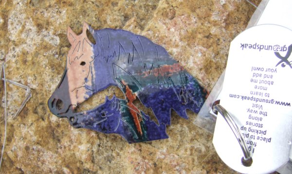
I emailed the TB owners to find out where they got the horses, but I never found out . . .
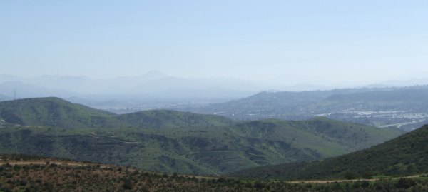
Once we turned around and headed back towards our eventual destination of Oak Canyon, the fog burned off and we could see Lyons Peak off to the southeast.
By the time we were headed up a steep hill to a bradybunchboys' cache called, 'MTRP CCC#2 "Revegetation Project"', I was finally able to peel off a couple of layers of clothing that I needed a few hours earlier when we started this little adventure in the dark and the fog.
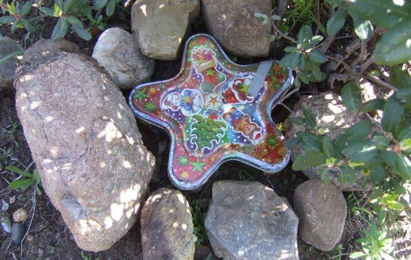
One of the caches we found was another "Star Cache" by T.R. Violin, a prolific cacher in this area. Many times his "Star Caches" are painted black and very hard to spot when they are tucked into the shadows of a bush. This one was hidden under and "artificial pile of rocks" and it was colorful.
I'm not sure what the correct route is to get to "Rest Stop for Old People," but I know we didn't take it . . . The Polar Bear took one route up the hill, Eric and Hill, Blonds Run Amuck, and I took a different, non-approved route.
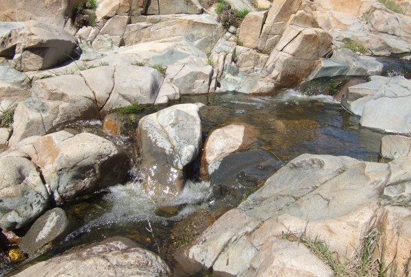
From here, we made our way to Oak Canyon where the sound of the water flowing through the water-smoothed rocks was so wonderful, I took a little movie with my camera so I can have that sound on my computer, anytime I want it. ;-)
After some discussion about the most direct route to get back to our parking place outside the gate on Mast Blvd., we continued down Oak Canyon. Here is The Polar Bear heading down the homestretch.
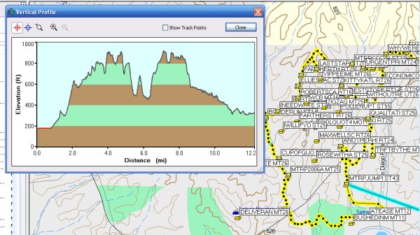
We really had a great day and considering we walked more than twelve miles, I felt pretty good. In fact, I stayed in town for the next few hours "recreating" and relishing my time away from home.
This is the profile of our hike.
I thought there would be more people there, but was happy to see The Polar Bear and Eric and Hill and Blonds Run Amuck waiting when I arrived. Once we made it up to the ridge, the fog was burning off and I got some great pictures from there.
A bit further down the trail there was a prickly pear cactus to add a bit of interest to the picture's foreground.
Jahoadi and John placed a cache called "This is Why We Recycle!" above this operation.
This was a cache we hoped to get FTF on, but just before we started towards it, we saw Toby's Gang on the trail. He had ridden his mountain bike and was splattered with mud from the wet trails. Looking at the size of that operation below us, I was sure glad we were there on a Sunday when it was quiet. I bet that is an obnoxiously-noisy place when it is open and working.
After finding that cache, while my companions followed the normal route, I took a little shortcut in order to get over to the other ridge. I got to the next cache before my companions and dropped off a Kansas Sunshine Geocoin I picked up over in Yuma at the big Event last weekend.
Then I walked back to see my companions emerging out of the mist . . .
From there, we continued further out on the ridge where I dropped off one of the coolest TBs I have ever had in my possession. It is called "[url=http://www.geocaching.com/track/details.aspx?guid=3528b541-0b5d-44ba-8cf2-0008562a3951]Draggin' the Body Back TB[/url]" and each side is different.
I emailed the TB owners to find out where they got the horses, but I never found out . . .
Once we turned around and headed back towards our eventual destination of Oak Canyon, the fog burned off and we could see Lyons Peak off to the southeast.
By the time we were headed up a steep hill to a bradybunchboys' cache called, 'MTRP CCC#2 "Revegetation Project"', I was finally able to peel off a couple of layers of clothing that I needed a few hours earlier when we started this little adventure in the dark and the fog.
One of the caches we found was another "Star Cache" by T.R. Violin, a prolific cacher in this area. Many times his "Star Caches" are painted black and very hard to spot when they are tucked into the shadows of a bush. This one was hidden under and "artificial pile of rocks" and it was colorful.
I'm not sure what the correct route is to get to "Rest Stop for Old People," but I know we didn't take it . . . The Polar Bear took one route up the hill, Eric and Hill, Blonds Run Amuck, and I took a different, non-approved route.
From here, we made our way to Oak Canyon where the sound of the water flowing through the water-smoothed rocks was so wonderful, I took a little movie with my camera so I can have that sound on my computer, anytime I want it. ;-)
After some discussion about the most direct route to get back to our parking place outside the gate on Mast Blvd., we continued down Oak Canyon. Here is The Polar Bear heading down the homestretch.
We really had a great day and considering we walked more than twelve miles, I felt pretty good. In fact, I stayed in town for the next few hours "recreating" and relishing my time away from home.
This is the profile of our hike.
posted by Miragee at
8:38:00 PM
![]()
![]()

 10-Day Forecast


4 Comments:
That looks like a great and difficult hike.
One day you are going to have to write a techniqal blog teaching of how you get the screen capture of the route and the altimeter page.
That's a neat trick I would like to know.
By rakethetable, at 9:06 AM
Hi, Miragee.
Can I ask what software you use for displaying your hike route and elevation data?
Thanks!
By Dan, at 11:42 AM
I was just wishing I could do the same kind of thing for my latest blog entry! I was trying to figure out a way I could get the map of my caches on there but gave up in the interest of time and futility.
By cosmiccowgirl, at 8:00 PM
I've been wanting to make a trip to Mission Trails. It sounds like you had a great time. Thanks for the great pictures (As usual!) I too am putting in my request for an instructional on the elevation map. Great post!
Geocaching With Team Hick@Heart
By Josh, at 7:23 PM
Post a Comment
<< Home