Hiking for some cache maintenance
After receiving the emails from someone affiliated with Anza Borrego Desert State Park, threatening to remove the final container for my cache, "ABDSP -- A Virtual Tour of the SW Region," I have wanted to check on it to make sure it is still in place, in a location far from the Park boundary.
So, on this beautiful day, I took off for the mountains, now that I was feeling better again, after a couple of very bad days.
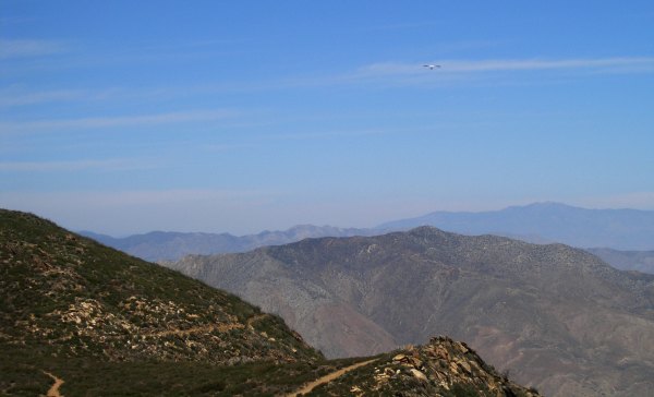
At the parking area for the final container, there were several men with hang gliders, taking off into the gentle breeze, hoping to catch wind currents that would take them many miles to the north. It looked like exciting and wonderful fun. Can you see the hang glider in this picture?
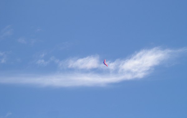
Here is another one taking off for distant places.
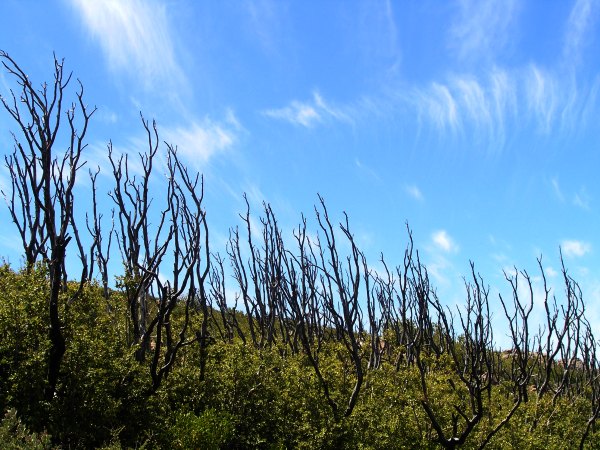
Watching the hangliders was fun, but I needed to check on my container, so I started up the tenative trail that goes up the hill. As I climbed further, the clouds reminded me of the flames that scorched this area in the firestorm of October, 2003.
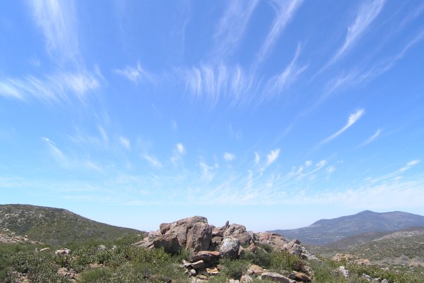
Wispy clouds sure gave more interest to the landscape on that rugged hill.
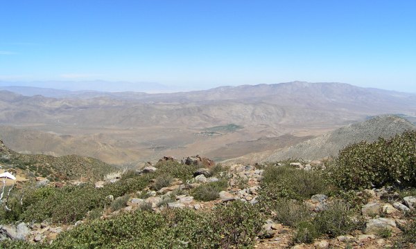
The view of the now-off-limits-to-Geocachers-Desert to the east was almost as clear as it can be from this vantage point more than 5500 feet higher than the desert floor.
After finding the container in place, and adding a couple more swag items, I walked back down the hill where I had a conversation with a motorcycle rider who knew about Geocaching. We talked for a long time, which delayed the start of my planned hike to do some cache maintenance. That was okay, however. I relish any opportunity to talk face to face with someone.
I drove to the Pioneer Mail trailhead where I started my hike to my "Champagne Summit Redux" cache. Along the way to that cache, I replaced the muggled container for "Which Way Now," one that Auld Pro had wanted to be his cache #999 so the next one could be #1000 . . .
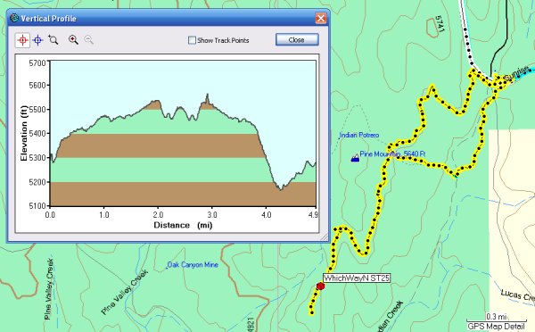
This is the Track and Profile of my hike.
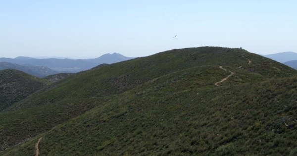
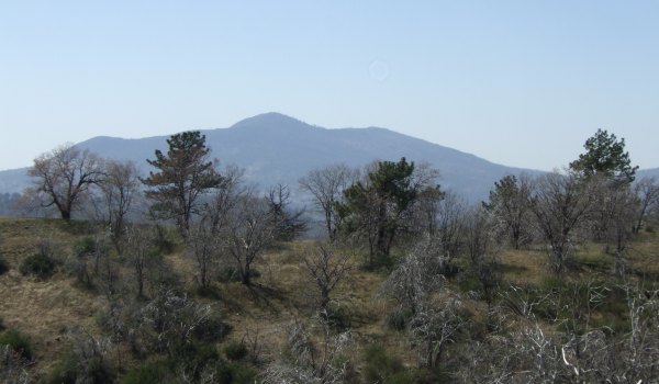
This is the view of the trail ahead of me, as well as Long Valley Peak and the Old Burma Road in the distance.
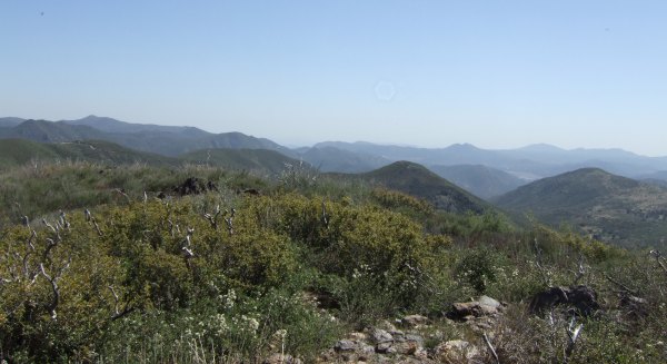
From the summit, this is just one part of the 360° view.
As long as I was up there, I took a little sidetrip off the trail to check on the large ammo can that holds the "Reclaimed Treasure of Manny A. Cacher." The view towards the west is somewhat surreal . . .
This hike must have really been spectacular before the firestorm in October 2003 that burned trees that had survived previous wildfires.
On the way back, I took an old road that headed down towards the valley. Many trees, burned in the 2003 Cedar Fire, had fallen over, blocking the road and presenting unexpected obstacles. As I encountered these, I thought about pioneers and miners who had to contend with circumstances like these after a long winter when they needed to get back to their cabins or mines. The road maintenance they had to contend with, with primitive tools, must have been a challenge, and a disappointment, when they had other, more productive tasks on their minds.
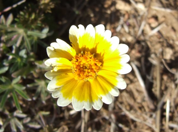
The elevation of this trail is above 5000 feet, so it hasn't been warm enough to urge wildflowers out of hibernation, although I did see a few of these little yellow flowers.
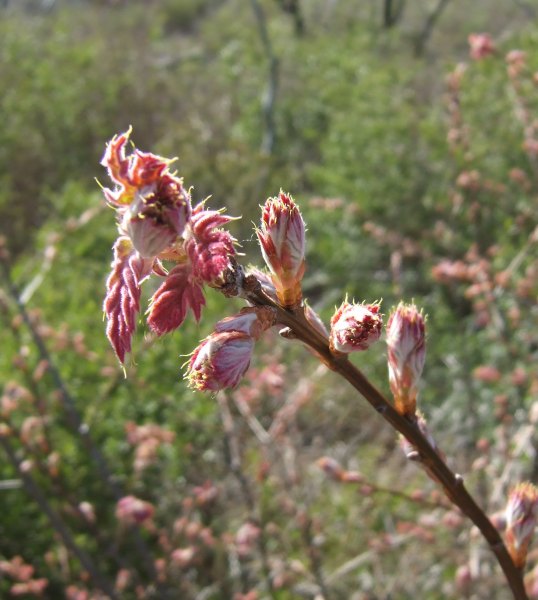
Then, I saw a large shrub just begining to leaf out. It will be interesting to see what it looks like in a few weeks, if I get back up this way with Auld Pro.
I had hoped to hike to another cache as long as I had made such a long drive, but it was 4:00 when I got back to the car, and the other cache was three miles away, so I drove home, taking the long way towards Cuyamaca Lake and then through Rancho Cuyamaca State Park. I would have driven fewer miles taking the Old Burma Road, as I did the day I placed the final container, but that is a slow and winding road. I got home in about an hour. That gave me plenty of time to get updated information for my GSAK database, and load my GPSr with all the new caches placed in the area around the Otay Reservoir where the Event was being held the next day.
So, on this beautiful day, I took off for the mountains, now that I was feeling better again, after a couple of very bad days.
At the parking area for the final container, there were several men with hang gliders, taking off into the gentle breeze, hoping to catch wind currents that would take them many miles to the north. It looked like exciting and wonderful fun. Can you see the hang glider in this picture?
Here is another one taking off for distant places.
Watching the hangliders was fun, but I needed to check on my container, so I started up the tenative trail that goes up the hill. As I climbed further, the clouds reminded me of the flames that scorched this area in the firestorm of October, 2003.
Wispy clouds sure gave more interest to the landscape on that rugged hill.
The view of the now-off-limits-to-Geocachers-Desert to the east was almost as clear as it can be from this vantage point more than 5500 feet higher than the desert floor.
After finding the container in place, and adding a couple more swag items, I walked back down the hill where I had a conversation with a motorcycle rider who knew about Geocaching. We talked for a long time, which delayed the start of my planned hike to do some cache maintenance. That was okay, however. I relish any opportunity to talk face to face with someone.
I drove to the Pioneer Mail trailhead where I started my hike to my "Champagne Summit Redux" cache. Along the way to that cache, I replaced the muggled container for "Which Way Now," one that Auld Pro had wanted to be his cache #999 so the next one could be #1000 . . .
This is the Track and Profile of my hike.
This is the view of the trail ahead of me, as well as Long Valley Peak and the Old Burma Road in the distance.
From the summit, this is just one part of the 360° view.
As long as I was up there, I took a little sidetrip off the trail to check on the large ammo can that holds the "Reclaimed Treasure of Manny A. Cacher." The view towards the west is somewhat surreal . . .
This hike must have really been spectacular before the firestorm in October 2003 that burned trees that had survived previous wildfires.

On the way back, I took an old road that headed down towards the valley. Many trees, burned in the 2003 Cedar Fire, had fallen over, blocking the road and presenting unexpected obstacles. As I encountered these, I thought about pioneers and miners who had to contend with circumstances like these after a long winter when they needed to get back to their cabins or mines. The road maintenance they had to contend with, with primitive tools, must have been a challenge, and a disappointment, when they had other, more productive tasks on their minds.
The elevation of this trail is above 5000 feet, so it hasn't been warm enough to urge wildflowers out of hibernation, although I did see a few of these little yellow flowers.
Then, I saw a large shrub just begining to leaf out. It will be interesting to see what it looks like in a few weeks, if I get back up this way with Auld Pro.
I had hoped to hike to another cache as long as I had made such a long drive, but it was 4:00 when I got back to the car, and the other cache was three miles away, so I drove home, taking the long way towards Cuyamaca Lake and then through Rancho Cuyamaca State Park. I would have driven fewer miles taking the Old Burma Road, as I did the day I placed the final container, but that is a slow and winding road. I got home in about an hour. That gave me plenty of time to get updated information for my GSAK database, and load my GPSr with all the new caches placed in the area around the Otay Reservoir where the Event was being held the next day.
posted by Miragee at
8:52:00 PM
![]()
![]()

 10-Day Forecast


1 Comments:
I'll be interested to see how that bush looks in a few weeks. The views are amazing, I love it when our skies are that clear.
Geocaching With Team Hick@Heart
By Josh, at 4:14 PM
Post a Comment
<< Home