I've been a busy Geocacher
In the morning, I washed out the inside of the two ammo cans "lostguy" gave me and gathered up all the swag I had on hand, as well as the things I purchased yesterday at a Thrift Store and the Dollar Tree. Then, I started putting everything together, finally making sure each container had a log or logbook, and a pen, or pencil, if one would fit in the container.
Finally, in the mid-afternoon, I pumped up the bike tires, and then loaded everything onto the bike. Whew . . . it was sure heavy as I loaded into the back of my car.
I drove up the road to the trailhead and got the bike out, and with all that weight on the bike rack, had some difficulty getting the front wheel back on the bike without dropping it. I sure hope no one was watching . . .
Because the trail starts out going uphill, and because the bike was so heavy, I had to walk it quite a ways before I could get on and pedal 50 feet before getting off and pushing it again. The ammo cans made it awkward to sit on the bike seat.
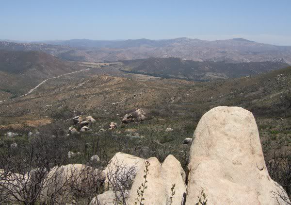
I checked out some potential hiding places on my way up the steep hill, one of which was near this viewpoint. I determined that cache was just going to be called "WOW," since that is what I said when I rounded the corner and saw the view.
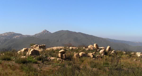
I determined to put those caches out on my way back. Right now, I just wanted to get rid of the first ammo can, one I planned on putting in this rockpile.
I parked the bike on the road and untangled the bungie cords holding the awkward load in place and grabbed the ammo can that had the books in it. One of the books was in "Bilbo's Book Exchange," the Archived cache I retrieved on a trip to the Lagunas in May. Once I made my way through the burnt sticks that remained from the California Buckwheat, Manzanita, and California Laurel plants that had been destroyed in the fire, I got to the slickrock. It took quite a bit of looking around to finally find a place for the ammo can. Those things are hard to hide in a way that muggles cannot find them . . .
I wrote a little bit about my adventure placing the cache in the front of the logbook and walked back across the burned landscape to the bike, which was easier to ride now that is was several pounds lighter. I could even sit back on the bike seat now that the ammo can was out of the way.
The road is perfect for mountain bike riding, fairly level, without bad erosion like that on the Anderson Truck Trail. It was fun riding the bike again and I wondered why I seem to forget how much enjoyment I get when I am riding . . .
In the GPSr, I had the "potential cache location" waypoints I marked the other day. I stopped at those and searched for hiding places, some of which turned out to be in the spot I found the other day, but others were quite a distance away. Near this incredible view, I placed the De-con container FlagMan gave me at an Event in Clairemont many months ago.
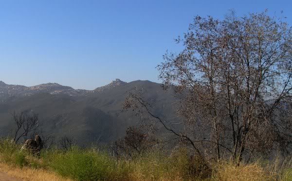
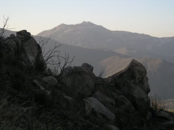
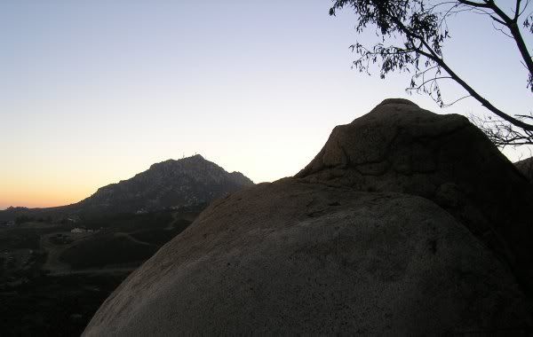
Another caches, called "Gone Postal" has this view of Lawson Peak.
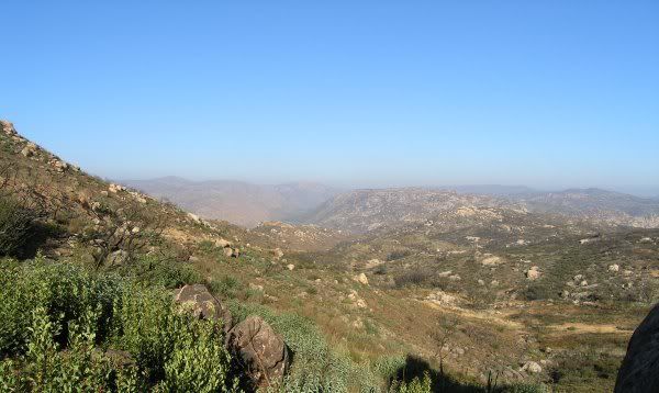
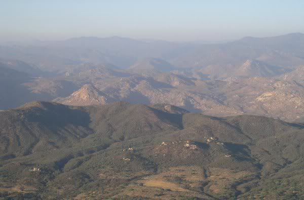
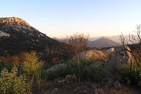
I placed a cache in the Manzanita bush where the chapparral survived the fire, and then continued all the way to the end of the trail so I could get rid of the second ammo can. This is just one of the views
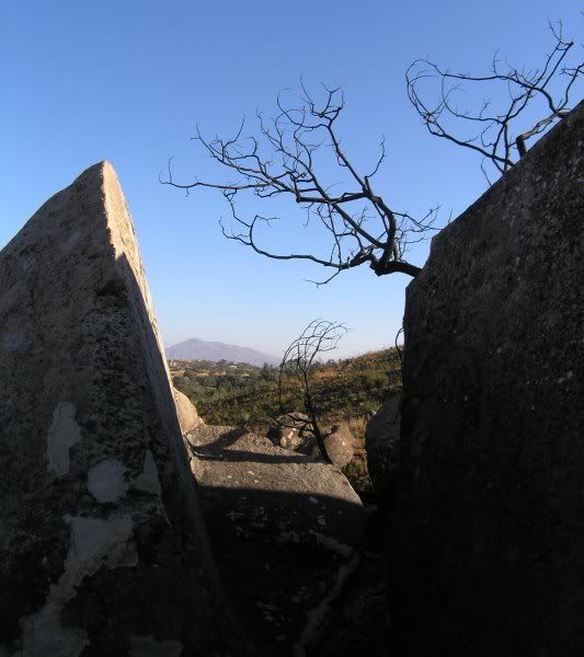
The cache hiding place is very close to this unusual split rock.
I had quite an adventure hiding the Terracache in a nearby rockpile. Once I made it through all the burned vegetation and got on top of one of the boulders, the view in front of me took my breath away and I almost said outloud, "Oh, to be master of all I survey." LOL
I stopped and took several pictures of the valley as I made my way back. In this picture, the hill on which I hid "Hard Hike/Easy Find" is highlighted against the darker valley floor. It shows evidence of the Horse Fire of August 2006, which the ridge in the foreground has the green of undisturbed chapparral.
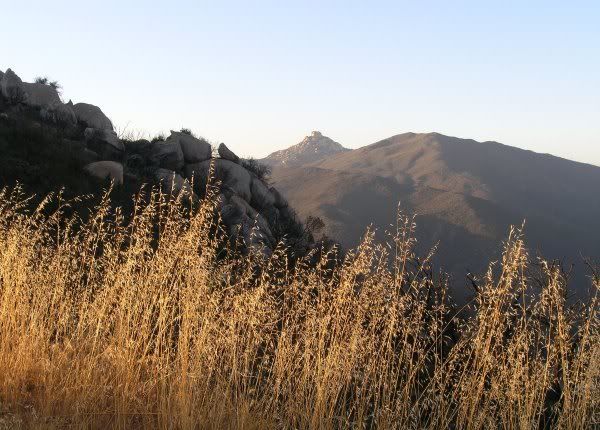
I wanted FlagMan to enjoy this trail, so I placed an "Ockham's Puzzle" cache here, where the rocks frame Gaskill Peak.
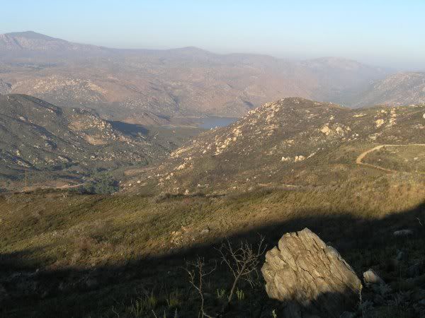
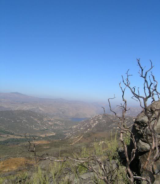
This was another picture I took of Barrett lake, near the "Gracias, FlagMan" cache, in the late-afternoon light.
Finally, I arrived at the location where this view of Lawson Peak. That is where I put the container for "WOW."
On the way down the grade towards my car, I placed a cache with this view towards Deerhorn Valley and Mother Grundy.
Just after the sun went down behind Lyons Peak, I placed the second to the last cache.
One more cache placed at the parking area next to Honey Springs Road and I was on my way home to sit at the computer for a couple of hours before submitting all 12 cache pages. I didn't mark them as "Active" since I wanted to work on the photos, get them uploaded, and link to them on the pages. That was going to be my project for the next day . . .
I didn't get completely done with all the HTML coding, and double and triple-checking the coordinates until late afternoon. Finally, I checked the box stating the caches were "Active" and waited. I didn't have to wait long. Marko Ramius was on the ball that evening. He Reviewed and Published the caches quickly.
That night, in the pitch black dark, Chuy!, Ginger!, Mocha!, and Jahoadi found all the caches. From their logs, it sounded like they had fun and enjoyed the variety of hides and containers, but they'll have to go back in the daylight, or on a night when the moon is full, to get the full effect of the expansive views.
Finally, in the mid-afternoon, I pumped up the bike tires, and then loaded everything onto the bike. Whew . . . it was sure heavy as I loaded into the back of my car.
I drove up the road to the trailhead and got the bike out, and with all that weight on the bike rack, had some difficulty getting the front wheel back on the bike without dropping it. I sure hope no one was watching . . .
Because the trail starts out going uphill, and because the bike was so heavy, I had to walk it quite a ways before I could get on and pedal 50 feet before getting off and pushing it again. The ammo cans made it awkward to sit on the bike seat.
I checked out some potential hiding places on my way up the steep hill, one of which was near this viewpoint. I determined that cache was just going to be called "WOW," since that is what I said when I rounded the corner and saw the view.
I determined to put those caches out on my way back. Right now, I just wanted to get rid of the first ammo can, one I planned on putting in this rockpile.
I parked the bike on the road and untangled the bungie cords holding the awkward load in place and grabbed the ammo can that had the books in it. One of the books was in "Bilbo's Book Exchange," the Archived cache I retrieved on a trip to the Lagunas in May. Once I made my way through the burnt sticks that remained from the California Buckwheat, Manzanita, and California Laurel plants that had been destroyed in the fire, I got to the slickrock. It took quite a bit of looking around to finally find a place for the ammo can. Those things are hard to hide in a way that muggles cannot find them . . .
I wrote a little bit about my adventure placing the cache in the front of the logbook and walked back across the burned landscape to the bike, which was easier to ride now that is was several pounds lighter. I could even sit back on the bike seat now that the ammo can was out of the way.
The road is perfect for mountain bike riding, fairly level, without bad erosion like that on the Anderson Truck Trail. It was fun riding the bike again and I wondered why I seem to forget how much enjoyment I get when I am riding . . .
In the GPSr, I had the "potential cache location" waypoints I marked the other day. I stopped at those and searched for hiding places, some of which turned out to be in the spot I found the other day, but others were quite a distance away. Near this incredible view, I placed the De-con container FlagMan gave me at an Event in Clairemont many months ago.
Another caches, called "Gone Postal" has this view of Lawson Peak.
I placed a cache in the Manzanita bush where the chapparral survived the fire, and then continued all the way to the end of the trail so I could get rid of the second ammo can. This is just one of the views
The cache hiding place is very close to this unusual split rock.
I had quite an adventure hiding the Terracache in a nearby rockpile. Once I made it through all the burned vegetation and got on top of one of the boulders, the view in front of me took my breath away and I almost said outloud, "Oh, to be master of all I survey." LOL
I stopped and took several pictures of the valley as I made my way back. In this picture, the hill on which I hid "Hard Hike/Easy Find" is highlighted against the darker valley floor. It shows evidence of the Horse Fire of August 2006, which the ridge in the foreground has the green of undisturbed chapparral.
I wanted FlagMan to enjoy this trail, so I placed an "Ockham's Puzzle" cache here, where the rocks frame Gaskill Peak.
This was another picture I took of Barrett lake, near the "Gracias, FlagMan" cache, in the late-afternoon light.
Finally, I arrived at the location where this view of Lawson Peak. That is where I put the container for "WOW."
On the way down the grade towards my car, I placed a cache with this view towards Deerhorn Valley and Mother Grundy.
Just after the sun went down behind Lyons Peak, I placed the second to the last cache.
One more cache placed at the parking area next to Honey Springs Road and I was on my way home to sit at the computer for a couple of hours before submitting all 12 cache pages. I didn't mark them as "Active" since I wanted to work on the photos, get them uploaded, and link to them on the pages. That was going to be my project for the next day . . .
I didn't get completely done with all the HTML coding, and double and triple-checking the coordinates until late afternoon. Finally, I checked the box stating the caches were "Active" and waited. I didn't have to wait long. Marko Ramius was on the ball that evening. He Reviewed and Published the caches quickly.
That night, in the pitch black dark, Chuy!, Ginger!, Mocha!, and Jahoadi found all the caches. From their logs, it sounded like they had fun and enjoyed the variety of hides and containers, but they'll have to go back in the daylight, or on a night when the moon is full, to get the full effect of the expansive views.
posted by Miragee at
6:51:00 PM
![]()
![]()

 10-Day Forecast


0 Comments:
Post a Comment
<< Home