A FTF on a Terracache and two new caches placed
Since my friend, and fellow Geocacher, got out of the hospital today, I didn't end up making a trip to town to visit him, so I thought I would make a hike to find his caches. I got a late start to the Horsethief Canyon staging area, and then when I got there, my GPSr couldn't find the satellites . . .
It had never done that before. It kept "Aquiring, Aquiring, Aquiring," but no satellite bars filled in on the satellite page. I finally gave up and started to drive back home. On the drive, something kicked in and the GPSr finally found itself, with 150' of accuracy. By the time I turned around, the accuracy was down to the normal range, so once back at the staging area, I was ready to take off. I had a brief conversation with some guys just getting back from a hike and getting in a new, hardtop, yellow Jeep. They asked if I was Geocaching and I lied and said "No."
The trail I hiked for quite a distance is one that was "created" by a bulldozer during the fire last summer. This area is really ugly, not just because of the fire damage, but because of the torn up earth and tumbled boulders. After "Blame it on Miragee," the trail is nicer, although not that easy to follow, which is why, on my way back, I placed a cache up on a hill that directs people to the correct ridge, so they won't overshoot it like I did . . .
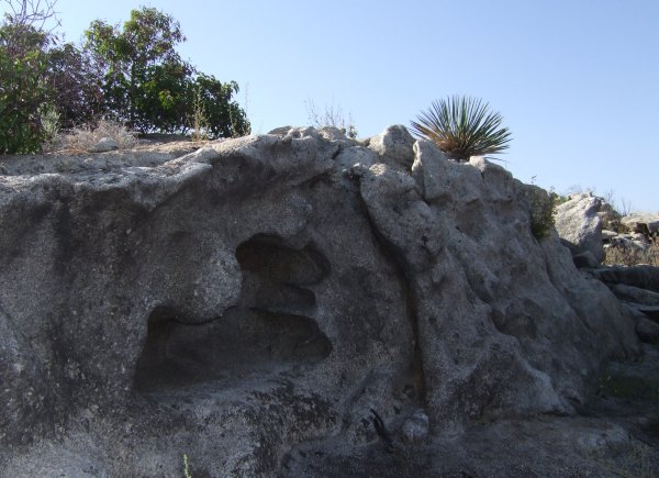
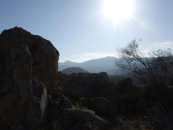
At T.R. Violin's first cache on the ridge, there were some interesting rock formations.
It took me a while to find the cache just because I got up on a big rock bench, thinking the cache would be up there, with a view of Gaskill and Lawson Peaks, but it wasn't. Once I got down, I found the container right away.
From that cache to the next one, there was a distance of .45 miles. I tried to find open areas to navigate through all the burned vegetation, but still brushed up against enough charred sticks so that I was getting very dirty, as I did when I hid "Elevation 2222" and "Hard Hike, Easy Find." I didn't think my pants would ever come clean after those two days of hiking, but they did. After this hike, the pants were definitely going to have to be washed before I could wear them again.
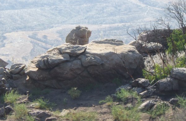
Along the way, I saw more interesting rock formations.
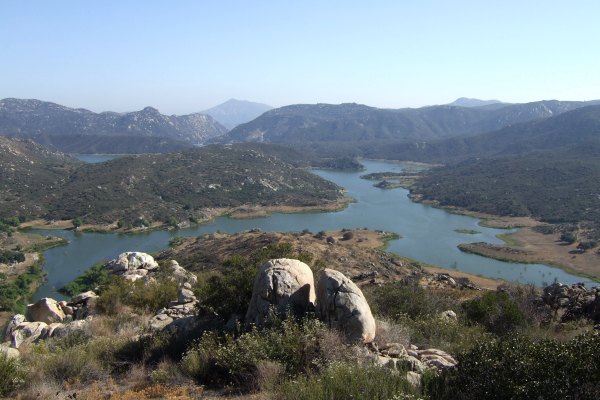
Out at the point, where I found the Geocache by stepping down off a rock and right on top of it, there was a great view of Barrett Reservoir.
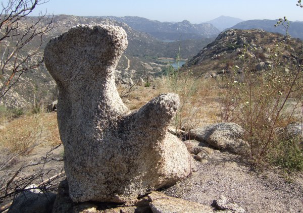
Nearby there was this odd rock formation that looked like a hippo to me.
I'll have to check with CTYankee9 to see what he thought it looked like. He is real good at this rocks-that-look-like-animals stuff . . .
The Terracache was nearby. It was in a cute Marmaduke tin container that had me humming an 80's song the whole rest of the hike.
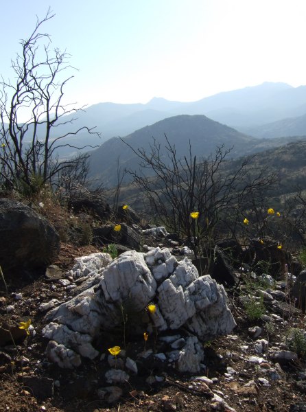
On the way back, I placed a cache up on a hill where there was lots of white quartz rock where the other rocks were black granite. My container was a cute little bunny rabbit container, that contrasted with the devastation left by the fire, so the cache got the name "Contrasts" when I wrote up the cache page tonight.
Not to far away, where some neat boulders framed both Lawson and Gaskill Peaks, I put out another container.
So, I succeeded in bridging part of the gap T.R. left when he put his caches out on that ridge, and these caches aren't too too far to hike when I have to perform maintenance. I'm really glad the caches way out on the end of the point are his, and not mine . . . I'm not sure I want to make that hike again . . .
It had never done that before. It kept "Aquiring, Aquiring, Aquiring," but no satellite bars filled in on the satellite page. I finally gave up and started to drive back home. On the drive, something kicked in and the GPSr finally found itself, with 150' of accuracy. By the time I turned around, the accuracy was down to the normal range, so once back at the staging area, I was ready to take off. I had a brief conversation with some guys just getting back from a hike and getting in a new, hardtop, yellow Jeep. They asked if I was Geocaching and I lied and said "No."
The trail I hiked for quite a distance is one that was "created" by a bulldozer during the fire last summer. This area is really ugly, not just because of the fire damage, but because of the torn up earth and tumbled boulders. After "Blame it on Miragee," the trail is nicer, although not that easy to follow, which is why, on my way back, I placed a cache up on a hill that directs people to the correct ridge, so they won't overshoot it like I did . . .
At T.R. Violin's first cache on the ridge, there were some interesting rock formations.
It took me a while to find the cache just because I got up on a big rock bench, thinking the cache would be up there, with a view of Gaskill and Lawson Peaks, but it wasn't. Once I got down, I found the container right away.
From that cache to the next one, there was a distance of .45 miles. I tried to find open areas to navigate through all the burned vegetation, but still brushed up against enough charred sticks so that I was getting very dirty, as I did when I hid "Elevation 2222" and "Hard Hike, Easy Find." I didn't think my pants would ever come clean after those two days of hiking, but they did. After this hike, the pants were definitely going to have to be washed before I could wear them again.
Along the way, I saw more interesting rock formations.
Out at the point, where I found the Geocache by stepping down off a rock and right on top of it, there was a great view of Barrett Reservoir.
Nearby there was this odd rock formation that looked like a hippo to me.
I'll have to check with CTYankee9 to see what he thought it looked like. He is real good at this rocks-that-look-like-animals stuff . . .
The Terracache was nearby. It was in a cute Marmaduke tin container that had me humming an 80's song the whole rest of the hike.
On the way back, I placed a cache up on a hill where there was lots of white quartz rock where the other rocks were black granite. My container was a cute little bunny rabbit container, that contrasted with the devastation left by the fire, so the cache got the name "Contrasts" when I wrote up the cache page tonight.
Not to far away, where some neat boulders framed both Lawson and Gaskill Peaks, I put out another container.
So, I succeeded in bridging part of the gap T.R. left when he put his caches out on that ridge, and these caches aren't too too far to hike when I have to perform maintenance. I'm really glad the caches way out on the end of the point are his, and not mine . . . I'm not sure I want to make that hike again . . .
posted by Miragee at
9:00:00 PM
![]()
![]()

 10-Day Forecast


0 Comments:
Post a Comment
<< Home