The SDCET decided to make the trip to Jamul to conquer Mt. McGinty. I have 11 caches on the mountain, and in the past week or so, several more had been placed by "lostguy", jahoadi and john, Tombmaker, and bradybunchboys.
When I arrived at the trailhead, there was a big group of cachers milling around. I grabbed my Geocoins thinking they would like to "Discover" them. On my way back to my car to put them away, I met a new cacher, jonesi, who had driven all the way from Rancho Bernardo.
Trailgators and Toby's Gang had already found several of my caches on the hill, so we took their vehicles to a parking place along Jamul Drive. We were going to go up the mountain and then down, down, down, to that location and shuttle back to the other trailhead and all the other vehicles.
Since I rarely have passengers in my car, I had to figure out how to get the back seat in an upright position . . .
Back on the other side, we parked in a different place that cut off almost half a mile of walking. From there, the trail ascends steeply. I didn't find the climb to be too bad -- I had finally recovered from the hike on Monday. On the really steep stretches, I was huffing and puffing and was happy to stop and catch my breath every once in a while.
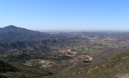
At the saddle, we stopped to rest, enjoy the view, and take some pictures. From way up there, you could see Mt. Miguel, the Sweetwater Reservoir, and the golf course we would eventually be walking across many, many hours later.
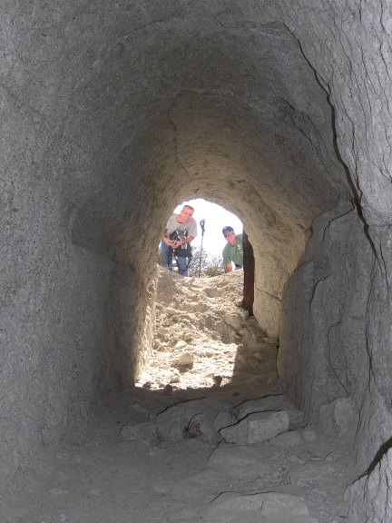
After a while, we started back up the trail and at the hill-traversing cut Nancy and I investigated on our hike up the mountain a few weeks ago, we proceeded. It wasn't too difficult to negotiate the rocks and vegetation, until the end where we had to go uphill for a little while, before descending the steep trail and the deep gully on one side of the mine entrance.
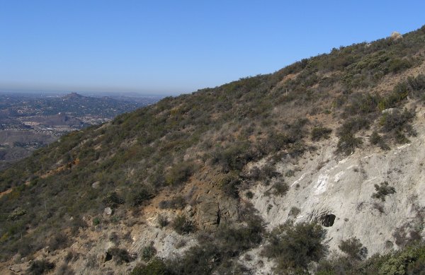
Along that path, we got a good view of the mine opening.
I got a great picture of the guys standing outside looking in.
At the top, as Toby's Gang, Trailgators and I ate a little lunch and rested while waiting for the others, I got a good picture of Trailgators with the view of El Capitan behind him.

From the top we started down the north side of McGinty, finding first one cache, then another, and another, and another. As we descended, and descended, and descended, somewhere along the way, we missed a trail that might have gotten us to the bottom more quickly.
The trail we were walked was heavily eroded in places. Although we didn't see recent evidence of the horses that obviously travel this route, we could tell it gets a lot of equestrian use at times.
Finally, as the sun was setting, we got to the golf course. We went through the fence, and then walked, up, up, up the concrete golfcart path. We eventually made it out to the clubhouse, and the nice young men who drove the golfcarts to pick up the stragglers of our group, took Toby's Gang and Trailgators to the vehicles, which were still half a mile away.
Our ragged-looking group did not fit in that hoity-toity neighborhood, and I'm sure the couple who drove by in a golf cart wondered who we were, why we were there, and how soon we would be leaving . . .
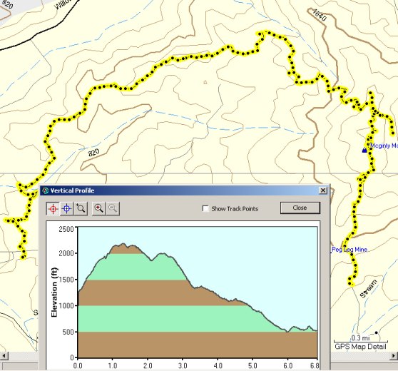
This is what our tracks looked like, and the profile of the nearly seven-mile-long hike.
It was a great day, the weather was perfect, the views were fantastic, and the company was wonderful. It was good to be out with the San Diego Cache Event Team again.


 10-Day Forecast


