A nice cool day for a couple of fun hikes
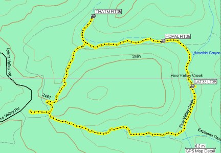
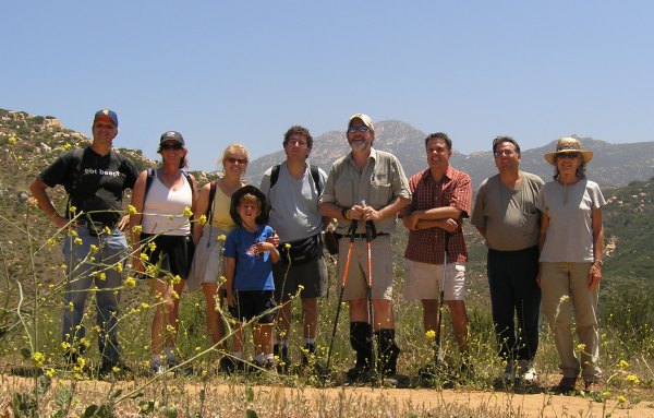
It was fun hiking up Viejas mountain with such good company today: TrailGators, Radio Racers, Team Geogeeks, and Toby's Gang. We sure didn't have much of a "vista," at the first cache, "Puetz Valley Vista." The typical "May Gray, June Gloom" marine layer of low clouds and fog had the mountain socked in.
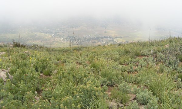
On a clear day, I'm sure there is a beautiful view from that location. The overcast and cool temperature today was definitely welcome, however, because Viejas Mountain is quite a steep hike, with an elevation gain of more than 1000 feet over a distance of only 1.72 miles.
We found three more caches on the peak. One is a new one placed by T.R. Violin at the pyramid. Last year when I hiked up Viejas on my way to a brand new cache, I actually walked right by the pyramid without noticing it . . . until I was on my way back down the mountain. From that "Viejas Pyramid Cache," we found a Terracache, also placed by T.R. Violin. This was TrailGators first Terracache and my second one.
From that cache, we walked the short distance to "Tax Freedom Cache" which was my first FTF last year. Boy, the swag in that ammo can has sure deteriorated in the past 13 months . . .
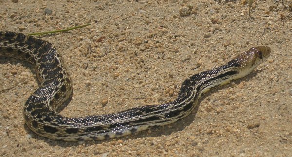
After making it back down the steep trail, I needed a nice, easy cache, and "No Passport Required," just outside the Viejas Indian Reservation, was perfect. I grabbed it on my way to the Viejas Outlet Stores where I didn't spend any money . . . well, I did, but only for a cup of coffee. From there, I headed back to Alpine where I found the "Cocktail Cache." At that one, my GPSr was initially confused, but I finally spotted the Geotrail through the roadside weeds.
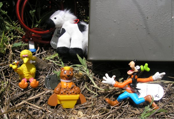
Since that cache is a nice, well-secured, close-to-the-Interstate ammo can, I decided to leave all four of my new T.B.s there, so it will be interesting to see what happens to them if they get picked up by four different people and travel in all different directions. Maybe I should say they are in a race, or something . . .
Here are the TBs partying before going in the cache.
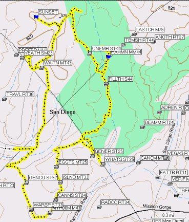
From there I headed over to the Carveacre Wind Caves trailhead in the Carveacre "subdivision" northeast of Gaskill Peak. I didn't know until I got to the Lost Trail road that I didn't have the parking coordinates in my Palm. A couple driving out that road stopped and I asked them about the Wind Caves trail. They said I could park up the road a bit at their "shack." So, I did, but I took them a bit too literally when they said shack and I parked near the remains of a building a few hundred feet below the actual "shack."
Therefore, I was searching for the trail in the wrong place. I wandered around and around in all the chipped brush doing the "drunken bee dance" trying to find the trail. I was about to give up when I finally found it.
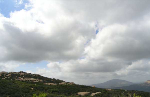
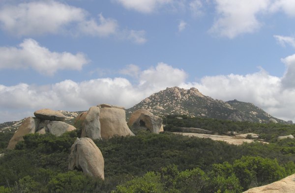
The walk up the nice wide trail I finally located was great and I enjoyed all the neat, wind-shaped boulders, and the sunshine peeking through the clouds as the skies started to clear. This picture shows the Wind Caves area as well as Viejas Mountain in the background.
Here is another picture of an area I walked by on my way to the cache.
When I got near the cache, I got a bit worried because I sure didn't see any evidence of anyone breaking their way through the bushes recently. However, I persevered, being reminded of "Snail Rock" as I crashed through the manzanita and chamise brush. I finally spotted the ammo can. What a relief. John, of Jahoadi and John, DNF'd the cache a couple of weeks ago, and after everything I had gone through trying to find the trail, I sure didn't want to do that.
There was a copy of a Kansas Geocoin in the cache and I retrieved it to move it along since it has been in the cache for a long time.
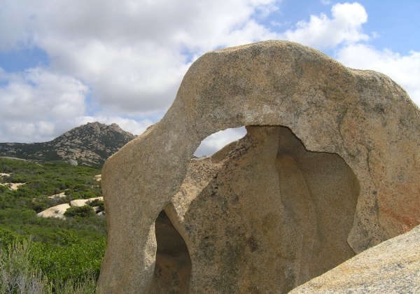
I took several more pictures before heading back down the trail and home. In this picture, I tried to frame Lawson Peak in the opening in the rock, with Gaskill to the left.
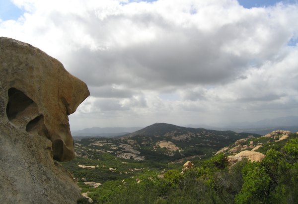
Here is another carved rock and the view off in the distance.
The area around the Carveacre Wind Caves cache is really cool, and the hike from where I parked is less than half a mile, so I might end up there again someday . . . and maybe I'll even place a cache to help people find the trail.
On a clear day, I'm sure there is a beautiful view from that location. The overcast and cool temperature today was definitely welcome, however, because Viejas Mountain is quite a steep hike, with an elevation gain of more than 1000 feet over a distance of only 1.72 miles.
We found three more caches on the peak. One is a new one placed by T.R. Violin at the pyramid. Last year when I hiked up Viejas on my way to a brand new cache, I actually walked right by the pyramid without noticing it . . . until I was on my way back down the mountain. From that "Viejas Pyramid Cache," we found a Terracache, also placed by T.R. Violin. This was TrailGators first Terracache and my second one.
From that cache, we walked the short distance to "Tax Freedom Cache" which was my first FTF last year. Boy, the swag in that ammo can has sure deteriorated in the past 13 months . . .
After making it back down the steep trail, I needed a nice, easy cache, and "No Passport Required," just outside the Viejas Indian Reservation, was perfect. I grabbed it on my way to the Viejas Outlet Stores where I didn't spend any money . . . well, I did, but only for a cup of coffee. From there, I headed back to Alpine where I found the "Cocktail Cache." At that one, my GPSr was initially confused, but I finally spotted the Geotrail through the roadside weeds.
Since that cache is a nice, well-secured, close-to-the-Interstate ammo can, I decided to leave all four of my new T.B.s there, so it will be interesting to see what happens to them if they get picked up by four different people and travel in all different directions. Maybe I should say they are in a race, or something . . .
Here are the TBs partying before going in the cache.
From there I headed over to the Carveacre Wind Caves trailhead in the Carveacre "subdivision" northeast of Gaskill Peak. I didn't know until I got to the Lost Trail road that I didn't have the parking coordinates in my Palm. A couple driving out that road stopped and I asked them about the Wind Caves trail. They said I could park up the road a bit at their "shack." So, I did, but I took them a bit too literally when they said shack and I parked near the remains of a building a few hundred feet below the actual "shack."
Therefore, I was searching for the trail in the wrong place. I wandered around and around in all the chipped brush doing the "drunken bee dance" trying to find the trail. I was about to give up when I finally found it.
The walk up the nice wide trail I finally located was great and I enjoyed all the neat, wind-shaped boulders, and the sunshine peeking through the clouds as the skies started to clear. This picture shows the Wind Caves area as well as Viejas Mountain in the background.
Here is another picture of an area I walked by on my way to the cache.
When I got near the cache, I got a bit worried because I sure didn't see any evidence of anyone breaking their way through the bushes recently. However, I persevered, being reminded of "Snail Rock" as I crashed through the manzanita and chamise brush. I finally spotted the ammo can. What a relief. John, of Jahoadi and John, DNF'd the cache a couple of weeks ago, and after everything I had gone through trying to find the trail, I sure didn't want to do that.
There was a copy of a Kansas Geocoin in the cache and I retrieved it to move it along since it has been in the cache for a long time.
I took several more pictures before heading back down the trail and home. In this picture, I tried to frame Lawson Peak in the opening in the rock, with Gaskill to the left.
Here is another carved rock and the view off in the distance.
The area around the Carveacre Wind Caves cache is really cool, and the hike from where I parked is less than half a mile, so I might end up there again someday . . . and maybe I'll even place a cache to help people find the trail.
posted by Miragee at
6:38:00 PM
|
0 comments
![]()
![]()


 10-Day Forecast


