Blog Template Musings about Geocaching: 2007-01-21

Musings about Geocaching

Saturday, January 27, 2007

The "Lost Patrol," Version 2.0

In the morning I met Jahoadi, 3cds, Mrs. 3cds, and their two boys, SuperDave!, his son jaredloser, and their beautiful German Shepherd, GEO-K9-Betsy at the trailhead for West McGinty. I was only going to go up about a mile, as far as Mrs. 3cds was going, but there was a new cache on the other side of the hill, and then I had that pesky DNF to take care of . . .

So, we did some "cache-hiding" and some "coin-discovery" reenactments for Mrs. 3cds so she could have background information and photographs for an article about Geocaching for The Christian Science Monitor.

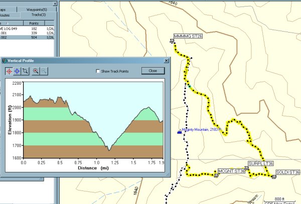
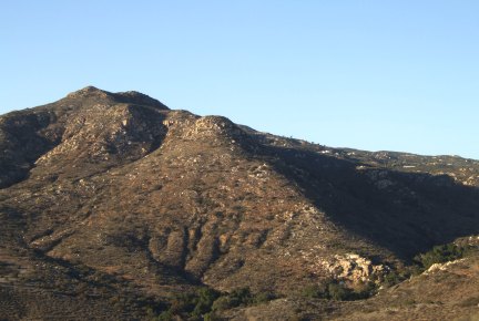
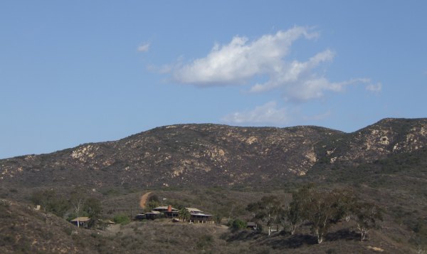
We made it up to a view of the mansion before spitting up. I continued on with Jahoadi, SuperDave!, jaredloser, and GEO-K9-Betsy. The first task Jahoadi had to accomplish was the retrieval of a cache she placed that turned out to be too close to the end point of a multi/puzzle cache by Team Adelos. On our way to her cache, we found "Daddy's Shortcut" for SuperDave!. After retrieving her cache, we found the other cache and signed the logbook . . . although I was already in the logbook as a member of the original "Lost Patrol" of January 6.

It will be interesting to see how long it takes the first person to find all Seven Dwarfs in order to get to "Snow White."

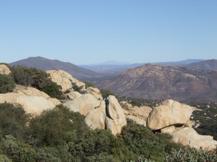
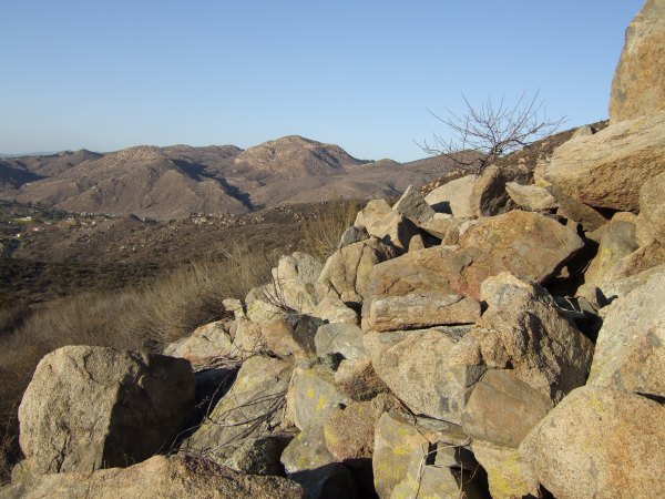
Now we were on to "The Hill Are Singing." I knew where to focus my search this time and I saw the item mentioned in the hint just after nearly falling down when my walking stick slipped on one of the huge rocks . . .

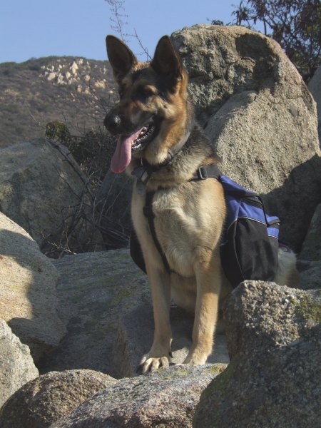
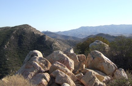
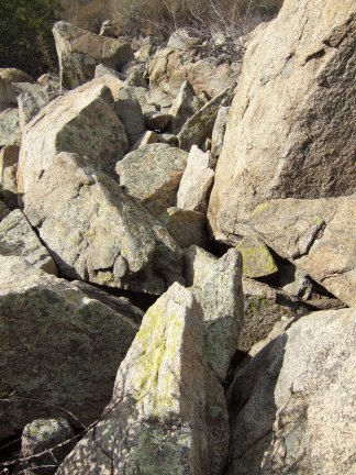
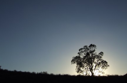
I didn't take very many pictures during this hike. I was enjoying the company and the conversation too much, however, I took a picture of beautiful GEO-K9_Betsy sitting on the rockpile. She looks, and behaves, exactly like a German Shepherd dog I had 20 years ago . . . was it really THAT long ago . . . ?


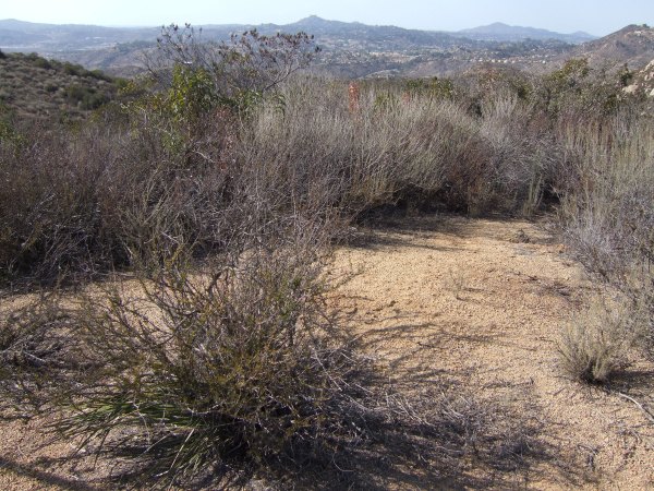
We continued down the trail to the new cache, "A Little Further Down the Trail," stopping at the other caches I found last Sunday as we walked. At that new cache, I think it was my brilliant idea to continue down to some oak trees. Jahoadi had a cache container with her, and that sure looked like a good place for a cache . . .

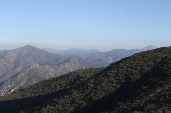
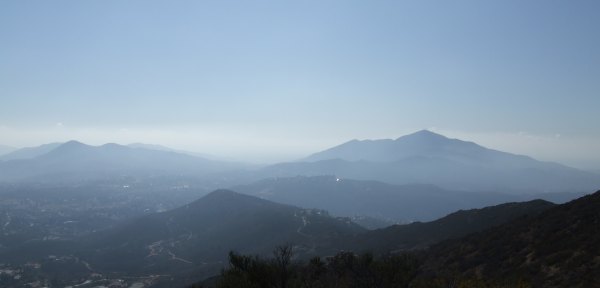
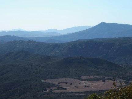
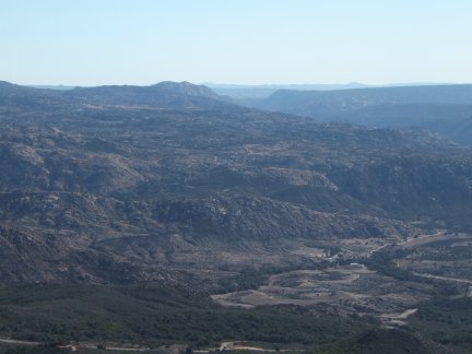
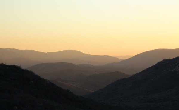
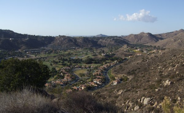
The oak trees were a bit too close to ChuckB's cache, so we continued a bit further. From there, we decided to look over the ridge to what was ahead of us . . . and from there we continued down, down, down.

At a neat rockpile, I took another picture of our very photogenic companion.


The pack she was carrying came in very handy further down the trail near the golf course when we found more than 30 golf balls . . .


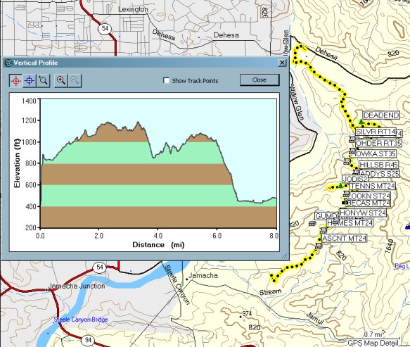
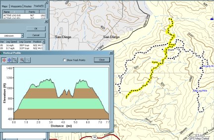
After negotiating a steep hill, and a steeper embankment, we finally reached the dry creekbed that bisected the Sycuan Golf Course. We only held up play for one group of golfers . . .

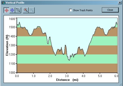
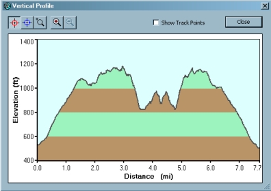
Thank goodness for cell phones and an available spouse who could come and pick us up on Dehesa Road after our eight-mile hike.


It sure was a great day. I had a wonderful time. Thanks Jahoadi and SuperDave! for letting me join you on such a fun adventure.


Friday, January 26, 2007

Another hike up Mt. McGinty

Even though I didn't really make a New Year's Resolution to climb McGinty every week, I have been making it up that peak more than once a week so far this year.

Today's hike was really fun, although I got myself into some places I probably shouldn't have been by myself . . .

After finding the third cache on the east side of the mountain, I found a trail that headed towards the north side of the mountain, which is where I needed to go. I followed it as the vegetation got thicker and taller on the northern exposure of the mountain. I stopped and took a picture at one point.


At that point, it still looked like a trail, believe it or not. Later, I couldn't find any evidence of the trail. I wandered around and backtracked and then forged ahead where the bushes thinned out a bit.

Finally, I made it through to the road that goes downhill from the "Another Sycuan View" cache. When I finally got to the road, I sat down and rested for a while . . . I also took off my boots and took all the sticks and stickers out of them.

This is what my tracks looked like, and what the profile of my "shortcut" looked like.


The marine layer was starting to come in today, so the pictures I got were hazy.

This is a picture of Sycuan Peak from "Mmm Mmm Good Sycuan View." In the forground is the hill I walked across . . .


After finding that last cache, I retrieved "lostguy"'s container he placed when we were on the mountain last Thursday. I thought about trying to find another place for it, and if I had found a really great spot, I might have hidden it for him.

I took a few more pictures as I continued back down the mountain. With the marine layer developing again and moving inland, the mountain had a different feel than the other days I have been up here recently when the air was so dry and the sky so clear.


I am meeting 3cds and Mrs. 3cds tomorrow morning for a short hike on the west side of McGinty. The short hike is about all I will be able to tackle after what I did this afternoon . . .


Thursday, January 25, 2007

My favorite hike on Gaskill Peak for a TC FTF

3cds wanted to get another Terracache this week, so we met along Japatul Valley Road and he drove his truck up the rough tangle of roads that goes through the Carveacre "development." When we got the the access to the Forest Service Road, there was a gate across the road with "No Trespassing" signs . . . Bummer! Right next to the gate is a sign for the National Forest Boundary, so we found a place to pull off the road and then we bushwhacked back to the road.

The reason the road is now closed is because two new homes, on incredible view lots, are being built. Now that they have their building permits, they have to improve the road and they have had to use some really heavy equipment to move the boulders and smooth out the road that used to be a challenging and techinical 4WD access to the ridge.

Once we got up to the ridge, the awsome views opened up on all sides. I kept stopping to take picture after picture, even though I have taken pictures on all my other trips up that wonderful trail.


In that picture, you can see Bell Bluff, the challenging peak both 3cds and I have conquered, although at different times. That would be my favorite hike in the county if it wasn't such a long, boring slog through previously-burned chaparrel to get to the base of the peak. It was sure fun to be on top of that peak playing around and among all the huge boulders.

Behind Bell Bluff, way off in the distance, is Mt. Palomar. Closer in, and to the left, is Viejas Mountain, the location of my first Geocache FTF.

We were there a bit after ten in the morning, so my pictures didn't come out as well as they would have if I had been on that trail a couple of hours earlier. This awesome view to the south hardly resembles what I really saw from the ridge.


On all my other hikes up this trail, I don't remember stopping here to get this particular view of Lawson Peak.


Further up the trail, looking to the east, you can see the terrible devastation of last summer's Horsethief fire. Because we have had very little rain this winter, there isn't any new green growth on those scorched hillsides.


The new Terracache is about 89 feet away from my "On the way to Gaskill Peak." It is TC47W, "Barrett Lake View" by Travelita. As she was looking for a place to put her cache, she accidentally found my cache . . .

3cds spotted the "cammo" on her small container before I did, so he was the true FTF. He took the "Fermented juice of the agave" as his FTF prize; I took the money! I'll have to buy at Starbuck's again the next time we are in town.

It was a really wonderful day. I had a great time, and I even got home in time to clean up and get ready to drive to La Jolla to see a free movie, "The Italian." Now that gas prices have come down a bit, it doesn't quite cost me the price of a movie ticket to drive to San Diego to take advantage of a free KPBS movie pass . . .


Tuesday, January 23, 2007

A hike into Hollenbeck Canyon for a Terracache FTF

Because I had to make a trip to the post office, I was driving right past the road to the northern Hollenbeck Canyon trailhead. I debated with my self a bit -- Go to Target to get some necessities or go for the FTF. Hmmmm . . . what would a Geocacher choose?

So, down the Private Road to the trailhead I drove, thankful for the single lane of pavement that was put down several months ago. Since I am going to own this car for a long, long time, I didn't like beating it up on the original rough and washboarded dirt road.

The afternoon was beautiful; a perfect temperature for hiking in just a long-sleeve t-shirt. The sky was a bit hazy, so I didn't take too many pictures, although the views along the trail were great. This would be a great hike for photography on a day after a storm when little puffy clouds are still in the sky to make the monotonous blue more interesting.

I walked the road to my "Lonely Trees with a View" cache, a road I could have ridden my mountain bike down just as fisnjack had said. Even though I had the bike in my car, I decided not to ride it because of that first really rough section through which I would have to practically carry the bike.

From "Lonely Trees with a View," where I picked up a Geocoin placed there by 3cds a few weeks ago, I bushwhacked down the steep hill to the road. Only when I got off the road and started walking through the brush did I realized how terribly dry the vegetation is. So far this winter, we have had very little rain.

On the peak ahead of me, there were two caches, the elusive bradybunchboys "Hollenbeck Holiday Hide" and 3cds' Terracache. I found the Terracache first. It was an Altoids tin hidden in this rockpile . . .


Actually, it was a pretty easy find because of the excellent hint.

After signing the pristine log, I started my search for the other cache. I walked around that rockpile working my way to GZ. Out of the corner of my eye, I spotted an object I am known for using as "cammo." I picked it up, looked at it, and then caught a glimpse of the object mentioned in the hint.

My log reflected my thanks to the person who left that object:
Man, oh man! I never would have found this cache if some kind soul had not left another item near the thing mentioned in the hint. I checked that out and then saw where the cache was. It was a beautiful day for a hike into the canyon. Thanks for the cache.


Near the cache, I saw this butterfly and was able to get close to it . . . its pose wasn't very photogenic, however.


After signing the log on that cache, it was still fairly early in the afternoon. I had a decision to make. Should I hike down, down, down into the canyon to hunt for "IHO: The Mountain Bikers," should I head back, or should I continue to the SW to look for three more caches that had been waiting to be found by me for more than two months.

I decided to do the latter.

The first cache I looked for was another in "lostguys" series incorporating the word "Couch." I love finding caches like that one. I circled the area where the cache might be, put my hiking stick down as I took a step, and hit the cache container. I hadn't even started my search yet!

From that cache, the "trail" was much fainter. I was bushwhacking up through waisthigh, tinder-dry chaparrel to a rocky outcrop with a commanding view to the west.

My easy find of the previous cache was made up for by a frustrating search for this one. The hint uses the word "crevice." I searched several narrow crevices in the large boulders and had no luck.

I took a bit of time out from the search to photograph this little butterfly.


It was much more shy than the other one and wouldn't let me get close . . .

I was about to give up and move on to the next cache, but decided to pick up the GPSr and try to get to exactly "0". Very near GZ, I put my hiking stick between three medium-sized boulders and something made a funny sound. It was the cache container . . .

From that cache, I had to bushwhack down to "The Ottoman Saddle." The profile of my track shows the ups and downs I made on my journey


On my way back up the hill, I had to refer to the tracks on my GPSr to find my way through the brush. Once back on the trail, I saw the camera I saw earlier.


I believe it is motion-sensitive and is meant for taking pictures of the resident mountain lion. The wildlife researchers are going to have a picture of me and my camera when they next review the pictures . . .

The sun was getting low in the sky and the view of the location where I hid my "Jamul Creek View" cache looked beautiful. Unfortunately, this picture doesn't do it justice . . .


Finally, back near the top and not too far away from my "Canyon View" cache I got several pictures of the sunset light in the canyon.


It was a beautiful day for a hike. The temperature was finally warmer than it has been over the past few weeks. While the temperature is moderate out here in the East County, I need to take advantage of it and hike as many of the trails as I can.


Monday, January 22, 2007

Still waiting for my new caches to be found

It has been a while since I placed a cache, and I forgot about the level of anticipation waiting for them to be found. bradybunchboys was FTF on the first one I placed yesterday, "Man, that was a lotta work!." He didn't comment on the steep ascent, or the hand-built road, but at 5:45 in the morning, maybe it was too early . . .

The other two caches involve a hike, or mountain bike ride, of more than a mile, so it will be a little while longer before someone gets up there. One of them is a container provided to me by "lostguy" and it looked very cute in its original hiding place.


He was up in the tree at about eye-level but when I walked away, I realized he was too visible so I moved him to a lower spot and covered him with pepper tree detritus.

The other cache is hidden somewhere in this picture:


After hiding the last cache near the abandoned "mansion," I continued on up the trail.


It was only a half a mile or so . . . as the crow flies . . . to the next cache. Of course, I didn't get to hike in a straight line. A deep gully that had served as the dump site for the people who lived in the "mansion" blocked my forward passage. I had to make a big loop to go around.

When I finally got to the location of "The Hills Be Singing," I was dismayed to see a huge rock pile almost as un-fun to climb around on as rip rap. Some rocks are really great to scramble on. These were not. Even though many were large, they were tumbled at odd angles and some of them were unstable and moved . . .


It probably wasn't the best place for me to be all by myself, especially since I, once again, had not told anyone where I was going . . .


I looked for a long, long time, finally consulting the hint and the past logs and then I looked and looked some more, all to no avail. As I searched, I was remembering Night Hunter's advice -- "If the hike is long, the cache should be easy-to-find."

From there, I walked to the next cache, which was down, down, down the eroded trail. I had a bit of trouble finding that cache until I looked at the hint and remembered what kind of container it was, a metal butter dish.

The next cache wasn't too far away, so I continued walking down to it. That was a very easy find. Thank you, Chuy! After that, I still had to go down further to get the final cache on this side of the mountain. After a little searching, I found the large tin that was very full. CTYankee left a large trade item when he was here a few days ago and I could hardly get the lid back on after signing the log.

Suburbia was in view below the cache location.


As the sun dipped behind the higher hills to the west, I started up the trail. At the location of my DNF, I stopped and looked again. I looked until the sun went down on the rock pile and the temperature dropped a few degrees.

After my disappointing DNF, I was happy to be rewarded with a scene like this on my way back down, down, down to my car.


On the return trip, I met another hiker. He had not heard of Geocaching before. Now he has. In fact, he probably heard more than he ever wanted to know about this little game.

I gotta stop doing that . . .


UPDATE: kwver was FTF on "Looking for the pond" and "Nope, nothing to see here . . . " Jahaodi was STF on "Man, that was a lotta work."


Time for some new Keen People maps

Okay, today I am recovering from all the hiking I did yesterday, last Thursday, and last Monday, so I ought to catch up with some things I haven't added to the blog for several months.

Here is the new map of my San Diego finds:


After placing three more caches, and after my Earthcache "Waymark" was moved back to Geocaching.com, I have 76 caches around the county.


Who knew when I placed that first cache along Lyons Valley Road almost two years ago I would turn into such a prolific hider. I certainly didn't. Back then, my health was so tenuous, I could hardly imagine being able to take care of that one cache 25 feet away from a road only five miles from my house.

A while back I Archived Lyons Valley Roadside Distraction because it had been muggled twice. Now that I think about it, even though it didn't get found very often, I might go hide another cache in that location.

That would give me something to do on this beautiful, bright and shiny, sunny day.


Sunday, January 21, 2007

Yet another hike on Mt. McGinty

The tangle of tracks shows where I have been on the mountain in the past two weeks. Thursday the hike was more than eight miles. Today, the hike on the mountain was 7.7 miles.


Here is a little closer view of the ups and downs I made during today's hike:


I placed three more caches today and just finished writing up the descriptions. One is in a place I scouted more than a year ago. Another one is on a point where the views in all directions are great. The last one is a container "lostguy" gave me a few months ago.

I hope all three of them get approved. I'm a little concerned about one of them because Team Adelos might have a puzzle cache hidden nearby. I checked for the distance from all the other nearby caches, but his brand new cache hasn't even been found yet, so no one but Paul, and Marko Ramius, knows where it is.

While the weather is cool people can get out this way to hike to my new caches. By June, the caches will get very lonely again and won't get any visitors until the temperature goes down again in the late fall.

I took lots of pictures and I'll try to post them tomorrow.


Web Counters
Office Max Coupon