Saturday, March 18, 2006
Thursday, March 16, 2006
Oh my! What an amazingly adventurous day!
DocDiTTo was still in town, so several of us “locals” used his presence here to get together to do two very far-flung caches, “None More Southwesterly” and “The Forbidden Forest,” and many more.
We met up in Coronado, which is just about halfway between these two destinations. We found a couple of caches on that “island” before heading down the Silver Strand towards Imperial Beach and ultimately to the trailhead for “None More Southwesterly.”
Once we got there, Duncan! had to leave, so our large group was down by one as we started out on the mile and a half walk to the cache. As we got closer to Mexico, we noticed the nice homes built right next to the border on that side, while on the US side, there is no development at all in this area. When we finally got near the cache, John ran down to the water, so of our group, he was the only one who truly got the most “southwesterly.”
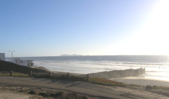
We signed the log and took some pictures before starting the trek back to the vehicles.
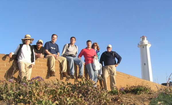
Once back at the parking, we check the next nearest cache and took off for "Spooners Mesa" which was up a steep road with a couple of switchbacks. On the way, hrtpmpfxr started to pass Jahoadi on one of the hills, but thought better of it . . . maybe. He did pass us up and drive right to the cache once we got to the top however.
The cache has a great view, but the cache container and the cache contents are in need of a little “owner maintenance.”
After logging that find, we continued on down the road finding several caches before arriving at a great little Mexican restaurant where Tombmaker hid a nano container. It took us a while to find the cache, and once again I think it was duganrm who make the grab. While people took turns searching, others of us took turns getting in line to order food.
We sat inside and ate our delicious meal and then took off to find a couple more caches in the Imperial Beach area before hitting the freeway for the more than 23-mile drive up to the location of “The Forbidden Forest.” While we waited for Dr. Boggis to arrive, we wandered around in the forest for a while, trying to locate the strange “Boo's Door.” Finally, the appointed time arrived and we took off down the trail looking for the reflectors. I discovered very quickly that my LED flashlight was not adequate for the task. I was glad the others had better flashlights and headlamps that could illuminate the little glowing triangles.
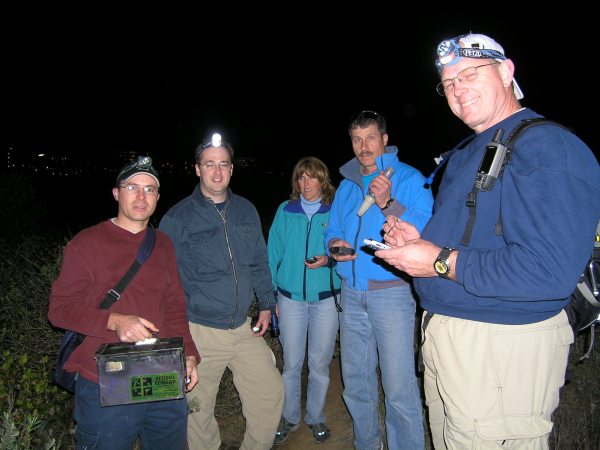
We walked quite a ways in the dark forest beneath a full moon before we found a box which provided the coordinates to the ammo can. We got quite a surprise when we opened the box. I took some pictures of us after we traded Travel Bugs and dropped off Geocoins.
When Jahoadi finally delivered me back to my car, I saw that I had a flat tire. The guys said I should not drive home with it like that, so I decided to go with them to a service station where I could get air. Gobolts! used his flashlight to help me see the tire guage and soon we were on our way to finding more caches.
Finally, at about 1:45 a.m., they decided to call it quits for the night and I set my GPSr on a GoTo for my Home so it could get me out of the unfamiliar area of Imperial Beach and on the Interstate and highways towards home.
It was a wonderful twelve hours and I am very grateful to Jahoadi for doing all that driving, and for letting me join her and John on the adventure.
- - - - - - - - - - - - - - - - - - - - - -
This afternoon I created a new Keen People map to show the new caches found way down in the Southwestern corner of the country.
- - - - - - - - - - - - - - - - - -
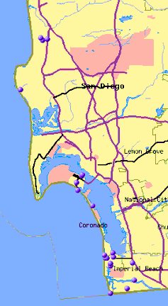
I thought it would be interesting to plot just the caches we found today. This shows why I am so grateful to Jahoadi for driving.
We met up in Coronado, which is just about halfway between these two destinations. We found a couple of caches on that “island” before heading down the Silver Strand towards Imperial Beach and ultimately to the trailhead for “None More Southwesterly.”
Once we got there, Duncan! had to leave, so our large group was down by one as we started out on the mile and a half walk to the cache. As we got closer to Mexico, we noticed the nice homes built right next to the border on that side, while on the US side, there is no development at all in this area. When we finally got near the cache, John ran down to the water, so of our group, he was the only one who truly got the most “southwesterly.”
We signed the log and took some pictures before starting the trek back to the vehicles.
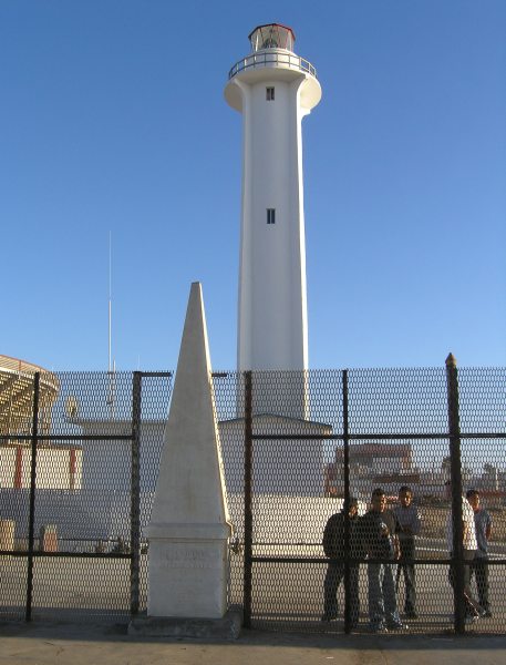
Once back at the parking, we check the next nearest cache and took off for "Spooners Mesa" which was up a steep road with a couple of switchbacks. On the way, hrtpmpfxr started to pass Jahoadi on one of the hills, but thought better of it . . . maybe. He did pass us up and drive right to the cache once we got to the top however.
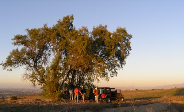
The cache has a great view, but the cache container and the cache contents are in need of a little “owner maintenance.”
After logging that find, we continued on down the road finding several caches before arriving at a great little Mexican restaurant where Tombmaker hid a nano container. It took us a while to find the cache, and once again I think it was duganrm who make the grab. While people took turns searching, others of us took turns getting in line to order food.
We sat inside and ate our delicious meal and then took off to find a couple more caches in the Imperial Beach area before hitting the freeway for the more than 23-mile drive up to the location of “The Forbidden Forest.” While we waited for Dr. Boggis to arrive, we wandered around in the forest for a while, trying to locate the strange “Boo's Door.” Finally, the appointed time arrived and we took off down the trail looking for the reflectors. I discovered very quickly that my LED flashlight was not adequate for the task. I was glad the others had better flashlights and headlamps that could illuminate the little glowing triangles.
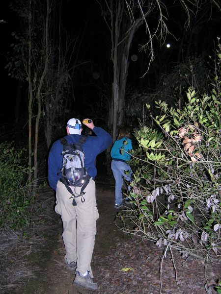
We walked quite a ways in the dark forest beneath a full moon before we found a box which provided the coordinates to the ammo can. We got quite a surprise when we opened the box. I took some pictures of us after we traded Travel Bugs and dropped off Geocoins.
When Jahoadi finally delivered me back to my car, I saw that I had a flat tire. The guys said I should not drive home with it like that, so I decided to go with them to a service station where I could get air. Gobolts! used his flashlight to help me see the tire guage and soon we were on our way to finding more caches.
Finally, at about 1:45 a.m., they decided to call it quits for the night and I set my GPSr on a GoTo for my Home so it could get me out of the unfamiliar area of Imperial Beach and on the Interstate and highways towards home.
It was a wonderful twelve hours and I am very grateful to Jahoadi for doing all that driving, and for letting me join her and John on the adventure.
- - - - - - - - - - - - - - - - - - - - - -
This afternoon I created a new Keen People map to show the new caches found way down in the Southwestern corner of the country.
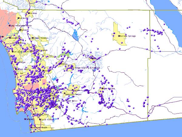
I thought it would be interesting to plot just the caches we found today. This shows why I am so grateful to Jahoadi for driving.
Monday, March 13, 2006
A great day of caching with a new cacher
I have "View From the Top" on my watchlist, so when a new cacher DNFd it the other day, I sent an email with a couple of questions. A previous cache up on Mt. Helix had been muggled, so I wanted to make sure this one was still there.
When bikehead DNFd the cache again, I emailed that could come down and meet him there, if he didn't mind being seen with a woman old enough to be his mother . . .
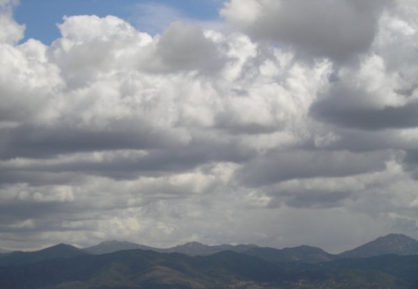
The views from up there were fantastic after the storm that dropped snow on the nearby mountains, so it was worth the trip, plus I was able to drop off Gobolts! "Idiosyncratic Bus" T.B. and I got some more pictures. This one shows Gaskill Peak and Lawson Peak, two I have climbed in search of caches.
Since I knew duganrm was caching with DocDiTTo, I thought bikehead and I could join them and he would get to see more caches, and meet a couple of other cachers who were more his age.
We took off for the coast and met up with duganrm at the Arby's on Rosecrans Street. He was working on a Puzzle cache I didn't know anything about. It was a real interesting and complex challenge created by FlagMan.
We went to one waypoint location, and bikehead was the one who found the waypoint . . . while I was still wandering around on the sidewalk trying to figure out where the steeple shadow would have been at a particular time . . .
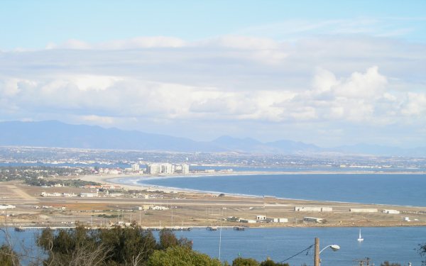
We ended up at another waypoint, where there was also another cache, so we got a "two-fer," and we got to see some incredible views of San Diego, the ocean, and the mountains off in the distance in Mexico. This picture shows the beautiful curve of the beach on Coronado.
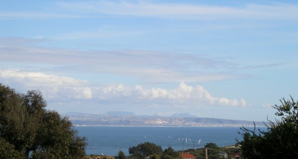
This was a view towards the southeast showing the mountains in Mexico.
We found a couple of other caches on Point Loma. I took this picture from above the cemetary.
The final location for the puzzle cache was quite a distance away, but it was near a few more caches, so bikehead was able to see how caches can be hidden, cammoed, and placed. Several of the caches were by Pathfinder & Snoopy, two of our more creative and prolific hiders in this area.
It was a great day, and even though I didn't feel very well, I was very glad for the diversion the group provided for me.