Eight miles of hiking up and down 2000' . . . WOW!!
Auld Pro suggested heading out to McCain Valley for our hike this week. That is a long drive, so I was very grateful he was willing to drive that far. Akop&Fam had placed a Geocache and a Terracache in the area, and then GeckoDad placed two Geocaches and one Terracache. So, we had lots of caches to find along the trail.
We started out at 7:30 in the morning and began our hike about 8:30. The temperature at that elevation was still cool at that time of the morning, and there was a nice breeze, which stayed with us the entire day. Since high winds had been predicted for the day, the breeze was welcome. I tried caching in McCain Valley one day with 50 mph wind gusts . . . That was not very fun.
The first cache was near the very end of McCain Valley Road. We circled the rock pile before figuring out the cache was hidden up high in a convenient crack between boulders.
We signed the log as STF after TeamGecko.
From there, we had a false start trying to find the trail, but soon found it and started what was ultimately a long, long descent down to the desert floor. We walked for a while, but then the trail disappeared. Auld Pro expected this because the trail petered out in Google Earth. So, from that point, we began a bushwacking adventure, something that wasn't too difficult in most places because the high desert vegetation is sparse. We had to watch out for the cholla cactus.
After going down into one little draw, and then up another ridge, we finally found the trail, and soon after that found the next cache, "Pepperwood Trail." That is why our track looks different going down, from coming back up.

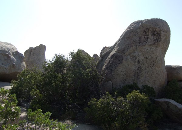
From there, we started down towards our ultimate destination. I was navigating to "Pepperwood Trail Camp," a Terracache placed by Akop&Fam. We saw this amazing rock formation as we walked and I stopped to take a couple of pictures.

Unfortunately, at that time, I didn't refer to my GPSr to see how close we were getting to the cache. The last time I looked at my Vista HCx, we were still .24 away. So, we continued walking. Whooops! By the time I looked at my GPSr again, we had walked more than 400' too far.
We chose wisely to turn around right then and trudge back up the hill to look for the cache at that time. Had we decided to find it on the way back up the hill, as I initially suggested, we might have been too tired . . .
The location was fantastic, with Indian Morteros in some rocks, however, it took us quite a while to figure out how to get to the hiding place. Once we got around there, it still took us a while to find the small container. The view from there was fantastic.

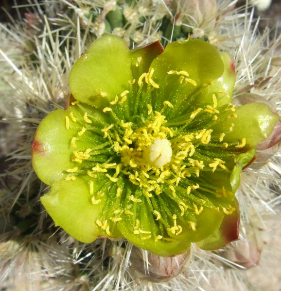
As we walked along the trail, going down, down, down in elevation, more and more of the cholla cacti were in bloom.
As we continued down, the trail seemed to diverge and I unwisely took the one that went straight, instead of making a hard right down towards some huge boulders. I was following fresh footprints, but the trail became fainter, and fainter. At one point, we walked out onto a promontory to see if we could see the real trail.

We didn't, so we continued the way were were heading. Once we got near the bottom of the creek, the vegetation got thicker. Auld Pro took over the navigation from then on . . .
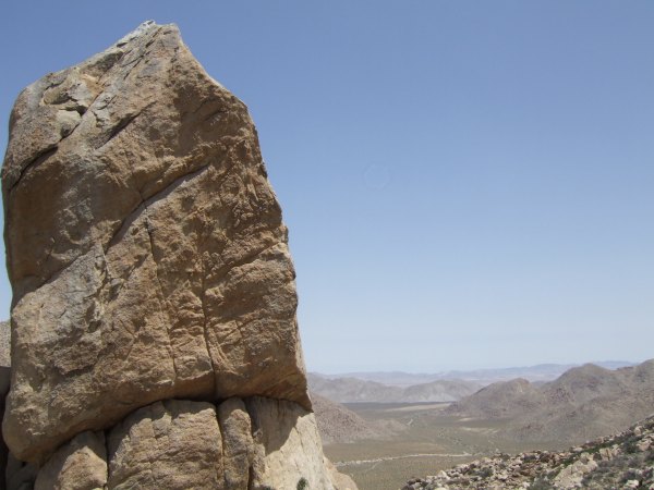
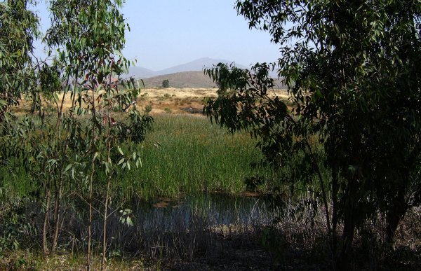
We finally found the real trail, which crossed from the west side of the creek to the east side, back at those enormous boulders. Now we made better time on our way to the Terracache at a huge pillar. From there, we could see to the Salton Sea and beyond.
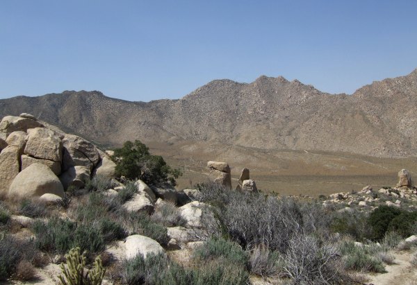
After leaving the location of the Pillar Cache, I took this picture of another interesting clump of house-sized boulders.

The descent to the desert floor from the Pillar Cache was daunting . . . We stopped once, looked way downhill and thought about turning back. However, we continued down some more, then stopped again, wondering if we would have the stamina to make it back up the steep slope ahead of us . . . Finally, we decided to continue and the descent on the soft sand was fun. It was almost like glissading down a snow-covered slope.
We were FTF on the "Pepperwood-Canebrake Parasaurolophus" cache, one which GeckoDad had put an entire set of Yrium Memorial cards in. It was fun looking through all of them, some of which I have, several others of which I don't have. I finally decided to trade for both a Night Hunter and a SlabyFam card.
After resting in the shade for a while, we put our packs back on and started up, up, up the steep, sandy trail. The parts that had been fun on the way down, were tough going up. With each step, I would slip back a few inches. I was thankful for my trekking poles because they helped a lot, taking some of the stress off my knees.
At one of the stops to catch my breath on the way back up, I turned around and saw these wonderful outcrops of rocks seemingly pointing the way to the Pillar.
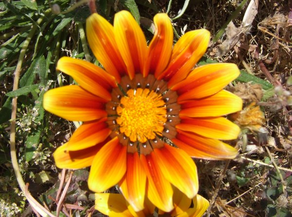
During another stop to take a breather, I took this picture of an Encelia bush in bloom.
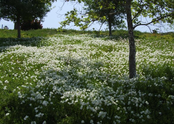
Earlier when I commented on the bright yellow flowers, say "They look so happy." Auld Pro said, "Stop it."
On our way back up, after TeamGecko's "Pepperwood Trail" cache, we continued up the correct trail, which took us to the Pepperwood Spring, near which there were these Indian Morteros.
Someone had created small pools for water to collect.

During one of our rest stops, I set the GPSr for the first cache we found today and had Auld Pro guess how far we had to go. Fortunately, the actual as-the-crow-flies distance was much less than his first guess. I'm not sure either one of us could have made a three-mile hike from that location . . . In actuality, we only had 1.85 miles to go . . . and only another several hundres feet of elevation to go up . . .
I had a wonderful time, and as I already said, I am very grateful to Auld Pro for driving all that distance, especially with the recent spikes in gas prices that put gas here in San Diego near $4.00 per gallon.
We started out at 7:30 in the morning and began our hike about 8:30. The temperature at that elevation was still cool at that time of the morning, and there was a nice breeze, which stayed with us the entire day. Since high winds had been predicted for the day, the breeze was welcome. I tried caching in McCain Valley one day with 50 mph wind gusts . . . That was not very fun.
The first cache was near the very end of McCain Valley Road. We circled the rock pile before figuring out the cache was hidden up high in a convenient crack between boulders.
We signed the log as STF after TeamGecko.
From there, we had a false start trying to find the trail, but soon found it and started what was ultimately a long, long descent down to the desert floor. We walked for a while, but then the trail disappeared. Auld Pro expected this because the trail petered out in Google Earth. So, from that point, we began a bushwacking adventure, something that wasn't too difficult in most places because the high desert vegetation is sparse. We had to watch out for the cholla cactus.
After going down into one little draw, and then up another ridge, we finally found the trail, and soon after that found the next cache, "Pepperwood Trail." That is why our track looks different going down, from coming back up.
From there, we started down towards our ultimate destination. I was navigating to "Pepperwood Trail Camp," a Terracache placed by Akop&Fam. We saw this amazing rock formation as we walked and I stopped to take a couple of pictures.
Unfortunately, at that time, I didn't refer to my GPSr to see how close we were getting to the cache. The last time I looked at my Vista HCx, we were still .24 away. So, we continued walking. Whooops! By the time I looked at my GPSr again, we had walked more than 400' too far.
We chose wisely to turn around right then and trudge back up the hill to look for the cache at that time. Had we decided to find it on the way back up the hill, as I initially suggested, we might have been too tired . . .

The location was fantastic, with Indian Morteros in some rocks, however, it took us quite a while to figure out how to get to the hiding place. Once we got around there, it still took us a while to find the small container. The view from there was fantastic.
As we walked along the trail, going down, down, down in elevation, more and more of the cholla cacti were in bloom.
As we continued down, the trail seemed to diverge and I unwisely took the one that went straight, instead of making a hard right down towards some huge boulders. I was following fresh footprints, but the trail became fainter, and fainter. At one point, we walked out onto a promontory to see if we could see the real trail.
We didn't, so we continued the way were were heading. Once we got near the bottom of the creek, the vegetation got thicker. Auld Pro took over the navigation from then on . . .
We finally found the real trail, which crossed from the west side of the creek to the east side, back at those enormous boulders. Now we made better time on our way to the Terracache at a huge pillar. From there, we could see to the Salton Sea and beyond.
After leaving the location of the Pillar Cache, I took this picture of another interesting clump of house-sized boulders.
The descent to the desert floor from the Pillar Cache was daunting . . . We stopped once, looked way downhill and thought about turning back. However, we continued down some more, then stopped again, wondering if we would have the stamina to make it back up the steep slope ahead of us . . . Finally, we decided to continue and the descent on the soft sand was fun. It was almost like glissading down a snow-covered slope.
We were FTF on the "Pepperwood-Canebrake Parasaurolophus" cache, one which GeckoDad had put an entire set of Yrium Memorial cards in. It was fun looking through all of them, some of which I have, several others of which I don't have. I finally decided to trade for both a Night Hunter and a SlabyFam card.
After resting in the shade for a while, we put our packs back on and started up, up, up the steep, sandy trail. The parts that had been fun on the way down, were tough going up. With each step, I would slip back a few inches. I was thankful for my trekking poles because they helped a lot, taking some of the stress off my knees.
At one of the stops to catch my breath on the way back up, I turned around and saw these wonderful outcrops of rocks seemingly pointing the way to the Pillar.
During another stop to take a breather, I took this picture of an Encelia bush in bloom.
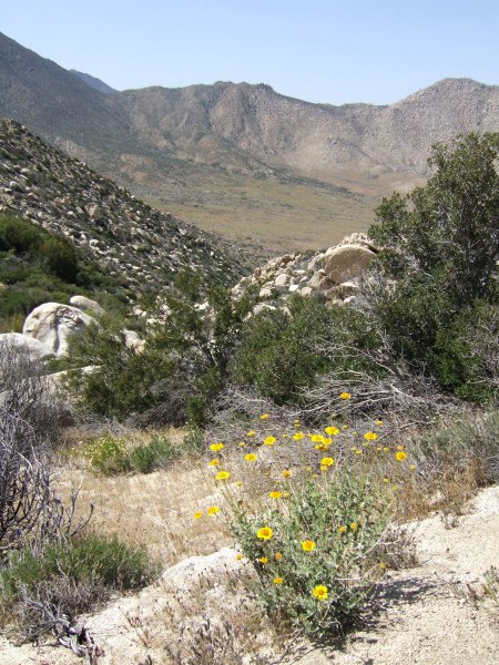
Earlier when I commented on the bright yellow flowers, say "They look so happy." Auld Pro said, "Stop it."
On our way back up, after TeamGecko's "Pepperwood Trail" cache, we continued up the correct trail, which took us to the Pepperwood Spring, near which there were these Indian Morteros.
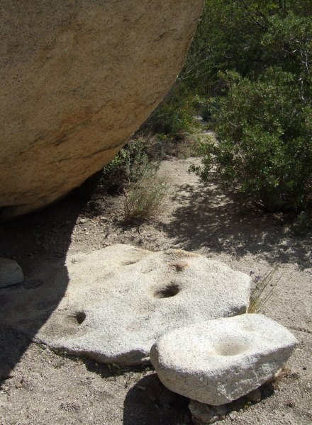
Someone had created small pools for water to collect.
During one of our rest stops, I set the GPSr for the first cache we found today and had Auld Pro guess how far we had to go. Fortunately, the actual as-the-crow-flies distance was much less than his first guess. I'm not sure either one of us could have made a three-mile hike from that location . . . In actuality, we only had 1.85 miles to go . . . and only another several hundres feet of elevation to go up . . .
I had a wonderful time, and as I already said, I am very grateful to Auld Pro for driving all that distance, especially with the recent spikes in gas prices that put gas here in San Diego near $4.00 per gallon.
posted by Miragee at
9:14:00 PM
|
2 comments
![]()
![]()


 10-Day Forecast


