Another very fun "We Be Jeepin'" Event
The Splashes planned another "We Be Jeepin'" Event and I begged a ride from The Fat Cats who have a brand new four-door Jeep outfitted with huge tires and all the other important features necessary for serious off-roading. I met them at the Descanso Park 'n Ride and off we went, up the winding road toward Julian and the even more winding Banner Grade road on our way to the meeting spot.
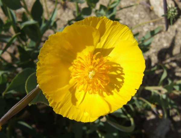
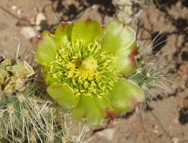
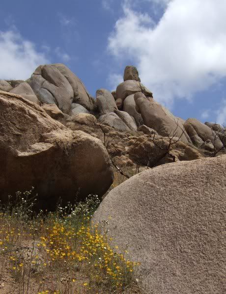
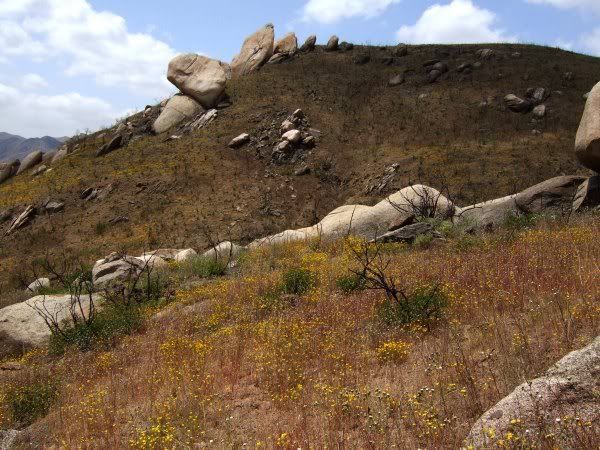
Jeep after Jeep started arriving until finally, all 21, or so, vehicles were ready to start up the Forest Service road. Most of the wildflowers were past their prime except for some of the cacti species, and several larger bushes.
Although we only found three caches during the day, we had lots of fun, especially when we watched some of the people take their vehicles over a challenging rocky obstacle. FishPOET went first and made it just fine. Then RUSCAL drove over the obstacle course, making it after realigning his Jeep a couple of times. Robyn picked a perfect line and made it look so easy and smooth.
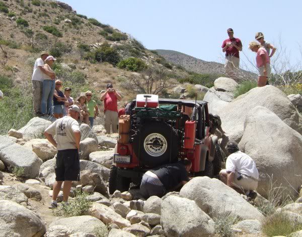
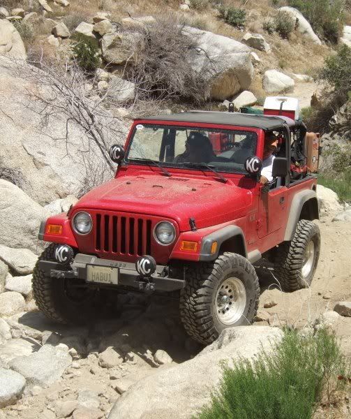
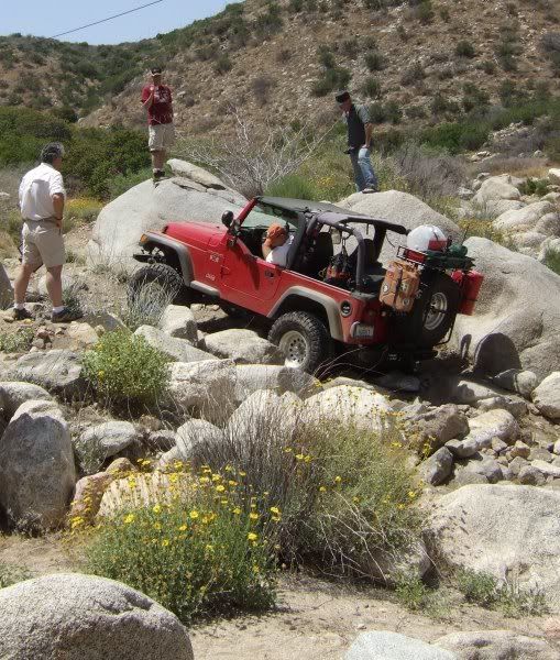
Then, it was Habu!'s turn . . . Here is a picture of him and his jeep before he got it stuck . . .
And, here are a few people trying to help his get it unstuck a while later.
Robyn got to use her winch to pull Habu! out of the predicament he had driven into . . . I'm not sure the cable show in this picture, but it's there . . .
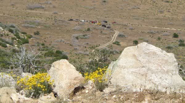
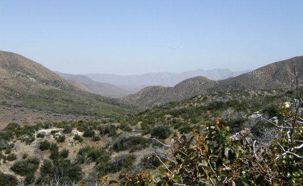
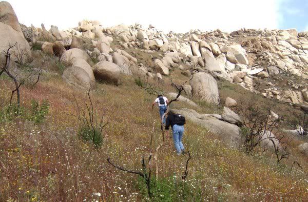
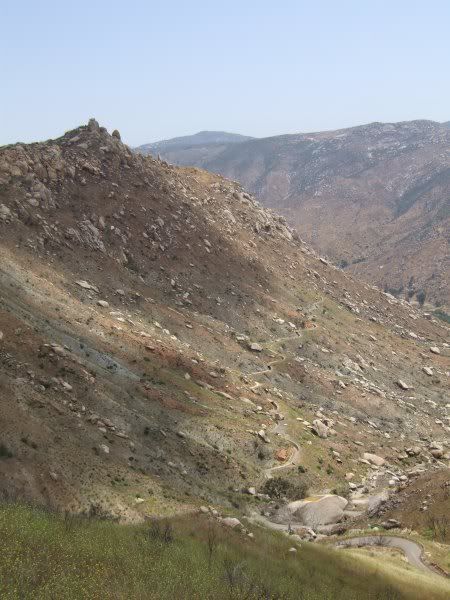
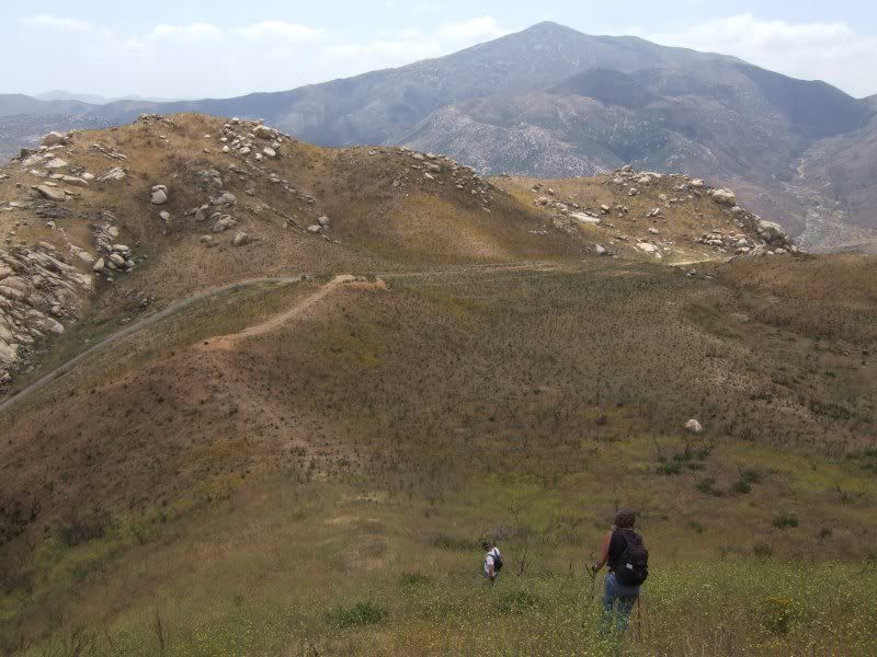
Finally we were all ready to head out and find the few caches along the road. From high up on one hill, I got a picture of a portion of the group far down below.
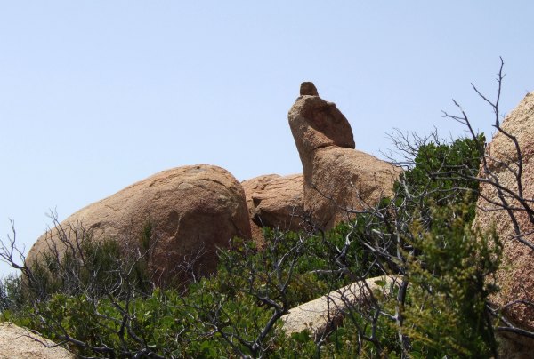
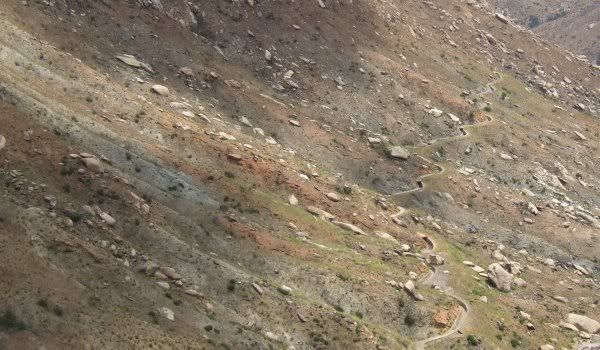
The first cache on our list was one by the bradybunchboys called "'If You CAN'T Hack IT ! Pack IT !' LSR." It was near a mine of some sort where we found several lavender-colored stones and rocks. It had this great view of the desert off to the east.
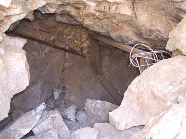
Inside one of the mine openings, we saw this 2 X 4 frame that I hope they weren't depending on supporting the overhead rocks . . .
Here is one picture of the group at the Palm cache.

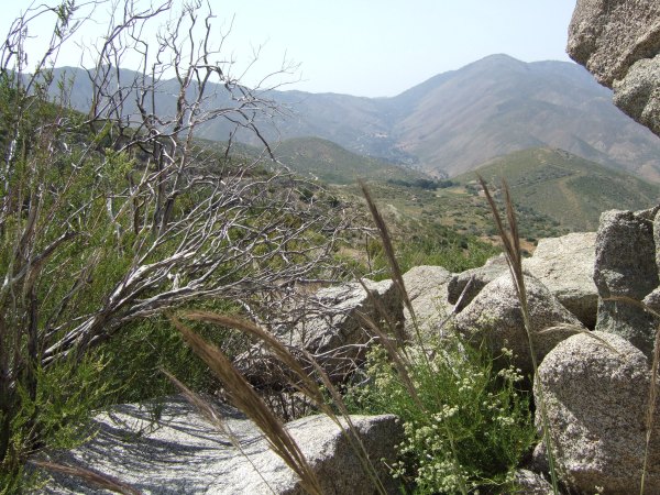
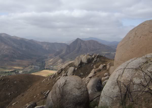
Near the cache hiding spot were a couple of Indian morteros that had this view of Banner Grade.
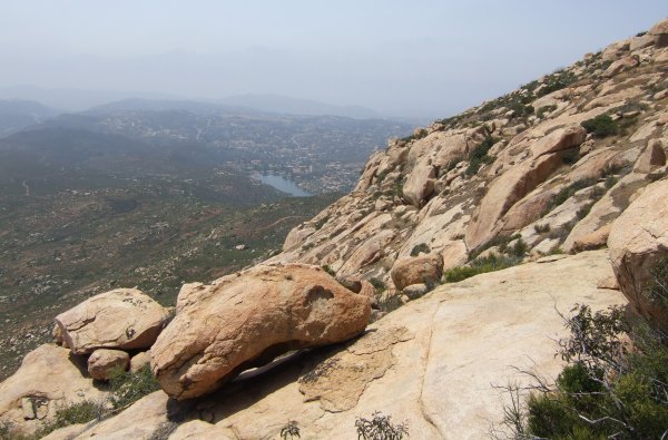
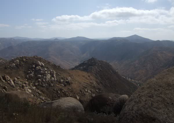
The last cache we found during the Event was "Volcan View 4." It had spectacular views in several different directions.

After that, we made our way back down to the highway where we had to air up the tires we had aired down for the rough terrain. It took a while to inflate the tires from 20 lbs. of pressure back up to 50 pounds.
The Fat Cats were nice enough to stop so I could find two more caches along the road as we headed home. One was under some trees and my GPSr directed me to a tree that was so infested with ants, I was just about to suspend my search when I got some help guiding me to the cache location nearly 30 feet east of where I was standing.
I'm sure glad the cache wasn't in that ant-infested tree. Even though it wasn't, I still brought a few of those guys back to the vehicle with me.
I had a good time and am very grateful to The Fat Cats for letting me join them on the adventure. I'm already looking forward to the next "We Be Jeepin'" Event.
Jeep after Jeep started arriving until finally, all 21, or so, vehicles were ready to start up the Forest Service road. Most of the wildflowers were past their prime except for some of the cacti species, and several larger bushes.
Although we only found three caches during the day, we had lots of fun, especially when we watched some of the people take their vehicles over a challenging rocky obstacle. FishPOET went first and made it just fine. Then RUSCAL drove over the obstacle course, making it after realigning his Jeep a couple of times. Robyn picked a perfect line and made it look so easy and smooth.
Then, it was Habu!'s turn . . . Here is a picture of him and his jeep before he got it stuck . . .
And, here are a few people trying to help his get it unstuck a while later.
Robyn got to use her winch to pull Habu! out of the predicament he had driven into . . . I'm not sure the cable show in this picture, but it's there . . .
Finally we were all ready to head out and find the few caches along the road. From high up on one hill, I got a picture of a portion of the group far down below.
The first cache on our list was one by the bradybunchboys called "'If You CAN'T Hack IT ! Pack IT !' LSR." It was near a mine of some sort where we found several lavender-colored stones and rocks. It had this great view of the desert off to the east.
Inside one of the mine openings, we saw this 2 X 4 frame that I hope they weren't depending on supporting the overhead rocks . . .
Here is one picture of the group at the Palm cache.
Near the cache hiding spot were a couple of Indian morteros that had this view of Banner Grade.
The last cache we found during the Event was "Volcan View 4." It had spectacular views in several different directions.
After that, we made our way back down to the highway where we had to air up the tires we had aired down for the rough terrain. It took a while to inflate the tires from 20 lbs. of pressure back up to 50 pounds.
The Fat Cats were nice enough to stop so I could find two more caches along the road as we headed home. One was under some trees and my GPSr directed me to a tree that was so infested with ants, I was just about to suspend my search when I got some help guiding me to the cache location nearly 30 feet east of where I was standing.
I'm sure glad the cache wasn't in that ant-infested tree. Even though it wasn't, I still brought a few of those guys back to the vehicle with me.
I had a good time and am very grateful to The Fat Cats for letting me join them on the adventure. I'm already looking forward to the next "We Be Jeepin'" Event.
posted by Miragee at
8:17:00 PM
|
2 comments
![]()
![]()

 10-Day Forecast


