The weather had been gray and gloomy for a few days, and we thought the sun would be out if we went east and up in elevation. I met P.T. at the Descanso "Park and Ride" and we took off for Pine Vally and the Pine Creek trailhead. Before starting our hike, since we had almost a mile and a half to walk to the "Secret Canyon" cache, we prepared a few caches to place along our route, if we found some likely spots.
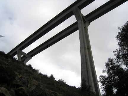
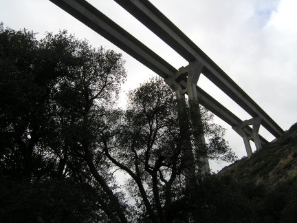
We began walking on the fire road, not really thinking about where it ultimately headed. Only after walking almost half a mile, and placing a cache where the view of the Interstate 8 bridge is impressive, did we realize we had missed the correct trail to the cache. Doh!! We turned around and headed back down the trail. By the time we were actually on our way to the cache, we had walked almost a mile already . . .
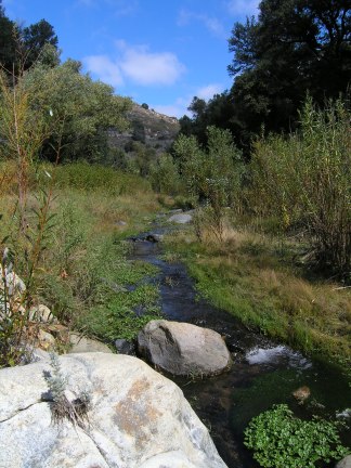
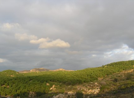
We got back to the trailhead and got on the correct trail, which crossed the stream to the east side. The sometimes rocky trail ascended high above the small creek below us. The temperature was perfect for hiking and we walked and talked and enjoyed the rhythm of the hike.
At one point, we looked up to see a guy coming toward us. At first I thought it was a Park Ranger, but it turned out to be a Border Patrolman looking for some illegal aliens. He told us there was lots of poison oak on the trail and led us to believe the main trail was on the other side of the creek. He had an eTrex Vista GPSr on his belt, but didn't have the unit turned on. I guess if he finds someone and needs to radio his position, he just has to wait for it to initialize and communicate with the satellites . . .
When the trail descended to near the level of the creek, we found a place to cross over. It was a beautiful spot and the sun came out to brighten the day and enhance my photograph.
The trail on the west side of the creek meandered aroung and disappeared at times. It seemed to be only a cow trail and we saw lots of evidence of their presence, including the cows and a bull who fortunately went their own way. While we walked around their stinking piles, I ranted about cattle on our public lands . . . Grrrrrr!
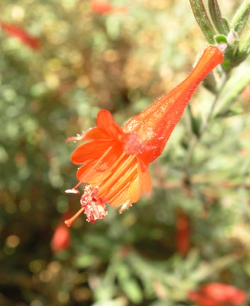
At one point right before we had to descend a very steep, treacherous track, we saw a bush completely covered with these orange flowers. We only saw one bush on the entire walk. As a former botanist, I'm ashamed to admit I don't know what kind of flower it is.
We also found some rosehips and snowberries along the trail.
Near the huge Interstate 8 bridge, we found another place to cross the creek and I quickly found the cache, which was placed in 2001, up in the rockpile under the impressive bridge.
We had fun looking through all the log entries in the four-year-old logbook. Many of the entries are by people we have never heard of. After signing the logbook and putting the cache away under its cammo of rocks, we found the correct trail on the east side of the creek and made better progress hiking along it, although we still found lots of poison oak that could be problematic for people more sensitive to it that I am.
About half a mile from the parking lot, I placed a small cache right next to the trail. After we got back to the car we looked at the map to figure out where to go next. There weren't any other caches nearby, so we decided to head back to town to find "Woody," a cache that has been on my "nearest" page in GSAK for months and months. Before taking off, I placed another small cache near the edge of the parking lot as a "bread crumb" to guide people to this really nice area.
This is what our track looked on our extensive tour of the canyon, the fire road and the trail.
 - - - - - - - - - - - - - - - - - - - -
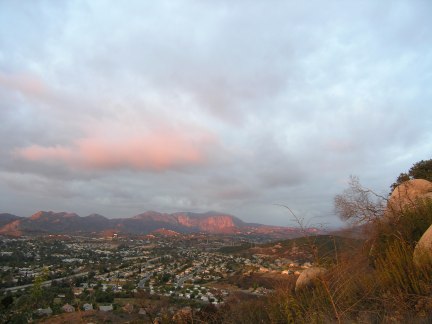
The hike up to "Woody" was strenuous, but a good cardio-vascular workout. I got a couple of pictures of the late afternoon light and the sunshine that eluded us much of the day.
From that cache we drove down to the parking coordinates given for "But Not Soon Enough." It was getting late in the afternoon, but we thought we had enough time to climb the distance to the first waypoint of the multi cache. We had to bushwhack the whole way, but at least most of the vegetation was dry now and easy to get through.
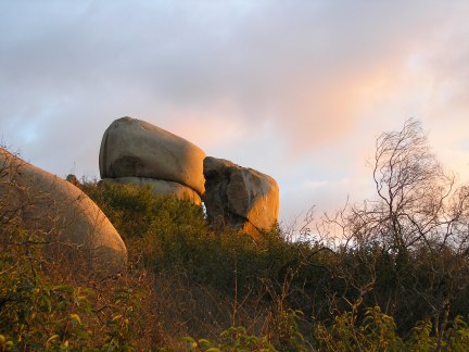
We found the benchmark and got the numbers off it and then headed up the hill to the final cache location. The light was beautiful and I took time out to get a few pictures.
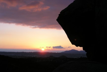
We started our search for the cache, but didn't have any luck where our GPSrs zeroed out, which was in the center of a huge Laurel bush. After the sun went down, we continued our search, but since the last searchers also couldn't find the cache either, and because we needed to get back down a very steep hill, we gave up after ten or fifteen minutes of searching. We came back down the hill on a more established "trail" we discovered on our way up.
On the way down we encountered the homeless guy and his barking dog that had been mentioned in previous logs for that cache.
It was a wonderfully productive day in that we walked probably five miles and climbed up and back down several hundred feet of elevation. It didn't matter that we only got two smilies for the day. Geocaching for me is getting out, seeing new places I've never seen before, and getting much-needed exercise.

 10-Day Forecast


