Eight miles of hiking and eleven new caches are out there
All those prepared caches I intended to place last Saturday were crying to be put out in the fresh air, and preferably where there was a great view. So, after days of rain and cold—on a beautiful clear day—I put several of the caches in my pack and set off on the California Riding and Hiking trail that heads east and then north from the parking area at Loveland Reservoir.
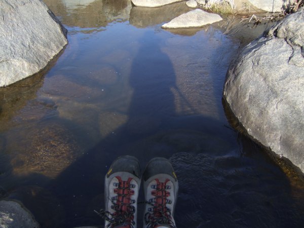
When I set out, I didn't think about the water that prevented me from continuing last Saturday and whether it might be in my way going from this trail . . .
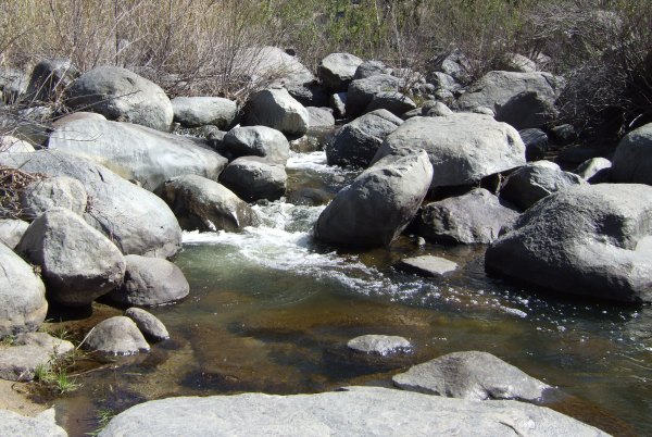
Fortunately, after scouting the river for a long time, I finally found a place where there were enough boulders and rocks spaced just right that I was able to make the crossing without getting wet.
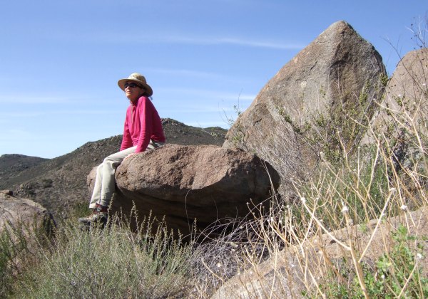
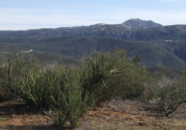
Once on the other side I walked on the trail parallel to Japatul Road for quite a distance before it finally started to the north, and up, and up, and up. The trail took a dogleg and started back in the other direction, continuing up and up until I got to some interesting rocks and boulders. It was a great place to sit before continuing north towards my destination, the trail to Bell Bluff.
That section of the trail barely clings to the hillside. The vegetation changes to mountain mahogany and other tall shrubs that thrive away from the scorching sun on the south slopes I previously walked.
I placed two more caches, one a little way off the trail up near some rocks where there was a great view of Bell Bluff. The other cache was the little rabbit container "lostguy" gave me. I took a picture of the hiding place, but forgot to take a picture of the cute critter.
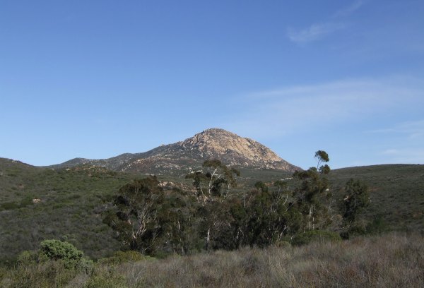
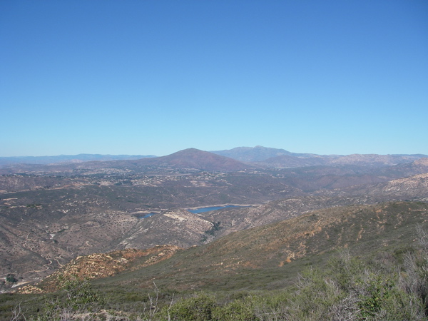
I continued walking up the Bell Bluff trail until I came to a fork in the trail. The trail to the right led to a location with a great view of Gaskill Peak. There might have been a house or something there at one time becuase there was evidence of a road or driveway. I found a rusty tin can right near where I placed the cache.
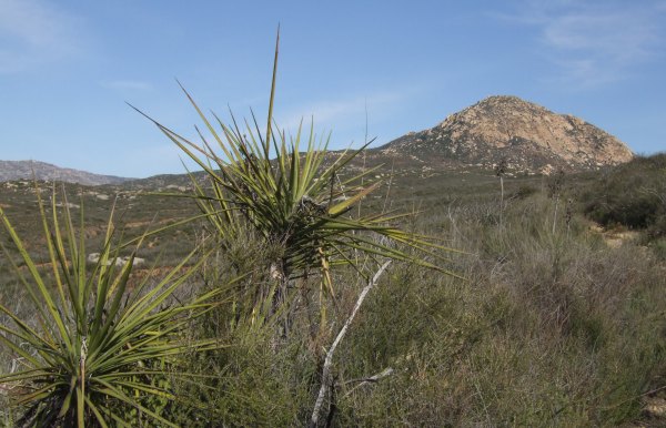
I walked back down that little spur trail and continued in the direction of Bell Bluff. I had already walked more than four and a half miles, and the gate at the parking area is locked at sunset, so I turned around after placing another cache at this location with this great view of Bell Bluff.
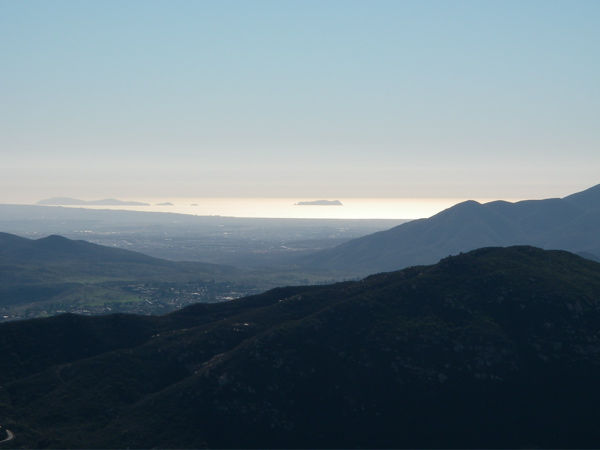
As I headed back down the trail that is on the north side of the hill, this incredible house—my dream house—came into view.
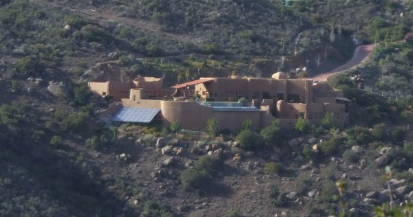
With a great view and solar panels, a vanishing-edge pool, all included in a southwest design that fits in with its surroundings—what more could you want in a home?
When I got to the cache location where I took my picture, I checked out the hillside and decided to bushwhack down to the trail to cut off some of the distance and give me more time to cross the creek, place a few more caches, and still get back to the car before sunset.
This is what my tracks looked like:
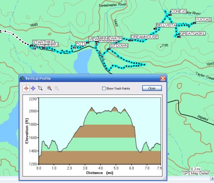
My "cheating" descent of that steep hill cut off more than a mile of hiking, but if I had remembered I had not placed a cache along that section of the trail, I might have returned the way I came . . .
I'm sure someone like CTYankee will place a cache or two in the gap when he makes the hike . . .
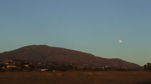
At the end of the day, as I drove through Alpine on my way back to civilization to do some shopping, I stopped to take a picture of the moon rising behind Viejas Mountain.
It was a great day. I had lots of fun, but since the weather this week had kept me in, it felt like a much longer hike. My knee started to hurt at the seven-mile mark and other parts of my body were protesting by the time the hike was over—I think it will take me a couple of days to recover.
As I recover, I get to anticipate the FTFs for all my new caches. What fun!
When I set out, I didn't think about the water that prevented me from continuing last Saturday and whether it might be in my way going from this trail . . .
Fortunately, after scouting the river for a long time, I finally found a place where there were enough boulders and rocks spaced just right that I was able to make the crossing without getting wet.
Once on the other side I walked on the trail parallel to Japatul Road for quite a distance before it finally started to the north, and up, and up, and up. The trail took a dogleg and started back in the other direction, continuing up and up until I got to some interesting rocks and boulders. It was a great place to sit before continuing north towards my destination, the trail to Bell Bluff.
That section of the trail barely clings to the hillside. The vegetation changes to mountain mahogany and other tall shrubs that thrive away from the scorching sun on the south slopes I previously walked.
I placed two more caches, one a little way off the trail up near some rocks where there was a great view of Bell Bluff. The other cache was the little rabbit container "lostguy" gave me. I took a picture of the hiding place, but forgot to take a picture of the cute critter.
I continued walking up the Bell Bluff trail until I came to a fork in the trail. The trail to the right led to a location with a great view of Gaskill Peak. There might have been a house or something there at one time becuase there was evidence of a road or driveway. I found a rusty tin can right near where I placed the cache.
I walked back down that little spur trail and continued in the direction of Bell Bluff. I had already walked more than four and a half miles, and the gate at the parking area is locked at sunset, so I turned around after placing another cache at this location with this great view of Bell Bluff.
As I headed back down the trail that is on the north side of the hill, this incredible house—my dream house—came into view.
With a great view and solar panels, a vanishing-edge pool, all included in a southwest design that fits in with its surroundings—what more could you want in a home?
When I got to the cache location where I took my picture, I checked out the hillside and decided to bushwhack down to the trail to cut off some of the distance and give me more time to cross the creek, place a few more caches, and still get back to the car before sunset.
This is what my tracks looked like:
My "cheating" descent of that steep hill cut off more than a mile of hiking, but if I had remembered I had not placed a cache along that section of the trail, I might have returned the way I came . . .
I'm sure someone like CTYankee will place a cache or two in the gap when he makes the hike . . .
At the end of the day, as I drove through Alpine on my way back to civilization to do some shopping, I stopped to take a picture of the moon rising behind Viejas Mountain.
It was a great day. I had lots of fun, but since the weather this week had kept me in, it felt like a much longer hike. My knee started to hurt at the seven-mile mark and other parts of my body were protesting by the time the hike was over—I think it will take me a couple of days to recover.
As I recover, I get to anticipate the FTFs for all my new caches. What fun!
posted by Miragee at
10:19:00 PM
|
0 comments
![]()
![]()

 10-Day Forecast


