Blog Template Musings about Geocaching: 2005-11-27

Musings about Geocaching

Thursday, December 01, 2005

A long, disappointing quest for a White Jeep


That is just a piece of the actual Magnalog and story that can be found here.

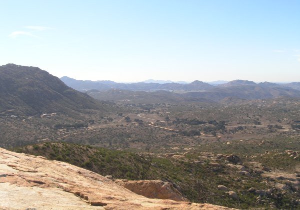
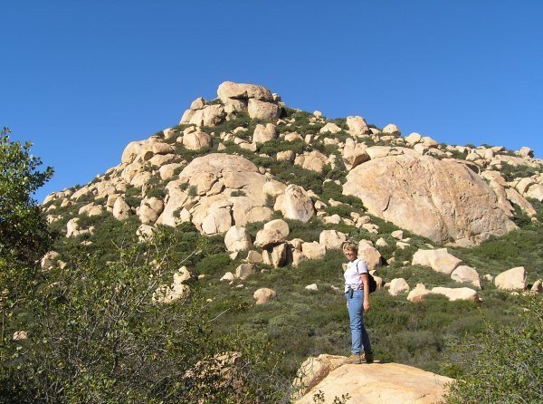
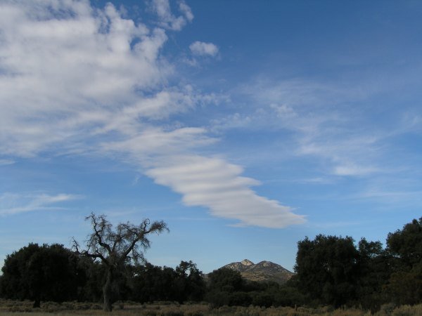
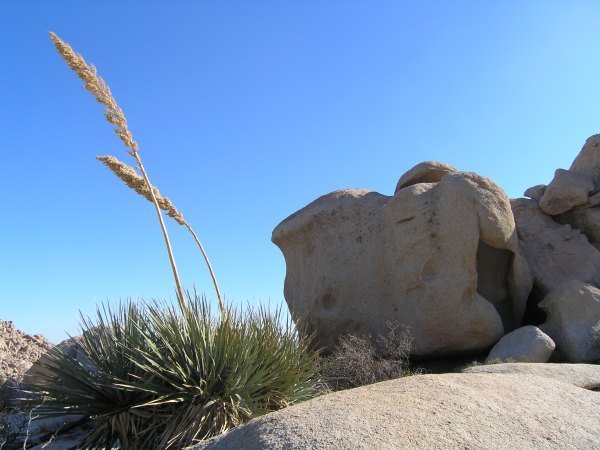
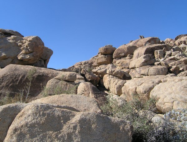
The location was fantastic, and I loved the boulder scrambling.


It was the long -- more-than-an-hour -- unsuccessful and frustrating search, with no hint to guide us to the cache, that made the experience a disappointment.


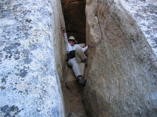
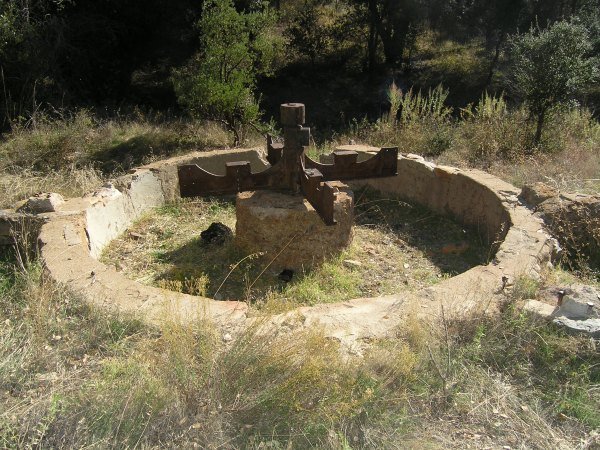
That is the lengthy, scrambled track we created wandering in and around and under some huge boulders. Princess Toadstool took some pictures of me inside the cavern where the evidence of packrats was everywhere. I was just glad I didn't see any mountain lions. There were many places that would have provided a nice den for one.

When I am looking for a cache, I often won't even read the description in my Palm, or look at the hint, until I have looked for the cache for a while. However, if I'm having trouble finding a cache, I sure appreciate a hint. That is what I do for my caches. After someone has hiked to the viewpoint or walked to the cache location, I want them to find the cache. Even though some of my cache locations are worthy of a second visit, I think most people would rather go somewhere new than return to look for the cache again . . .

Oh, and I also don't want to get those DNF emails in my InBox.

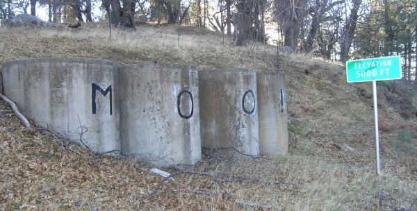
For "Lawson 4," Tom by Himself included a long, detailed hint. For some downtown San Diego caches, the cache owners have noted the "elevation," which helps to get you to the right spot, since the GPS signals are so scattered and unreliable around all those tall buildings.

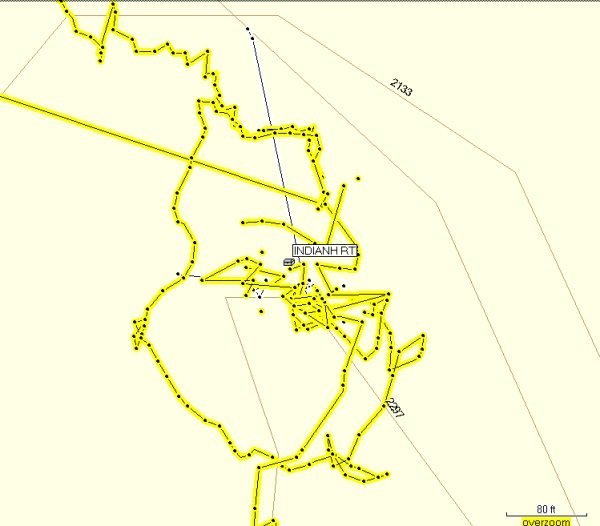
That is what we were contending with on Indian Head Peak. The boulders are as tall as two- and three-storey buildings, and the boulder "caves" we went through caused the GPSrs to lose signal. We thought we had a good arrow pointing us in the right direction, but if the coordinates are off by a couple of digits because of the interference of all the boulders, a hint would have encouraged us to expand the search in a different direction.

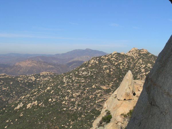
Expanding the search is what I did in this position out on a ledge.


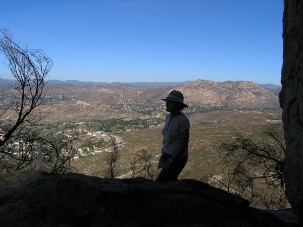
I found the greatest hiding place out there and couldn't believe the cache wasn't in it.

The actual cache hiding place is probably like that, but our GPSrs just didn't point in a different direction. We tried to get up on the huge boulders through a sort of "chimney," but the rocks were so slick, it was too dangerous for us to go further up than we did. We looked for other ways to get on top, including inspecting a nearby tree, but did not see a way.

Our search covered a 60-foot ellipsoid around the cavern, except for the seemingly-inaccessible top of the boulders. That is the part of the "circle" we missed searching . . . and where the cache is sitting right now, taunting me, taunting me, taunting me . . .

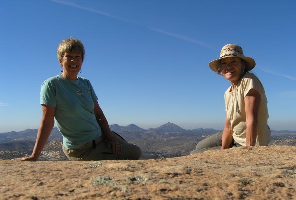
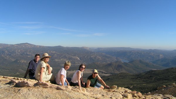
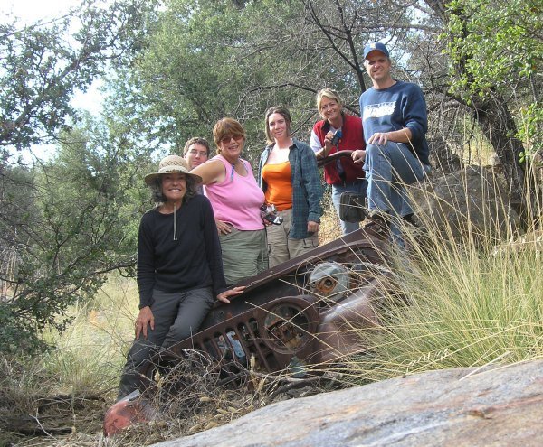
We might not have found the cache, or taken possession of the White Jeep, but we were on top and took pictures to prove it.


I woke up early this morning thinking about our quest. It was fresh in my mind, as one would expect for a ordeal that lasted that long, and I seriously considered going back up there to search again . . . but if the two of us couldn't find a way to get to the cache yesterday, how could I do it on my own?

Oh, and then there is the issue with my sore muscles. My legs are sore, my shoulders are sore, and my hands are fatigued. At my age, I'm surprised I'm able to do the things Geocaching has "encouraged" me to do, but I need a bit of recovery time now before accepting the challenge of "Indian Head Peak" again.


Wednesday, November 30, 2005

Lawson 4 was conquered

More to follow . . .

Here is our group on the top.


Lawson 4

- - - - - - - - - - -


Thursday, December 1, 2005 . . . update:

We met at the trailhead and finally started our ascent up the road around 10:45 a.m. We walked and talked up the road, deciding not to find the caches on the road up until we were coming down.

We stopped to view our goal where the road finally levels off.


A little further down the trail, Princess Toadstool surveyed the rocky goal.


The huge boulder to the right is the one my GPSr bounced down when it leaped from my fanny pack as I was taking a picture from that location.


From the top you can see Gaskill Peak and in the distance Cuyamaca Mountain.


duganrm took this picture of me coming down the slot we probably should have found to go up . . . although even this route would have been a challenge.

It was a great adventure with wonderful company. The walk back down the mountain seemed to take longer than the hike up. Maybe it was because the goal had been achieved and we didn't want the experience to end.


Monday, November 28, 2005

Another new Keen People map of my finds.


This one shows the little cluster of caches smilinglady13 and I found out in the desert last Saturday.


Thirty-one more caches and three more placed

During Thanksgiving week I went caching by myself on Tuesday. I found seven caches, DNF'd one in a rockpile posted with a "Keep off the rocks" sign (that I didn't see until I had given up the hunt and crawled through a fence at the top of the hill), and placed three new ones, "Eucalyptus Park," "Take a Lichen to this View," and "Rancho Mission Canyon." These are all in "town" where they will get more visits than my rural caches that involve a drive and then a long hike.

On Thanksgiving Day, I woke up late but I caught up with the group at the parking area for the PCT along Old Highway 80. Blonds Run Amuck was kind to let me join her and Dan-oh for the remainder of the Sandy Creek Caches, something I was very grateful for. And, my car was happy about that as well.

I had already found all of the SCC Caches, but it was great fun to watch everyone else try to figure out all the creative and unique caches.

After B.R.A. and Dan-oh had to leave, we joined up with smilinglady13 and duganrm to find some of the caches along the Old Burma Road, including "The Lion's Den," a cache that had only been found twice since its placement several months ago.


This is the arrastra that we saw near where we parked the Jeep.

When my companions had to leave to go to their Turkey Day commitments, I took off on my own to find some caches on Mt. Laguna. One of them was a large ammo can in this location:


The last cache I found was "Laguna #1." At that one it was a good thing my GPSr had a "snail trail" on the screen that I could follow because I thought I could take a different, shorter route back to my car . . . and I couldn't. I needed to look at the GPSr screen to find my way back to my previous trail.

Friday I joined up with smilinglady13 and the group at the OHV road up to Bear Valley. We had a great time. Once again, I had found most of the caches along the route, but there were four I hadn't found . . . and TrailGators had solved "Dream State," so all of us helped him find the trail to the cache and we all logged it.


On our way to Dream State, we found this "Dependable Off-Road Equipment" and posed for a picture in it.


The view from Dream State was like a dream . . . it was very beautiful.

Saturday I met up with smilinglady13 at the Descanso Park 'n Ride. It was cold and very foggy which was such a contrast to the two previous sunny days. As we drove east, the clouds lifted. We stopped at the La Posta Diner where I fulfilled the "goal" of a Travel Bug I picked up on Mt. Laguna by taking pictures of him at the diner.


The first cache I tried to find was a DNF. Disappointing. However, I found the next two before we descended the long hill down into the low desert near Ocotillo.

The wind was really blowing, which made our cache searches interesting, and almost dangerous. A gust of wind blew me over onto a rock at one cache. At another cache, where I had to retrieve the container from way up high on a boulder, I couldn't enjoy the view from there because the wind was so strong. As I sat on the boulder signing the log, it almost felt like the boulder was moving in the really strong gusts.


This pile of rocks was really fun to scramble around on. The cache was cleverly hidden and the container was unique.


Although I missed traveling to my sister's place in Idaho for Thanksgiving as I have for the past six years, this Thanksgiving week was a great one. I made new friends and got to know other Geocachers better. I think there will be more "group outings" from now on because it is easier to tackle those caches together.


Web Counters
Office Max Coupon