Blog Template Musings about Geocaching: 2007-03-25

Musings about Geocaching

Saturday, March 31, 2007

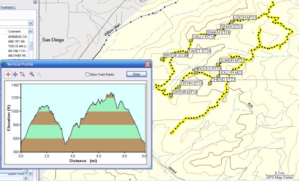
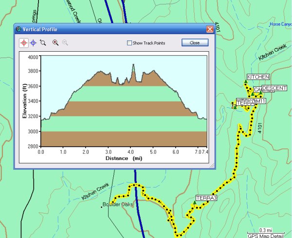
Can't believe I made a nearly 10-mile hike today . . .

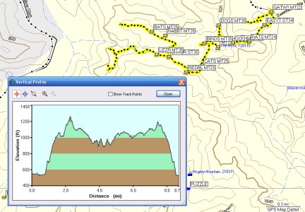
After yesterday's long hike, I'm a bit amazed I was able to make a nearly 10-mile hike up and down and back up and down and back up and finally down the west side of Mt. McGinty to clear off all the caches, except some pesky puzzles, with Let's Look Over Thayer.


I met LLOT at an Event about a year and a half ago, but I knew of him prior to that because of the great logs he writes on the caches he finds, and the great, funny cache description he wrote for one of his own caches. He has such a quick wit that some of his posts in our San Diego threads in the Forums have made me laugh outloud.

He is a great hiking companion and I was sure glad to have someone with me to find all those meandering trails. He also came well-prepared for this journey with printouts from Google Earth. We referred to those on several occasions trying to negotiate the trails efficiently . . . something we almost succeeded at . . .

During our trek, I found twelve caches. I'm not sure how many he got, but it was several more, including two of mine.

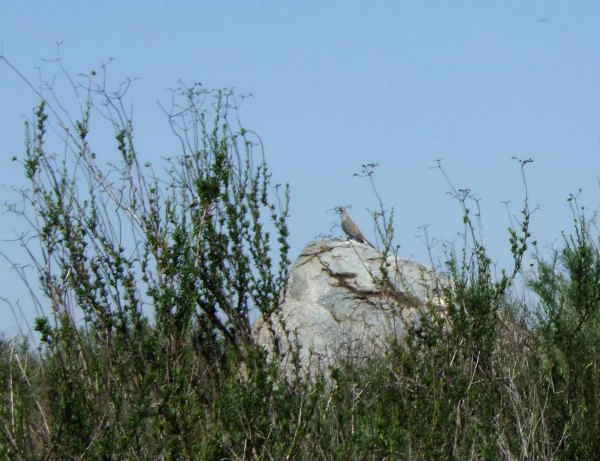
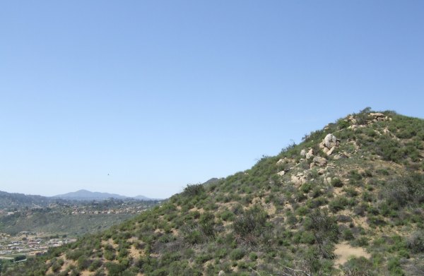
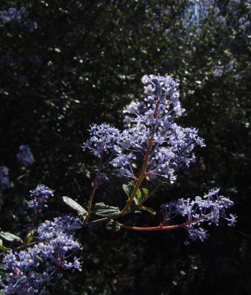
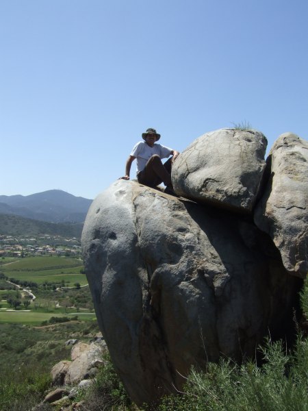
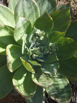
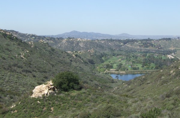
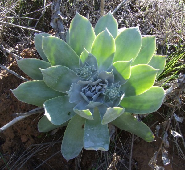
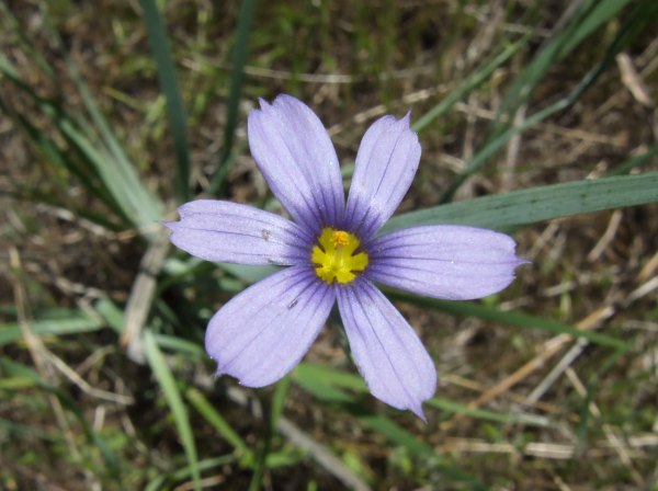
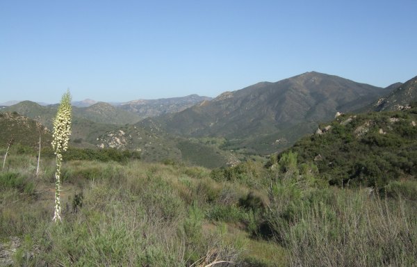
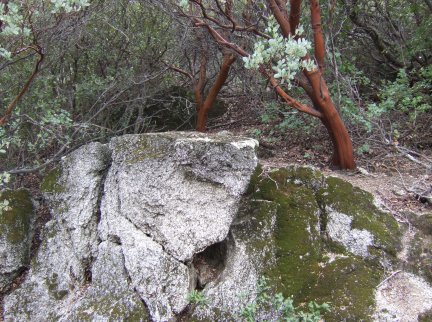
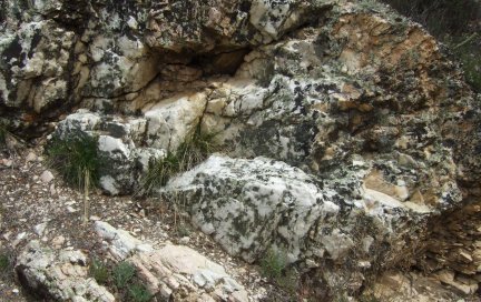
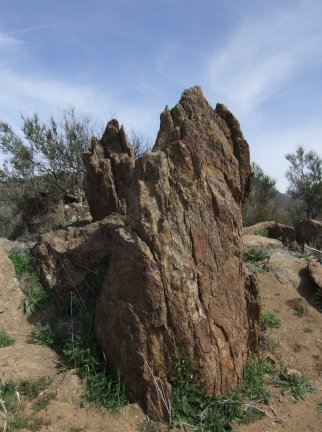
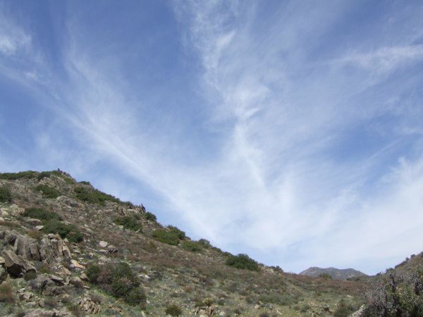
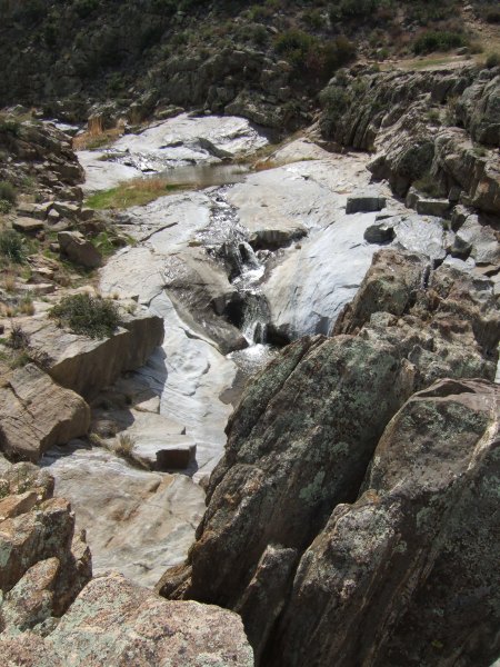
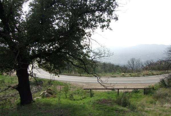
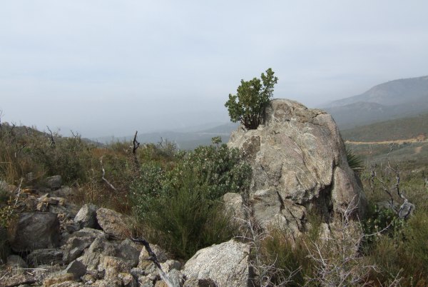
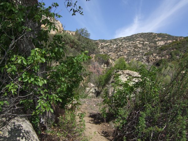
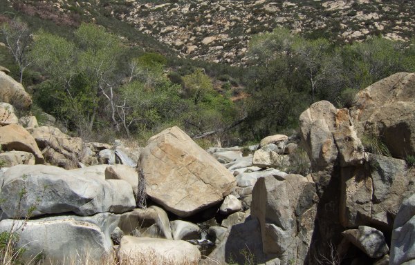
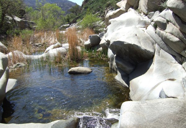
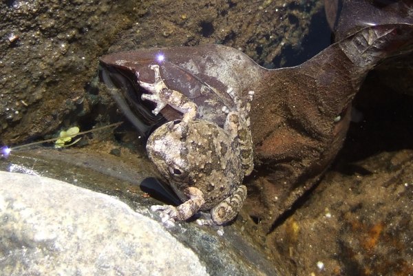
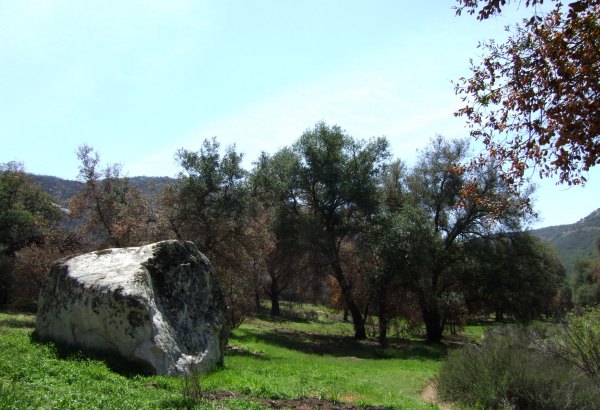
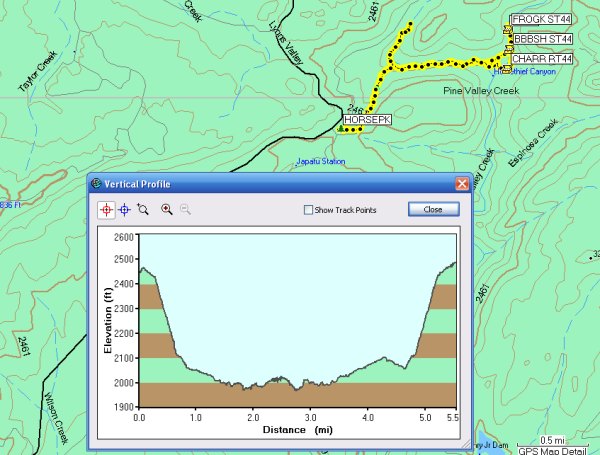
Here are some of the pictures from our day:


At one point in the hike, we descended to the golf course golf cart track. Up on the hill, I found a golf ball. I released it on the track and the little ball rolled and bounced and bumped off the concrete curb and continued picking up speed on the downhill track. At a dogleg turn, it got stopped in a crack. LLOT helped it on its way. When we had to get off the track for some golfers speeding by, we lost track of the ball. It sure looked like it was having fun the last time we saw it.

For now, I have the entire mountain cleared off . . . except for a Puzzle I haven't logged yet and another puzzle I haven't figured out. Maybe someday I'll get those off my list.


Friday, March 30, 2007

Another great hike on Mt. McGinty with dillweed

For many weeks, I have wanted to get to the caches on the northeast side of Mt. McGinty. Some of the caches are about six miles, as the crow flies,from where I live, but it is about a 20-mile drive to the trailhead.

I met dillweed at a nearby shopping center and she was kind to drive the rest of the way.

It was a beautiful day to make our assault on the several caches on that side of the mountain.


We covered a lot of territory and revisited some caches I had already found, or had been a "beta tester" on during the day of the "Lost Patrol Version 2.0" with Jahoadi and SuperDave!, Geo-K9-Betsy, and JaredLoser.

There were great views along the different, winding trails we took, and there were spring wildflowers emerging.


It was a really great day, and I finally cleared off that side of the mountain, except for the cache right at the beginning of the trail, which we were unable to find.

Maybe someone will give me a hint so I can get that one the next time I'm over in that area.


Thursday, March 29, 2007

I placed another cache today . . .

I didn't really intend to place a completely new cache today. I was only going to move a cache I had to Archive a few weeks ago so "Minnie Tinnie Starts Out on a Hike" could be activated.

However, to get more than .1 away, I had to walk a distance on the winding trail. I found a nice bush close to the trail that offered a decent hiding spot for a medium sized Christmas tin, so a new cache was born in this location, with a view of "Bell Bluff."


I also took a picture of the "Tow Away" signs along the road . . . the road where Chuy! parked when he went for the FTFs on the new caches along the California Riding and Hiking trail placed after I put out my series.


From the wording on the sign, I think they are serious. However, I'm sure the signs were put up a few years ago when the reservoir water level was a lot higher and people were parking along the road to fish.

I doubt if the tow truck drivers are trolling the area now . . . but . . .

Monday, March 26, 2007

Another great day of hiking with 3cds

For the past few weeks, I have missed hiking with 3cds. It was great to get out with him and his friend, and it was a perfect day for our assault on a long and challenging Terracache Multi placed by Travelita. We parked on Old Highway 80 where the Pacific Crest Trail and started up, up, up, stopping to find the "Sandy Creek Cowboy Cache #1" on the way.

3cds didn't have the coordinates in his GPSr, so I hoped I would remember the location. I thought I recognized the location and a bit of a Geo-trail. I was mumbling about how Princess Toadstool and I had a bit of a hard time finding it when, without the aid of his GPSr, 3cds said, "Is is large, and round, and painted to look like the rocks . . . ?" He had to pound the end of it to get it open, not once, but twice, because I was still holding something that had been in the cache when he closed it up and returned it to its hiding place . . .

Along the trail, there were the most astonishing, ancient Manzanita bushes.


There were also interesting rock formations and outcrops of quartz. It was a long, meandering hike, but offered interesting things to look at all along the way.


There were some rocks like those we saw on the other portion of the PCT, near the "Double D's" cache, that could be petrified redwood trees.

I sure wish I knew a geologist who could verify that. A man I spoke to the other day, who was with the group from the Natural History Museum, said redwood trees existed here in past eons.

Near that "tree trunk rock" is where we missed the more direct trail to the second waypoint. It looked like we were going to really have an adventure making our way down to the creek from the PCT high above it, but the place we scouted turned out to actually be a trail, so it wasn't as bad a descent as we anticipated.


We climbed up a hill and then made our way towards the third waypoint. I walked up to a highpoint and was surprised to see it was the exact spot where 3cds and I were a few weeks ago. Until I looked down, I didn't recognize it was the same place since we approached from the creek levelon that previous visit.


It is impossible to tell from the photograph how far down the creek and the falls are, but from that location, one wrong step would be disastrous. The wind came up a bit as I was perched out there, so I was being extra careful.

High on that rocky outcrop, 3cds left a Terracache in honor of his brother who passed away recently.

To get to the fourth waypoint, Travelita made us climb up, up, up to another rocky crag. As I entered the coordinates in my GPSr, I was sure hoping the location would be back in the direction of the truck, and it was. The final location turned out to be not very far away from the "Sandy Creek Cowboy Cache #1."

Both 3cds and his friend had commitments that afternoon, so when I got back to my car, there was still a lot of time left in the day. Since I was relatively close to the Boulder Creek Road, I took a drive down it to retrieve and replace a cache of 3cds. On my way back, I placed another cache of my own near this switchback. It was a location I scouted when I placed my "BCR series," but I think I got tired that day, and it got late—and dark—so I did not put a container in this spot back then.


3cds new cache is near this interesting little Manzanita that is somehow growing out of the rock.


It was a really fun day, during which I walked more than eight miles. That makes more than 18 miles in three days . . . not bad for someone of my "advanced age . . . "

Here is what today's track and profile looks like:


Sunday, March 25, 2007

Two more FTFs after another Horsethief Canyon hike

It was a beautiful day for another hike in Horsethief Canyon. I got my start after talking to some people in the staging area who were from the Natural History Museum. They were going on a "Pre-hike" for a hike coming up in May.

There was a wonderful breeze as I walked along the trail, and the sky had some interesting, wispy clouds.


I stopped to take another picture of that oak tree that has so much character, and which is going to recover.


I found the first cache under a very-obvious artificial pile of sticks. It is off the main trail, however, after I signed the logbook, I found some rocks and managed to hide the container a little better. From there, I made my way back up towards the pool of water where I found the cache yesterday.  I crossed over on the rocks and then negotiated the trail, trying to avoid the emerging poison oak.


Yesterday when I saw the caches go "live," I noticed that Lance had posted a "spoiler pic." When I got to the cache location, I spotted the objects in the picture, but still followed my GPSr to see where it would take me. And, it took me down next to the water, 31 feet away from where I found the cache, thanks to both the "spoiler pic" and the hint.

After signing the log, I continued further up the trail where I found even more wonderful rocks to play around on.


In the canyon, the breeze was really wonderful, as was the descending trill of a canyon wren.

I turned around and when I got back to the first pool, I saw the "Frog King."


Actually, one of the people from the Natural History Museum spotted him as the group crossed the creek. The little frog let people take turns taking its picture.

On my way back through the canyon, I saw a group of about a dozen people on the other trail. I hurried to make sure I got ahead of them at the intersection. When I stopped to talk to two botanists, the group caught up, but quickly stopped and got back out of sight. It was a group of illegal aliens being guided through the canyon.

The two botanists are working on a project to find new species emerging after the fire. The conversation was intersting and stimulating, and I enjoyed talking to them, but they needed to get back to their work, so I continued on, walking up Horsethief Canyon to the location of Night Hunter's "That Man Stole My Horse." I thought about the group of illegals as I walked up, and back out that lonely, narrow, little-used trail.


It was good to catch up to the group from the Natural History Museum and walk back up the trail with a couple who live nearby.

At the end of the hike I spoke with Dave, the ranger for this area of the National Forest. He gave me some pointers about staying safe when I am hiking alone, something he thought was necessary because groups like we saw today frequent the canyon. He was very concerned I had gone off on my own up Horsethief Canyon . . .

He said groups like that could be dangerous to someone like me, hiking alone, and he wanted to make sure I knew what to do. I appreciated his insignt, and his advice.

Here are the tracks of my hike and the profile:


It was a beautiful day, and it sure turned into a social event with all the different people I talked to. My thanks again to bradybunchboys for placing two more caches in the area.


Web Counters
Office Max Coupon