Iron Mountain is finally cleared off . . . for now
When I got home from the long drive and hike yesterday, I sent an email to Auld Pro suggesting we just go somewhere, look at a nice view, and tell everyone we went for a hike.
That was not to be . . . He and "lostguy" had already planned to go up to Iron Mountain to get some of the caches that had been placed since they had last been there. I had not hiked Iron Mountain since August 2006, so there were also caches for me to find. Locating the final for Habu!'s Multi was on the agenda. I had been holding onto those final coordinates for a long time . . .
Now that I knew our destination, I hoped my legs would get me up and down the trail after walking 18 miles over the past three days . . .
When we arrived at the parking area and set off, we were greeted by a "Community Service Officer" who told us there had been break-ins lately. So, Auld Pro and I walked back to his Jeep, rearranged the items we had to leave behind, and then moved the vehicle closer to the trailhead, hoping the busy trail would keep anyone from trying anything with the Jeep.
It sure is sad that people, er, scumbags, are doing that. Grrrrrr.
The first cache we went to was the first waypoint of Habu!'s Multi. "lostguy" and I watched Auld Pro do the drunken-bee dance as he followed his Magellan's wandering arrow until it finally pointed to the correct bush, where the container was visible from 30 feet away. We grabbed a "ballot" from the cache and Auld Pro input the coordinates for the "Alternate Candidate." When we arrived at that location, we were greeted by this message on the outside of the huge ammo can that was padlocked to a tree.
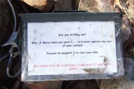
So . . . now we were off to cast our vote for Marko Ramius. This time Auld Pro spotted the container first. As I crashed through the laurel bush to get to the other side, I grabbed the ammo can from its hiding place.
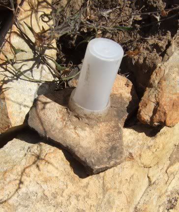
To get to the trail, we had to backtrack a bit. We were headed to "Which way to the Brownie meeting." The next cache after that one, was cleverly hidden.
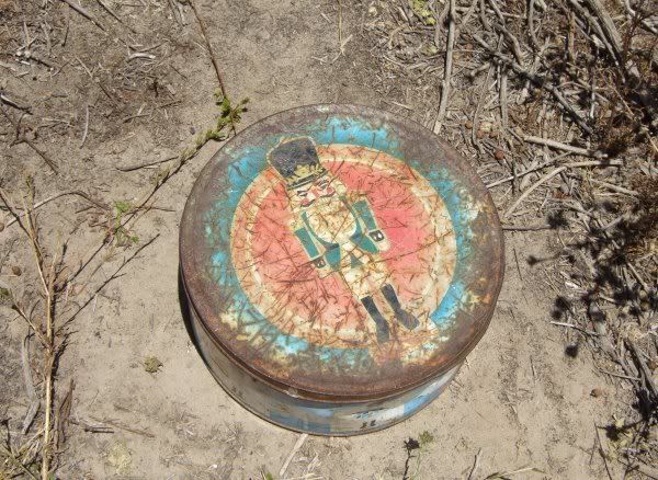
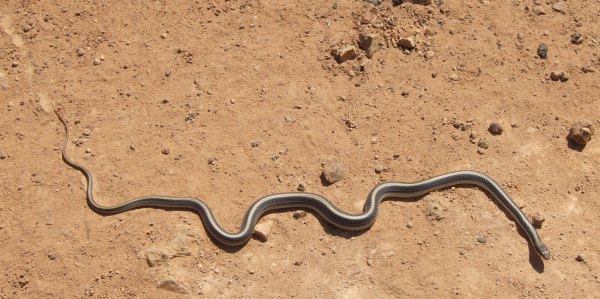
This is what was under that rock flake.
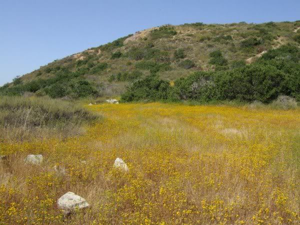
We continued up, up, up the trail, finally stopping at a great viewpoint where you can see to the west as well as to the east. Auld Pro didn't have the coordinates in his GPSr, however he spotted the container above where I was searching.

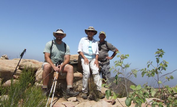
From there, we followed some bunny trails to get to two more caches higher up on the nearby peaks. At the first location, I took a picture of our little group.
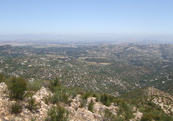
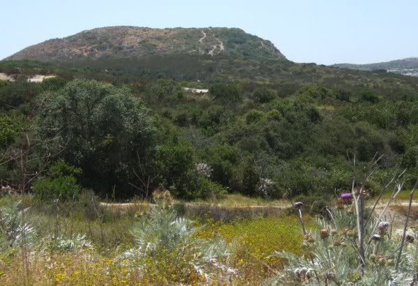
After finding the caches on the peaks, we walked down, down, down several switchbacks to get to the trail that goes out to "Ramona Overlook" where I saw this view.
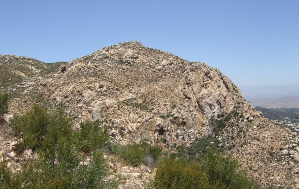
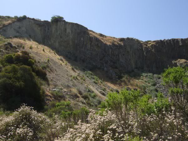
Nearby there were some amazing cliffs that a young man we met on the point wanted to climb.
After that cache, I was done, but both "lostguy" and Auld Pro had a couple more caches to find. At the last one, we were only .22 from the peak where the Terracache was hiding. I offered to go to the top with Auld Pro, but he didn't want to make the trek, which would have been a lot further than the "as-the-crow-flies" distance.
We turned around and started down the steep and rocky trail. The last time I walked that trail, it was dusk on a cloudy evening. I was holding my hiking companions back because my knee hurt, something that hasn't happened for several months now. I was glad I could keep up with my younger companions today.
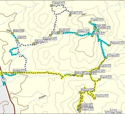
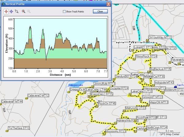
Here is an image of the tangled tracks of the three trips I have made up and around Iron Mountain.
After we got back to the Jeep, which was thankfully untouched by vandals, we drove up to the Ellie Lane trail to make a quick .4-mile walk to a cache placed by Toby's Gang. I admired the pretty buckskin horse in the pasture that brought back memories from a long time ago . . .
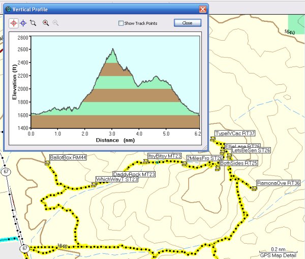
This is the Profile of our hiking adventure:
As usual, I had a great time. I really enjoy hiking with "lostguy" who has a great sense of humor, even though he won't let Auld Pro and me stop to eat. Auld Pro even made note of that in his log for "Type IV Cache of Holding" where he wrote:
I'm very appreciative of my fun hiking companions and am looking forward to our next adventure.
That was not to be . . . He and "lostguy" had already planned to go up to Iron Mountain to get some of the caches that had been placed since they had last been there. I had not hiked Iron Mountain since August 2006, so there were also caches for me to find. Locating the final for Habu!'s Multi was on the agenda. I had been holding onto those final coordinates for a long time . . .
Now that I knew our destination, I hoped my legs would get me up and down the trail after walking 18 miles over the past three days . . .
When we arrived at the parking area and set off, we were greeted by a "Community Service Officer" who told us there had been break-ins lately. So, Auld Pro and I walked back to his Jeep, rearranged the items we had to leave behind, and then moved the vehicle closer to the trailhead, hoping the busy trail would keep anyone from trying anything with the Jeep.
It sure is sad that people, er, scumbags, are doing that. Grrrrrr.
The first cache we went to was the first waypoint of Habu!'s Multi. "lostguy" and I watched Auld Pro do the drunken-bee dance as he followed his Magellan's wandering arrow until it finally pointed to the correct bush, where the container was visible from 30 feet away. We grabbed a "ballot" from the cache and Auld Pro input the coordinates for the "Alternate Candidate." When we arrived at that location, we were greeted by this message on the outside of the huge ammo can that was padlocked to a tree.
So . . . now we were off to cast our vote for Marko Ramius. This time Auld Pro spotted the container first. As I crashed through the laurel bush to get to the other side, I grabbed the ammo can from its hiding place.
To get to the trail, we had to backtrack a bit. We were headed to "Which way to the Brownie meeting." The next cache after that one, was cleverly hidden.
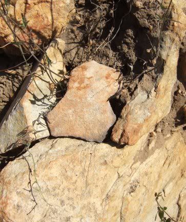
This is what was under that rock flake.
We continued up, up, up the trail, finally stopping at a great viewpoint where you can see to the west as well as to the east. Auld Pro didn't have the coordinates in his GPSr, however he spotted the container above where I was searching.
From there, we followed some bunny trails to get to two more caches higher up on the nearby peaks. At the first location, I took a picture of our little group.
After finding the caches on the peaks, we walked down, down, down several switchbacks to get to the trail that goes out to "Ramona Overlook" where I saw this view.
Nearby there were some amazing cliffs that a young man we met on the point wanted to climb.
After that cache, I was done, but both "lostguy" and Auld Pro had a couple more caches to find. At the last one, we were only .22 from the peak where the Terracache was hiding. I offered to go to the top with Auld Pro, but he didn't want to make the trek, which would have been a lot further than the "as-the-crow-flies" distance.
We turned around and started down the steep and rocky trail. The last time I walked that trail, it was dusk on a cloudy evening. I was holding my hiking companions back because my knee hurt, something that hasn't happened for several months now. I was glad I could keep up with my younger companions today.
Here is an image of the tangled tracks of the three trips I have made up and around Iron Mountain.
After we got back to the Jeep, which was thankfully untouched by vandals, we drove up to the Ellie Lane trail to make a quick .4-mile walk to a cache placed by Toby's Gang. I admired the pretty buckskin horse in the pasture that brought back memories from a long time ago . . .
This is the Profile of our hiking adventure:
As usual, I had a great time. I really enjoy hiking with "lostguy" who has a great sense of humor, even though he won't let Auld Pro and me stop to eat. Auld Pro even made note of that in his log for "Type IV Cache of Holding" where he wrote:
Lostguy was gracious enough to allow Miragee and me 3.7 minutes eat something here. I thank him for that.
I'm very appreciative of my fun hiking companions and am looking forward to our next adventure.
posted by Miragee at
10:37:00 PM
|
0 comments
![]()
![]()


 10-Day Forecast


