"Where to Begin?!" is in the Found column
"Where to Begin?!" was placed by a fairly-new cacher back on December 21. On the last day of the year, we attempted to drive to it, but got sidelined by a Ranger at the Cuyamaca State Park sign. Today, it was beautiful, and after fisnjack had to cancel our trip to "Long Valley Peak," I felt well enough to justify driving up to Cuyamaca to make the hike by myself.
I first learned about this cache in the Forums. The cache owner did not want to tell people "Where to Begin?" Personally, I don't like this, although other cachers think it is part of the "hunt." So, I did my research, but even after looking at the location in Google Earth, I was not sure which trail was the one to take. And, even after finding out the name of the trail, I drove right past it because the sign doesn't say "Cold Spring Trail." It says, "West Area Parking." So, I ended up driving all the way up to the campground and beyond before turning around and finding the trailhead . . .
It was a perfect day for the hike, with clear air, a cool breeze, and bright sunshine. I had a bit of a false start at my car when I found out the cache was not in my GPSr. I got out my Palm m515, which had just enough battery power to stay on long enough to allow me to read the coordinates and put them into my GPSr, and set off. My Palm m500 stays charged for days and days. I'll have to remember to put the new m515 in the cradle more frequently.
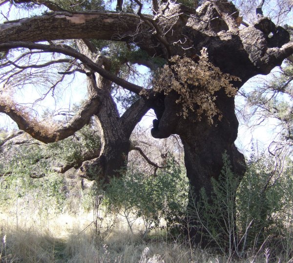
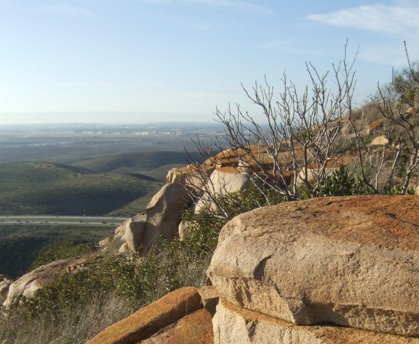
In October of 2003, this area got hit very hard by the firestorm that was called the "Cedar Fire." It devastated a large area of San Diego County, burning more than a hundred thousand acres and destroying more than 3000 homes. These oak trees are struggling to survive, but they are adapted to fire, and often can recover . . . although the heat of this fire killed many trees that had survived previous fires over the past 100 years.
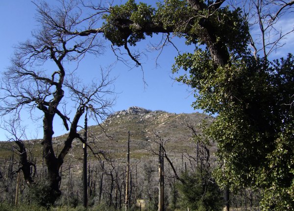
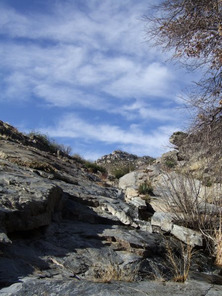
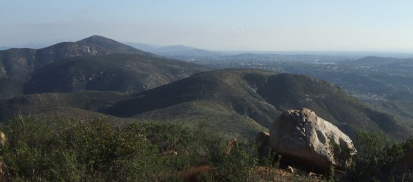
Along sections of the trail, the impressive Stonewall Peak was visible. In this image, an oak tree, recovering from the devastating fire, frames the peak, while another dead tree, stands on the other side.
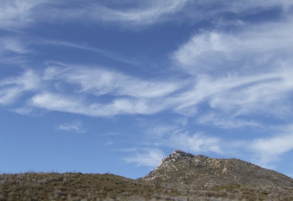
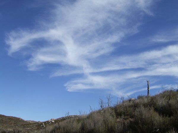
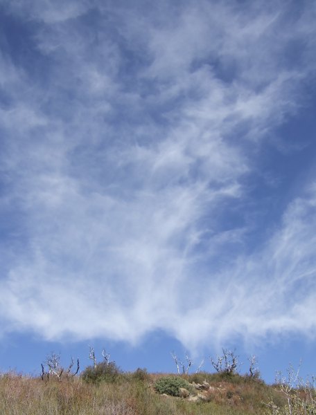
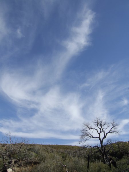
I got some great pictures of the incredible Mare's Tail clouds accenting the sky.
This is the Profile of the hike.
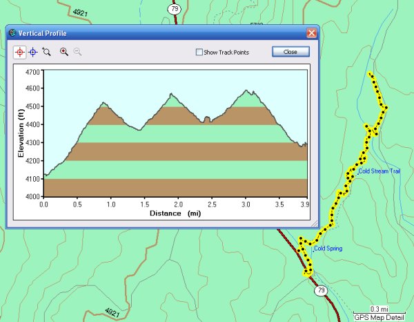
I took both my GPS units with me to see if the new one was as accurate as my old one, now that I updated the firmware. The two were off by a bit, but only a little bit. Too bad I didn't have fisnjack's Map60CSx to compare the other two with to see if his records more distance, which I think might be what is happening sometimes.
It was sure a beautiful day for the hike. I enjoyed it, but it doesn't offer the kind of views the Gaskill Peak trail offers, or the trail to my "Historic Cache" final. I would have enjoyed the hike more if there had been some awesome distant views, especially since it was such a clear day. I did enjoy wandering up the creek and listening to the sound of the creek as it tumbled down. I even took a short movie with my little Fuji camera so I could bring that relaxing sound home with me.
My thanks to figtreesky for going to the trouble of placing a cache in Cuyamaca State Park, a State Park that allows Geocaches, once they meet their requirements. That is a much better way to proceed than what happened in Anza Borrego Desert State Park, which allowed Geocaches for years, until they recently began removing and trashing caches, without prior warning to Groundspeak, or to the cache owners. That was not a good Public Relations act. Some of the caches that were so rudely removed had been in place for almost six years.
I hope the Superintendent of ABDSP, and the Superintendent of Cuyamaca State Park get together and come to a consensus that Geocaching is a benefit, because it brings people who might not otherwise visit the area.
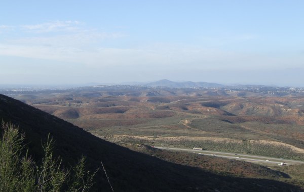
After returning to my car, I took the long way home. I wanted to take a look at Long Valley Peak, the one fisnjack wanted to climb today. Wow, what an imposing peak that is . . . and I've been up there.

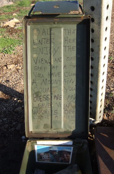
Photo by T.R. Violin
For someone who hasn't been up there, I can imagine them thinking it would be nearly impossible to climb. Come to think of it, it was nearly impossible to climb . . .
I stopped at a cache we found about ten days ago. On my wandering path to the container, going by memory without the GPSr to guide me, I found a TB on the ground. It had been lost since last September. I was glad to be able to "Discover" it and let the cache owner know it was still "alive" and well, and now in that cache waiting for the next cacher to pick him up.
By the time I got home, the gas gauge was on a quarter full. So, I won't be going anywhere for awhile, not until I can justify the trip into town in order to fill the tank again. Gas was $3.25/gallon the last time I filled up and they are predicting gas will go to $4.00 per gallon. It costs me almost $7.00 every time I go into town to run my errands and drive back home. There isn't a lot of money available for using the car for recreation when it costs that much just to accomplish the necessary tasks . . .
I first learned about this cache in the Forums. The cache owner did not want to tell people "Where to Begin?" Personally, I don't like this, although other cachers think it is part of the "hunt." So, I did my research, but even after looking at the location in Google Earth, I was not sure which trail was the one to take. And, even after finding out the name of the trail, I drove right past it because the sign doesn't say "Cold Spring Trail." It says, "West Area Parking." So, I ended up driving all the way up to the campground and beyond before turning around and finding the trailhead . . .
It was a perfect day for the hike, with clear air, a cool breeze, and bright sunshine. I had a bit of a false start at my car when I found out the cache was not in my GPSr. I got out my Palm m515, which had just enough battery power to stay on long enough to allow me to read the coordinates and put them into my GPSr, and set off. My Palm m500 stays charged for days and days. I'll have to remember to put the new m515 in the cradle more frequently.
In October of 2003, this area got hit very hard by the firestorm that was called the "Cedar Fire." It devastated a large area of San Diego County, burning more than a hundred thousand acres and destroying more than 3000 homes. These oak trees are struggling to survive, but they are adapted to fire, and often can recover . . . although the heat of this fire killed many trees that had survived previous fires over the past 100 years.
Along sections of the trail, the impressive Stonewall Peak was visible. In this image, an oak tree, recovering from the devastating fire, frames the peak, while another dead tree, stands on the other side.
I got some great pictures of the incredible Mare's Tail clouds accenting the sky.
This is the Profile of the hike.
I took both my GPS units with me to see if the new one was as accurate as my old one, now that I updated the firmware. The two were off by a bit, but only a little bit. Too bad I didn't have fisnjack's Map60CSx to compare the other two with to see if his records more distance, which I think might be what is happening sometimes.
It was sure a beautiful day for the hike. I enjoyed it, but it doesn't offer the kind of views the Gaskill Peak trail offers, or the trail to my "Historic Cache" final. I would have enjoyed the hike more if there had been some awesome distant views, especially since it was such a clear day. I did enjoy wandering up the creek and listening to the sound of the creek as it tumbled down. I even took a short movie with my little Fuji camera so I could bring that relaxing sound home with me.
My thanks to figtreesky for going to the trouble of placing a cache in Cuyamaca State Park, a State Park that allows Geocaches, once they meet their requirements. That is a much better way to proceed than what happened in Anza Borrego Desert State Park, which allowed Geocaches for years, until they recently began removing and trashing caches, without prior warning to Groundspeak, or to the cache owners. That was not a good Public Relations act. Some of the caches that were so rudely removed had been in place for almost six years.
I hope the Superintendent of ABDSP, and the Superintendent of Cuyamaca State Park get together and come to a consensus that Geocaching is a benefit, because it brings people who might not otherwise visit the area.
After returning to my car, I took the long way home. I wanted to take a look at Long Valley Peak, the one fisnjack wanted to climb today. Wow, what an imposing peak that is . . . and I've been up there.
Photo by T.R. Violin
For someone who hasn't been up there, I can imagine them thinking it would be nearly impossible to climb. Come to think of it, it was nearly impossible to climb . . .
I stopped at a cache we found about ten days ago. On my wandering path to the container, going by memory without the GPSr to guide me, I found a TB on the ground. It had been lost since last September. I was glad to be able to "Discover" it and let the cache owner know it was still "alive" and well, and now in that cache waiting for the next cacher to pick him up.
By the time I got home, the gas gauge was on a quarter full. So, I won't be going anywhere for awhile, not until I can justify the trip into town in order to fill the tank again. Gas was $3.25/gallon the last time I filled up and they are predicting gas will go to $4.00 per gallon. It costs me almost $7.00 every time I go into town to run my errands and drive back home. There isn't a lot of money available for using the car for recreation when it costs that much just to accomplish the necessary tasks . . .
posted by Miragee at
7:10:00 PM
|
1 comments
![]()
![]()

 10-Day Forecast


