Blog Template Musings about Geocaching: 2007-04-15

Musings about Geocaching

Wednesday, April 18, 2007

A late afternoon hike to place two new caches

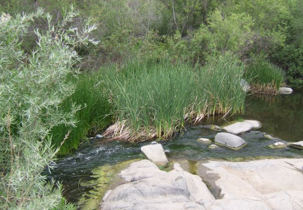
Across Lyons Valley Road from the staging area for Horsethief Canyon is a trail I saw some horseback riders take the other day. I checked it out on Google Earth at home to see if it somehow connected to the Gasill Peak trail I access from the Carveacre area. From Google Earth, I couldn't tell if the trail connected or not, so, this afternoon I drove the eight miles to the trailhead and set out to see where the trail went.


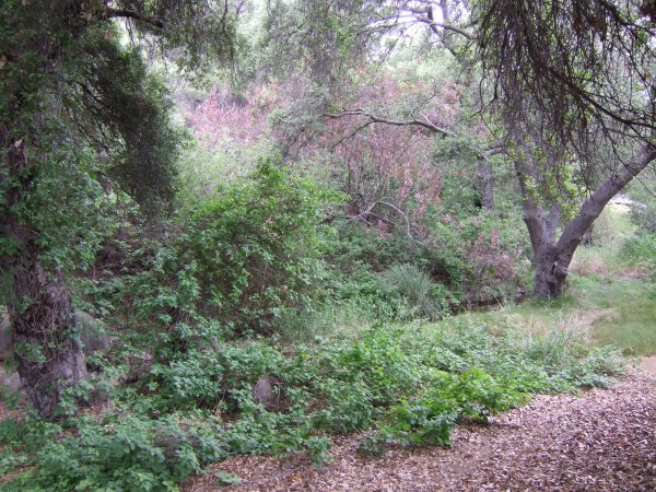
After hiking the scorched and burned devastation of Horsethief Canyon so many times in the past several weeks, it was great to be hiking through mature Manzanita and Mountain Mahogany shrubs. The trail was narrow and fun . . . except for the trash and bottles left behind by the Illegal Aliens who travel through here.

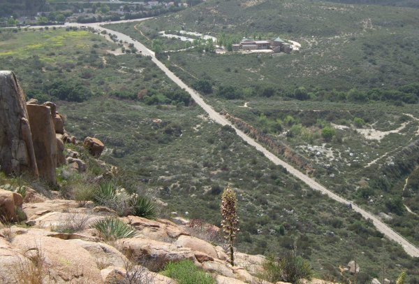
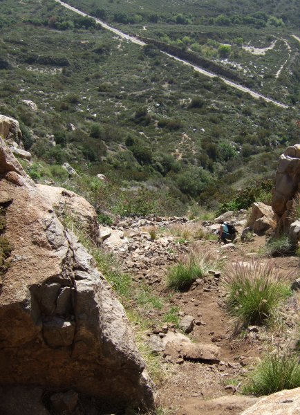
At a slickrock outcrop, I placed the first cache. I thought I might come back and move it if I found a better location, but it stayed where this is the view of Barrett Lake.


I continued down the trail, taking little side trips to see if there were any trails leading up to the ridge. At one point the "trail" was just the vaguest of paths marked only by broken branches.

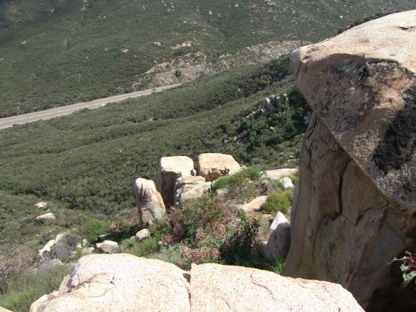
I reluctantly turned around when I couldn't get to the ridge and on my way back I placed a little cache on another outcrop of slickrock.


The hike is easy and not very long. I should head back that way one day and get some better pictures from the different vantage points.


Tuesday, April 17, 2007

A challenging climb in MTRP to get "Middle Earth"

A new cache popped up in the morning, so I called dillweed to see if she wanted to meet me there for the FTF. It was sort of on the way to MTRP where we were going to be hiking.

I got to the location first and looked for a while, but didn't see any sign of a cache . . . and even though the dog wasn't present, I didn't like the "Beware of Dog" signs on the fence, and the house window across the same fence . . .

When dillweed got there, we looked for the cache, trying to make sense of the hint. After 15 minutes, we gave up, but on our way back to the car, we saw rscaensd, who was headed towards the hiding spot. So, we turned around to join him. It didn't take very long before I found the little container. I don't know how I missed moving that bark and ground cover during my previous semi-destructive search . . . Only then did I see the Groundspeak 'G' carved into the base of the tree . . . Apparently, that is what bradybunchboys are doing now for their hints . . .

From there, we headed for the MTRP Visitor Center parking, stopping for one easy cache along the way that I saw on my GPSr map as we drove down Jackson Dr.

After parking the car, we walked down the road finding "FATTBOY'S FIRST" and then a few other caches including two in these great locations.


We looked at the caches on our GPSrs and saw several on the peak to the east of us, so we started up that steep trail that goes to rocks mountain climbers use for practice.

We didn't find one of the caches, but we left a "replacement" for future cachers until Chuy! can get up there to check on it.

Here is my log for the next cache after we made the dangerous ascent up the "Safest" route.
Wheeuuu! What a climb! After leaving Limbo Area, we scouted one route and then took the hard way to the "safest" route. Once on top, we found the cache easily, and others have apparently also been finding the cache easily. Muggles left "unapproved" items in the cache (cigarette, matches, pills) and apparently took the Jeep and the Geocoin. Neither were in the cache. I took some pictures of the muggle logs. Thanks for the great adventure and for all the exercise.


We wandered the criss-crossing trails up to the top of the peak, finding a few more caches, including one by Travelita that offered this view.


We were not aware of any other way to get back down the peak, so we very, very carefully made our way down the dangerous "Safest" route.


This is what our tracks and the hike profile looked like:


There was still a lot of daylight left when I got back to my car, and even though my legs were very tired, I decided to look for a few more caches since I was in a part of town I rarely get to. I set my GPSr to auto-route me to one of HaZzMaTt's caches. I arrived at what I thought was GZ and after reading the Past Logs to see that the cache was difficult to find, I set out on my own search of the thorny bushes.

I got poked by the nasty bushes as I searched, but kept wondering where the plant in the hint was. I finally did another Find/Geocache/Off Road on the GPSr, and it sent me 180 feet away where I found the cache easily without having to deal with any nasty, thorn-wielding bushes at all. That fact made me wonder a bit about a "Found It" log that mentions the thorns . . .

After finding one more bradybunchboys cache near Lake Murray, which also had a Groundspeak 'G' as a hint, I started the long drive home, turning on the radio and hearing the terrible news about a shooting at a University in Virginia, Virginia Tech.

Sad, very sad . . .


Sunday, April 15, 2007

Another hike in Horsethief Canyon for a FTF

As I hiked the canyon yesterday, I checked some caches along the way and saw T.R. Violin's name on the logsheets. As I wrote, I thought he was there to get the FTF on the Terracache, but he was there to find the other caches, and place one of his own . . . "Way Out Kitty."

Today it was overcast and windy, and threatening rain. I waited for several hours before taking off, thinking the weather would improve. As I drove the seven miles to the trailhead, there was some mist on the windshield, but at the trailhead, it was just cool and windy. So, I took off down the shortcut trail at a quick pace, soon realizing I had forgotten my walking stick.

At the bottom, I followed the arrow on my GPSr when an illegal alien trail took off from the main trail. I had to cross the creek stepping on a slender branch and some stones to keep from getting my boots wet. The elusive trail was marked by trash, red and yellow plastic from snack bags.

The trail meandered in the wrong direction, so I ended up walking up the same hill I walked yesterday, through the burned sticks of manzanita and California buckwheat. I finally saw the trail the cache was hidden on. It clings to the side of the hill and heads east from the pool area.

I found the container quickly, and just as I began to write my name in the logbook, it started to rain.


I rehid the container and started back, taking the trail this time. At the fork, I debated which way was the shortest and ended up going back the way I came. The rain on my new REI hat reminded me of the sound of rain when I have been camping in my tent.

I got back to the car in about 45 minutes and was back home about two hours after I left . . . the whole experience happened so quickly, it was like a dream when I found myself back at this laptop writing my FTF log for the cache.

I downloaded my tracks to the Mapsource maps and broke up the different tracks. It turns out that from the fork, it is .2 further to go back the way I chose . . .

My thanks to T.R. Violin, and CTYankee and SEPTICTANKHANK for placing the new caches in an area closer to home.


Web Counters
Office Max Coupon