Blog Template Musings about Geocaching: 2007-06-03

Musings about Geocaching

Saturday, June 09, 2007

Uh Oh . . . someone didn't read the cache page

I have a cache placed right next to a small parking spot at the beginning of a hike, which has several intersecting, and parallel trails. On the trails, there are more than 15 caches. In the cache description of the "Parking Spot Cache," I explain in detail how to get to the main trail and even provide a trail waypoint, as well as a link to the next cache up the trail.

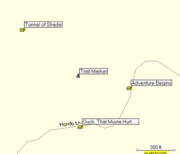
To the WNW of this parking spot is another cache, on a parallel trail, however, the cache description doesn't mention that cache, only the one to the south. The three caches, and the trail waypoint look like this on my Mapsource map:


I feel very bad for the person who got on the wrong track, because they were from out of town, and their bushwhack struggle really cut into the fun they could have been having on the trail.

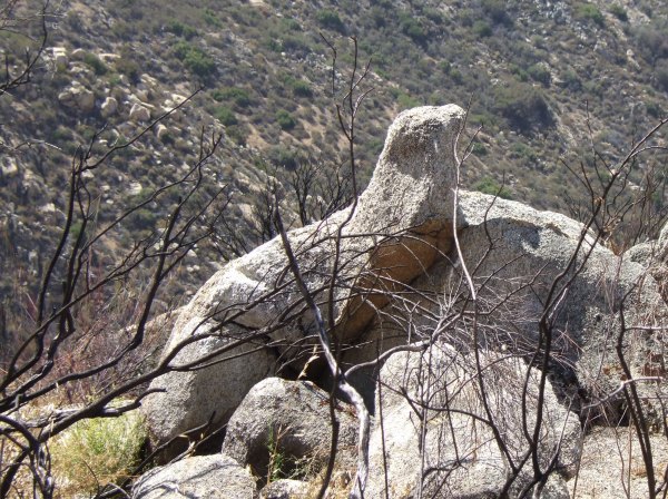
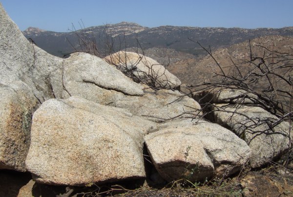
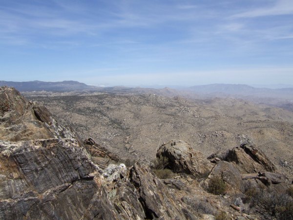
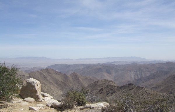
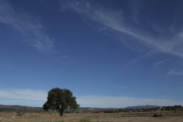
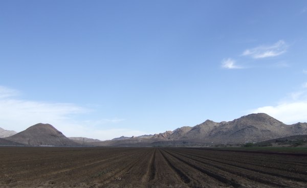
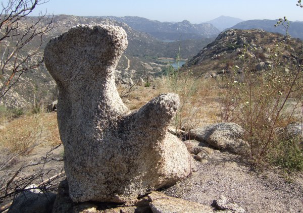
Without reading the cache page, and by trying to go to the "Tunnel of Shade" cache, which is on a parallel trail, it would be easy to get lost. That parallel trail is separated from the road by impenetrable chaparral vegetation, something I mentioned in my May 17th blog entry. You really can't get from the parking spot to the other trail . . . although this cacher apparently did . . . after an hour-long struggle.

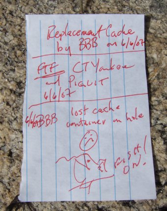
I posted a Note to the cache page, and included an image of the caches, and the trail waypoint, mentioned in the cache description.

There was a recent thread in the Forums about people not reading the cache pages where one experienced cacher stated that the cache page looked like this to him:
Coordinates

Blah, blah, blah

Hint

So, I'm not sure any additional text on my cache page would be helpful . . .


Friday, June 08, 2007

Another hike to the Barrett Lake viewpoint

After my trip to town yesterday, my heel hurt so I didn't think it would be good to make another six-mile hike today. However, fisnjack is a great motivator, and he came by to pick me up at 7:00 a.m. It was a beautiful morning with perfect weather and temperatures for hiking.

At the staging area, my GPSr didn't have any problem finding the satellites the way it did last Sunday, so after Resetting the trip computer, we set off down the trail that heads east from the parking lot.

Along the trail I saw these amazing Mariposa lilies that were different from those I have seen on my other hikes.


When I did this hike last Sunday, I took a shortcut near this first cache. Today, we walked around the trail which adds a bit more than .1 to the distance of the hike. The next cache was easy to find and we added another plastic bag to the log so it won't get wet, if it ever rains again . . .

There were more flowers along the trail including more of those yellow mariposa lilies and a few other species.


I took another picture of the rock I photographed last Sunday. It looked different in the morning, compared to late afternoon.


Nearby I saw this seal.


The last cache along the trail, before the final ones at the point, was one where bradybunchboys lost the container in a hole when he put it back . . . Using an extendable, magnetic pole he carries with him, fisnjack managed to retrieve the container. The rock formation where the cache was hidden really did look like a bunion and some hammer toes . . .


This was the cute log bradybunchboys left in his replacement container he left after the "mishap."


After we visited all eleven caches along the trail and the ridge, I wanted to check out the view to the east. I climbed up to the ridge, where I took this picture, and then I placed another cache to lure others to this great "Photo Op."


It was a great day and fisnjack, his little dog Teddie, and I had a great time. It was wonderful to have such beautiful weather. Very soon it will be too hot to hike out this way, even when getting a very early morning start to the day.

When I got home, I wrote the "Found it" logs for the six caches I found today, and then I wrote up the cache page for the new cache. I did not submit it stating that the cache is active yet because I have another location in mind for an ammo can . . . Maybe I'll go there sometime this weekend and hide that cache, then I can list both of them at the same time.


Wednesday, June 06, 2007

A very windy trip to McCain Valley

The first cache we found was a Terracache hidden by Gecko Dad. The wind just about blew me over at one point when I got up after kneeling down to take a picture. The view was great from up there, and the rocks were amazing.


From that cache we went over to the viewpoint where there used to be information plaques, only two of them are still there, and one of them is in bad shape . . .


The view from that location is great, even on a day like today when the dust was blowing in the desert below.


The last cache I found that day was called "Cowboy Cache 1" which was near this interesting artifact of days gone by.


I have more pictures from the day, and I would like to write more about it, but I'm going for a hike in the morning, so I'll have to "flesh this out" another time.


Monday, June 04, 2007

A one-day trip to Yuma with Mr. and Mrs. CTYankee9

We got an early start, leaving from my house at 6:30 in the morning, and not getting back until after 9:00 p.m. So, as I write this, I'm a bit tired. I'll try to "flesh out the details" later on, but for now, these few pictures, and my brief comments will have to suffice.

Since we got such an early start, it made for better pictures as we headed east along Old Highway 80. This picture was taken of a lonely Oak Tree along the road to McCain Valley, not too far from "Can You See the Bear?"


At the Old Hot Springs, I took several pictures of the building. From the east side, I can almost see the elegance and class the building had many years ago.


The early morning light made some interesting, contrasting shadows.


At the old hotel near the cache, "Talula's Place," I took a few more pictures, since I didn't have a chance to get close to the building when I was there May 19th.

The wavy-glass windows of the old Hotel near offered interesting photography opportunities.

I took another picture of the fields when we got near the "Organic Veggies" cache.


We made a stop at the gas station and Subway restaurant where this funny sign can be found.


At the Jacumba Train graveyard, CTYankee9 took lots of pictures, as did I.


Finally, we got on the Intersate and made it down to the hot desert where we looked for a cache for a long time. It was called "Rock on Tree," and we never did figure out what the significance of that name was . . . and we very nearly didn't find the cache. It was hot, the coordinates were off, and after ten minutes, I was ready to call it a DNF. Good thing CTYankee9 is more persistant than I am in circumstances like that, because I happened to pick up the rock that had the bison tube attached to it a few minutes after he said, "Just five more minutes."

That was my first find of the day. I found nine caches during the day, CTYankee9 found 53. We also had one DNF, and a few other "No Finds," like at the cache called "Derailed," which has truly been "De-railed" because the rails aren't there anymore . . .

I really had a good time. I love being on the road, even if it is just a one-day road trip like this one. If I had the money, I would start out now, heading for some interesting locations, like up the 395 again. I haven't made that drive in almost two years and would sure like to see the Alabama Hills, Bishop, and the eastern Sierras again.


Sunday, June 03, 2007

A FTF on a Terracache and two new caches placed

Since my friend, and fellow Geocacher, got out of the hospital today, I didn't end up making a trip to town to visit him, so I thought I would make a hike to find his caches. I got a late start to the Horsethief Canyon staging area, and then when I got there, my GPSr couldn't find the satellites . . .

It had never done that before. It kept "Aquiring, Aquiring, Aquiring," but no satellite bars filled in on the satellite page. I finally gave up and started to drive back home. On the drive, something kicked in and the GPSr finally found itself, with 150' of accuracy. By the time I turned around, the accuracy was down to the normal range, so once back at the staging area, I was ready to take off. I had a brief conversation with some guys just getting back from a hike and getting in a new, hardtop, yellow Jeep. They asked if I was Geocaching and I lied and said "No."

The trail I hiked for quite a distance is one that was "created" by a bulldozer during the fire last summer. This area is really ugly, not just because of the fire damage, but because of the torn up earth and tumbled boulders. After "Blame it on Miragee," the trail is nicer, although not that easy to follow, which is why, on my way back, I placed a cache up on a hill that directs people to the correct ridge, so they won't overshoot it like I did . . .

At T.R. Violin's first cache on the ridge, there were some interesting rock formations.


It took me a while to find the cache just because I got up on a big rock bench, thinking the cache would be up there, with a view of Gaskill and Lawson Peaks, but it wasn't. Once I got down, I found the container right away.

From that cache to the next one, there was a distance of .45 miles. I tried to find open areas to navigate through all the burned vegetation, but still brushed up against enough charred sticks so that I was getting very dirty, as I did when I hid "Elevation 2222" and "Hard Hike, Easy Find." I didn't think my pants would ever come clean after those two days of hiking, but they did. After this hike, the pants were definitely going to have to be washed before I could wear them again.

Along the way, I saw more interesting rock formations.


Out at the point, where I found the Geocache by stepping down off a rock and right on top of it, there was a great view of Barrett Reservoir.


Nearby there was this odd rock formation that looked like a hippo to me.


I'll have to check with CTYankee9 to see what he thought it looked like. He is real good at this rocks-that-look-like-animals stuff . . .

The Terracache was nearby. It was in a cute Marmaduke tin container that had me humming an 80's song the whole rest of the hike.

On the way back, I placed a cache up on a hill where there was lots of white quartz rock where the other rocks were black granite. My container was a cute little bunny rabbit container, that contrasted with the devastation left by the fire, so the cache got the name "Contrasts" when I wrote up the cache page tonight.


Not to far away, where some neat boulders framed both Lawson and Gaskill Peaks, I put out another container.


So, I succeeded in bridging part of the gap T.R. left when he put his caches out on that ridge, and these caches aren't too too far to hike when I have to perform maintenance. I'm really glad the caches way out on the end of the point are his, and not mine . . . I'm not sure I want to make that hike again . . .


Web Counters
Office Max Coupon