Successful Event and a very fun day with 3cd's
When I wasn't feeling well in the middle of the week, it was hard to make plans to attend the A Lake, A Snake, and A Cake ! Event. However, when I got an email from 3cd's saying he was going, and asking if I wanted to go, that made my decision for me.
What a great time! More than 100 people attended, possibly just so they could see this cake:
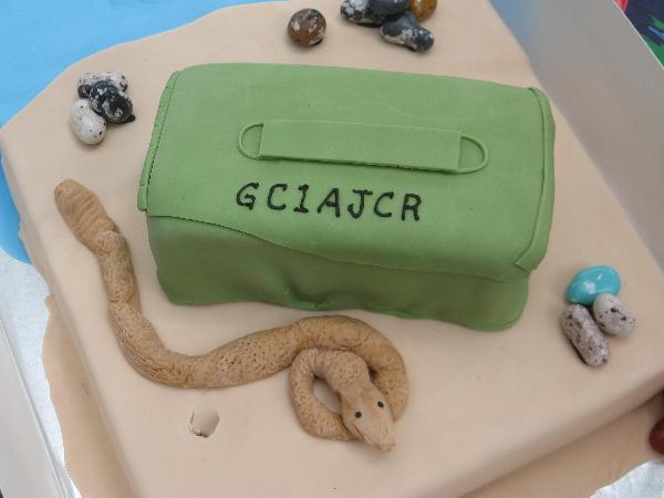
Photo by Team Duckit
I had so much fun trying to fill in all the squares on the Bingo game, I never even saw the cake in person . . .
I learned a lot about my fellow cachers through playing the game, like who has cached in other countries, who was born outside the US, and who is a librarian. It sure was a great ice breaker and a wonderful way for new cachers to mingle with those of us who have been around for a while.
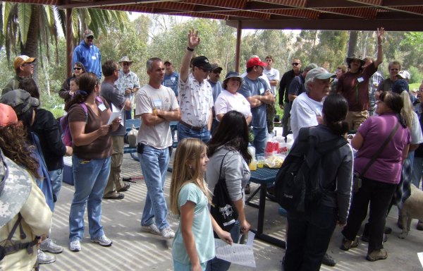
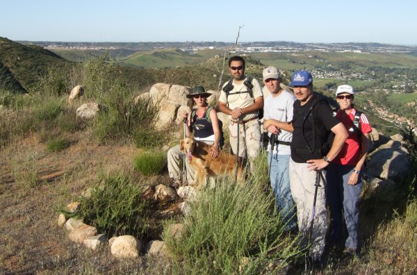
At the Event, I didn't take too many pictures except when people were answering questions about the Bingo game.
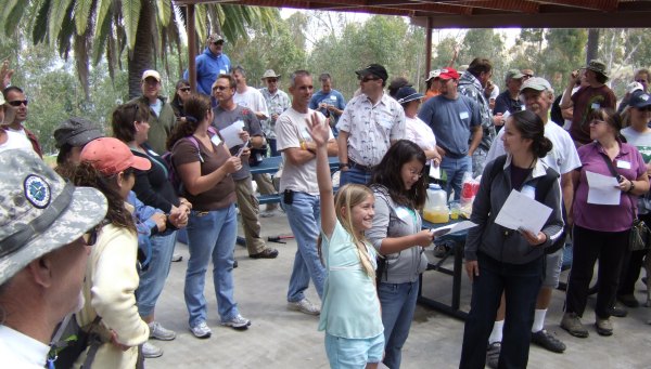
There weren't very many people who qualified for the question Jahoadi asked before this show of hands. I think it was the one about who is an engineer.
After the first part of the Event, we walked down to two nearby caches, then came back for the raffle. This time I was lucky and won, getting to choose from three Geocoins that were left. Whoooo Hoo! Now I have another prize to give to the FTF of my "Desert Virtual" cache.

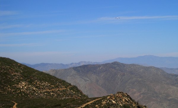
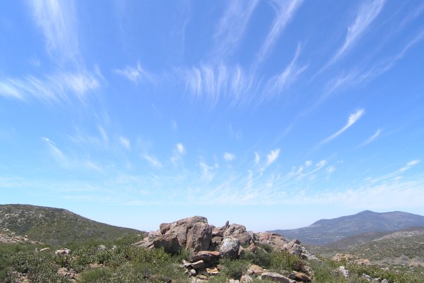
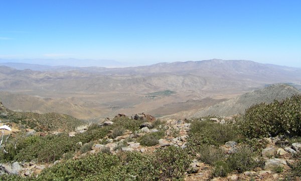
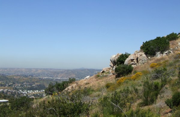
After the raffle was over, we mingled for a while, then set out to find the newest cache that was nearby. From there, we went up the hill to find a few more. One of which had a "Dam Fine View."
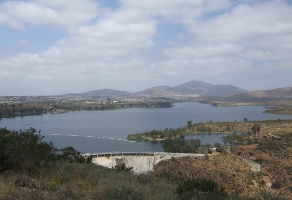
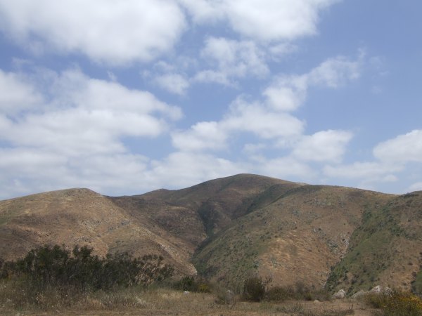
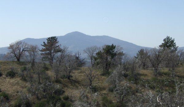
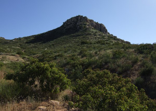
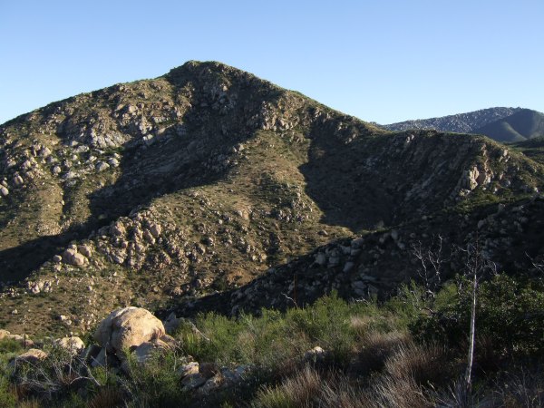
At one of gratefuldad's caches, we got this view of the peak that has a Terracache on the top of it. We wisely decided to save that cache for a different day.
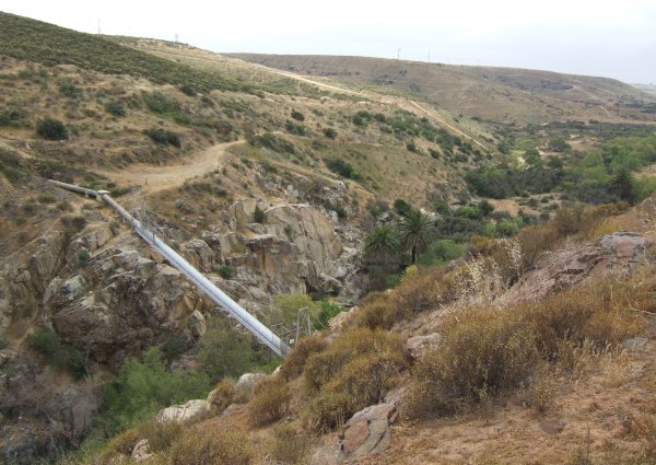
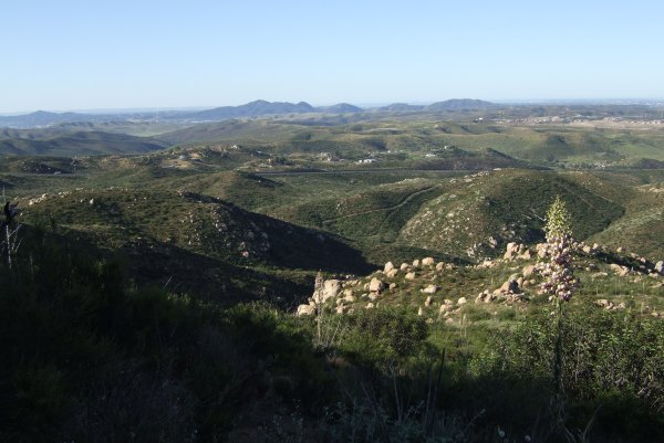
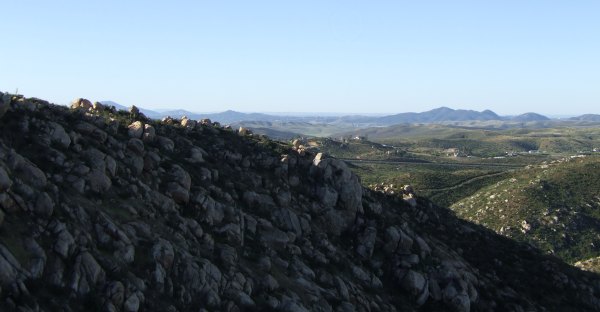
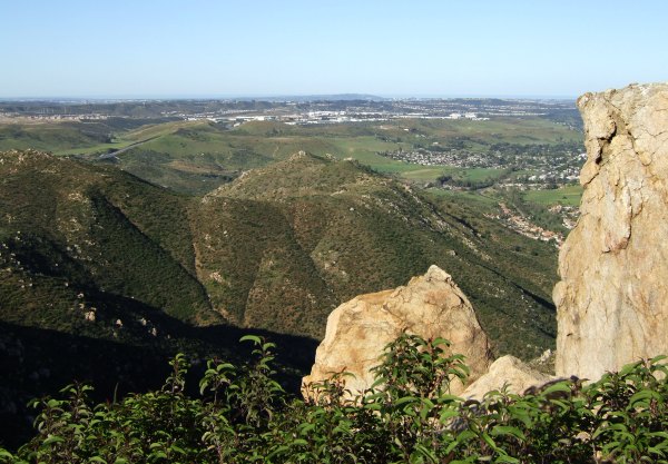
Then, we walked to an older cache, placed by W9JIM back in 2002. The view from there was interesting.
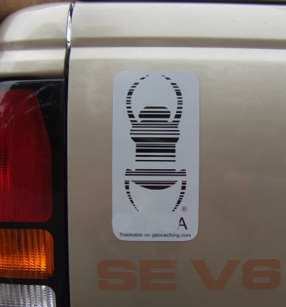
When we came back from that cache, we saw SqrRigger in the parking lot. They were just getting ready to head over to a different area, so we decided to join them, but not before I got this picture of one of the largest Travel Bugs I've ever seen.
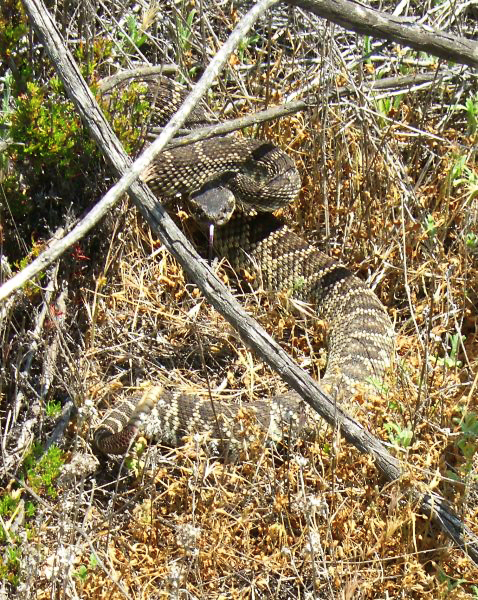
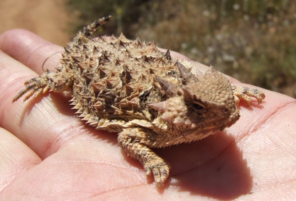
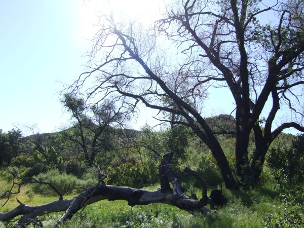
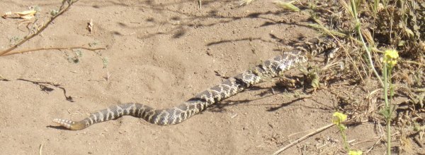
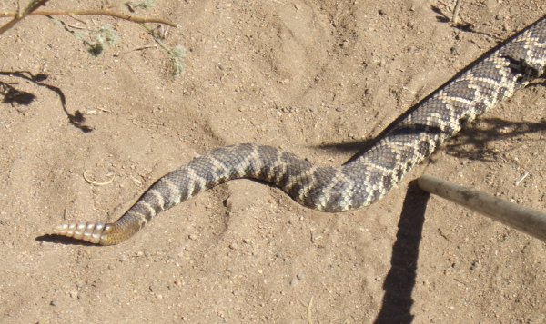
The day was perfect, with some clouds to keep the temperature down so we didn't have to worry about snakes, like the one I saw a couple of years ago when I hiked up a small hill above the reservoir.
There are still a lot of caches in the area to find, so I'll have to get back down there again before it gets too hot. I was pleased to read a log by The Lost Clan where she wrote:
Too bad all Park Rangers, and Park Superintendents, don't realize Geocaching is a fun, safe, family activity that should be allowed in all public parks supported by tax money. I even did some CITO today, picking up a discarded beer bottle on the way back from one of the caches.
It was sure a fun day! I was glad to feel much better than I did the day of the "We Be Jeepin'" Event almost a month ago. I am grateful for that. I am also grateful for 3cd's company, and for doing all the driving as we searched for caches after the Event, a loop that took us way, way south of where we started out. With gas prices hovering around $4.00 a gallon now, this was not an inexpensive day . . .
What a great time! More than 100 people attended, possibly just so they could see this cake:
Photo by Team Duckit
I had so much fun trying to fill in all the squares on the Bingo game, I never even saw the cake in person . . .
I learned a lot about my fellow cachers through playing the game, like who has cached in other countries, who was born outside the US, and who is a librarian. It sure was a great ice breaker and a wonderful way for new cachers to mingle with those of us who have been around for a while.
At the Event, I didn't take too many pictures except when people were answering questions about the Bingo game.
There weren't very many people who qualified for the question Jahoadi asked before this show of hands. I think it was the one about who is an engineer.
After the first part of the Event, we walked down to two nearby caches, then came back for the raffle. This time I was lucky and won, getting to choose from three Geocoins that were left. Whoooo Hoo! Now I have another prize to give to the FTF of my "Desert Virtual" cache.
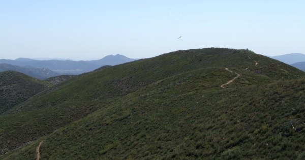
After the raffle was over, we mingled for a while, then set out to find the newest cache that was nearby. From there, we went up the hill to find a few more. One of which had a "Dam Fine View."
At one of gratefuldad's caches, we got this view of the peak that has a Terracache on the top of it. We wisely decided to save that cache for a different day.
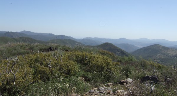
Then, we walked to an older cache, placed by W9JIM back in 2002. The view from there was interesting.
When we came back from that cache, we saw SqrRigger in the parking lot. They were just getting ready to head over to a different area, so we decided to join them, but not before I got this picture of one of the largest Travel Bugs I've ever seen.
The day was perfect, with some clouds to keep the temperature down so we didn't have to worry about snakes, like the one I saw a couple of years ago when I hiked up a small hill above the reservoir.
There are still a lot of caches in the area to find, so I'll have to get back down there again before it gets too hot. I was pleased to read a log by The Lost Clan where she wrote:
On the way back we met a very nice ranger and had a long chat with him about the area. He was very excited to have so many people visit his park, and had only nice things to say about geocachers. Wish some other rangers were as friendly!
Too bad all Park Rangers, and Park Superintendents, don't realize Geocaching is a fun, safe, family activity that should be allowed in all public parks supported by tax money. I even did some CITO today, picking up a discarded beer bottle on the way back from one of the caches.
It was sure a fun day! I was glad to feel much better than I did the day of the "We Be Jeepin'" Event almost a month ago. I am grateful for that. I am also grateful for 3cd's company, and for doing all the driving as we searched for caches after the Event, a loop that took us way, way south of where we started out. With gas prices hovering around $4.00 a gallon now, this was not an inexpensive day . . .
posted by Miragee at
9:00:00 PM
|
2 comments
![]()
![]()


 10-Day Forecast


