Another great adventure
Yesterday, P.T. and I hiked a very nice trail that hugs the hills above the San Diego River valley northeast of Lakeside searching for four caches.
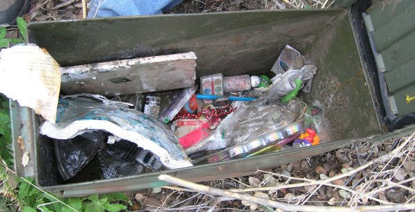
One of them, "ToolTime" had been muggled and the muggles wrote some really nasty stuff in the logbook. I just don't know where that sort of homophobic anger comes from. Why would someone say a plastic toolbox filled with trinkets and tools is a "gay ass" game? Really, really sad.
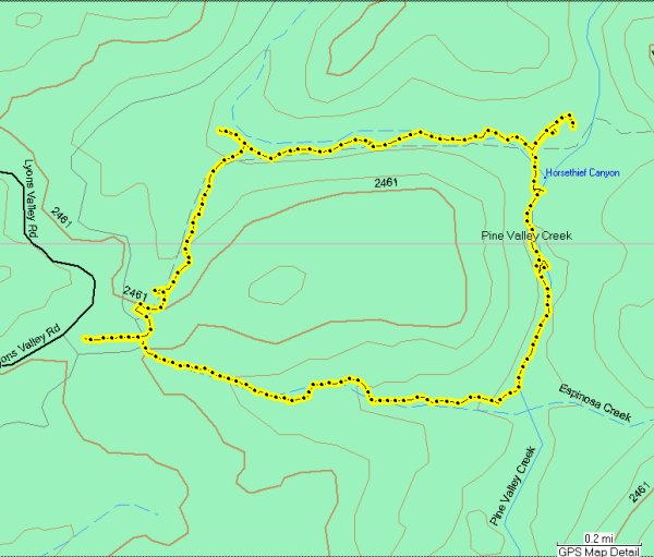
After walking the 3/4 of a mile back to the car, P.T. and I drove down old Highway 80. We stopped where the cache owner of "Up, Up, and Away" recommends. This is a cache that has been on our radar for months. It had only been found by the "tough guys," cachers like T.R. Violin, NightHunter, FlagMan, Chuy, and GeckoDad.
We commiserated for a little while about the cache that was only .38 of a mile away, then we put on our packs, grabbed our walking sticks, and headed out on the trail. Unfortunatly, we turned onto a rabbit trail that started up the hill much too soon. We quickly found ourselves trying to negotiate a route between large rocks and poison oak, over terrain that was at times soft and muddy or covered by loose rocks.
There were a few times when I couldn't see a way around the obstacles and had to backtrack, always keeping an eye on the GPSr arrow. It stayed at .1 for the longest time, going up to .11 a few times. When it finally went down to feet, we still had many rocks to scramble over and at one time, P.T. was actually crawling up the steep terrain.
Recently, TucsonThompsen posted a picture of his shattered elbow in the Forums. As we made our way over the unstable rocks with wet hiking boots, I had that horrific image in my mind. Of all the challenging caches I have done, including "Train Creek," "But Not Soon Enough," and "Indian Head Peak," this approach was the most difficult.
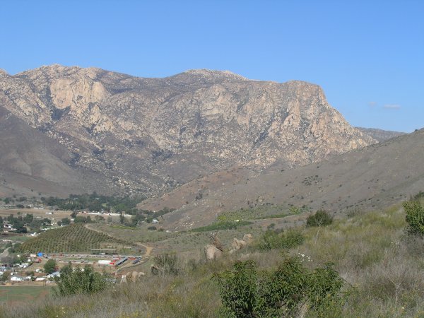
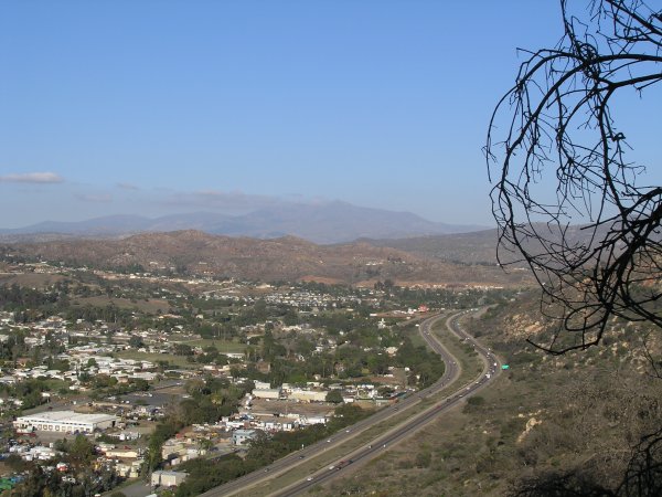
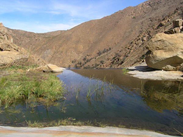
The views were fantastic, but the loud noise of the freeway below us was distracting for most of the distance.
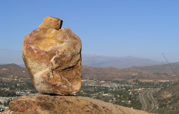
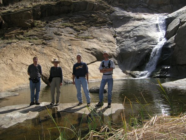
After a long time, we finally got to the top of the ridge and there we found the trail. Our GPSr arrows were pointing to the east, so we walked down towards the cache location. We saw this cute trail marker on our walk.
Fortunately, when we got near the cache and I went up the hill where my arrow pointed, the cache was right there. An easy find. After all the scrambling to get there, that was really appreciated. I traded a little car for a couple of items just because I wanted a memento of the extraordinary effort we made to get to the cache.
We took the meandering trail back down to the bottom, walking more than 1.3 miles to get back to the car from the cache that was only .38 miles away.
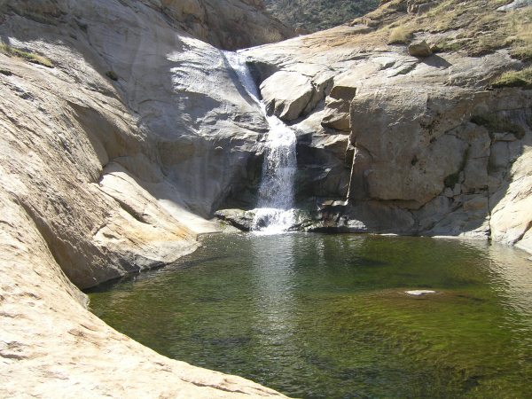
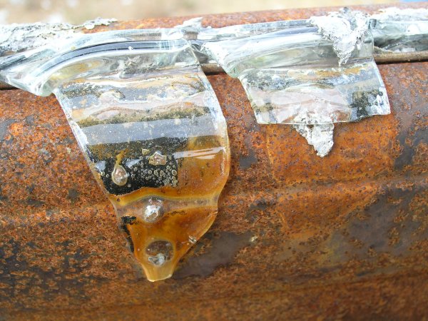
On the way back, we found this great cistern.
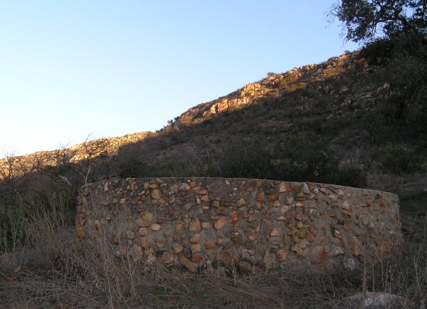
If we had known to walk to it, we could have probably found the trail to the cache and our "expedition" would have been much less adventurous and dangerous.
I think I see a cache at that location in the near future. I have about ten caches all ready to be placed -- I just need to take a day to get out there and hide them.
One of them, "ToolTime" had been muggled and the muggles wrote some really nasty stuff in the logbook. I just don't know where that sort of homophobic anger comes from. Why would someone say a plastic toolbox filled with trinkets and tools is a "gay ass" game? Really, really sad.
After walking the 3/4 of a mile back to the car, P.T. and I drove down old Highway 80. We stopped where the cache owner of "Up, Up, and Away" recommends. This is a cache that has been on our radar for months. It had only been found by the "tough guys," cachers like T.R. Violin, NightHunter, FlagMan, Chuy, and GeckoDad.
We commiserated for a little while about the cache that was only .38 of a mile away, then we put on our packs, grabbed our walking sticks, and headed out on the trail. Unfortunatly, we turned onto a rabbit trail that started up the hill much too soon. We quickly found ourselves trying to negotiate a route between large rocks and poison oak, over terrain that was at times soft and muddy or covered by loose rocks.
There were a few times when I couldn't see a way around the obstacles and had to backtrack, always keeping an eye on the GPSr arrow. It stayed at .1 for the longest time, going up to .11 a few times. When it finally went down to feet, we still had many rocks to scramble over and at one time, P.T. was actually crawling up the steep terrain.
Recently, TucsonThompsen posted a picture of his shattered elbow in the Forums. As we made our way over the unstable rocks with wet hiking boots, I had that horrific image in my mind. Of all the challenging caches I have done, including "Train Creek," "But Not Soon Enough," and "Indian Head Peak," this approach was the most difficult.
The views were fantastic, but the loud noise of the freeway below us was distracting for most of the distance.
After a long time, we finally got to the top of the ridge and there we found the trail. Our GPSr arrows were pointing to the east, so we walked down towards the cache location. We saw this cute trail marker on our walk.
Fortunately, when we got near the cache and I went up the hill where my arrow pointed, the cache was right there. An easy find. After all the scrambling to get there, that was really appreciated. I traded a little car for a couple of items just because I wanted a memento of the extraordinary effort we made to get to the cache.
We took the meandering trail back down to the bottom, walking more than 1.3 miles to get back to the car from the cache that was only .38 miles away.
On the way back, we found this great cistern.
If we had known to walk to it, we could have probably found the trail to the cache and our "expedition" would have been much less adventurous and dangerous.
I think I see a cache at that location in the near future. I have about ten caches all ready to be placed -- I just need to take a day to get out there and hide them.
posted by Miragee at
11:36:00 AM
|
0 comments
![]()
![]()


 10-Day Forecast


