Two FTFs, one on a Terracache, another on a Geocache
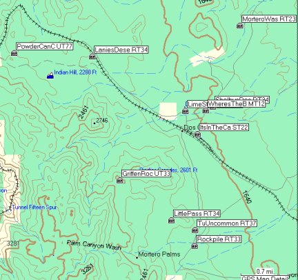
Today was another great day with Auld Pro. This time we drove up towards Bear Valley from the Buckman Springs side and stopped at the locked gate that was open when I first cached in this area with Princess Toadstool in the spring of 2005. That was when we actually drove a good portion of the entire route in her P.T. Cruiser.

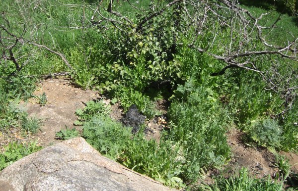
From that location, Auld Pro and I walked up the road to the parking coords Akop&Fam gave for the cache. From there, we walked up the obstacle-laden firebreak, or through the area of burned vegetation scorched in the Pine Valley fire that occurred in the summer of 2007.
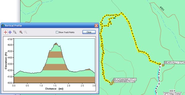
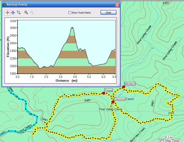
This is what the Profile of our hike looked like:
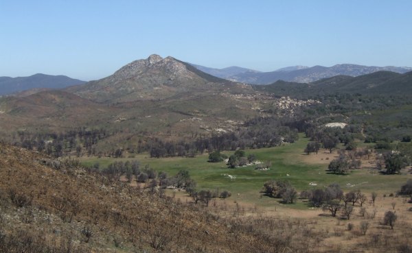
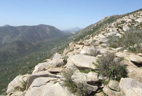
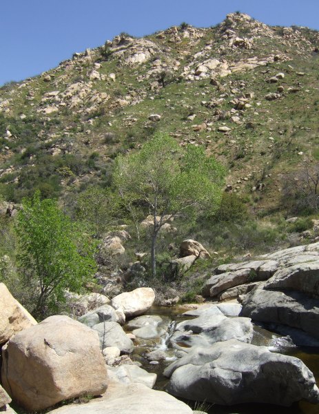
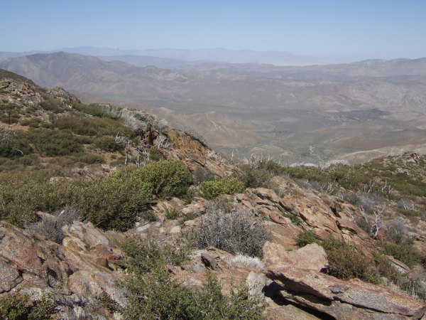
As we climbed up the peak, I took several pictures of the amazing Long Valley Peak.

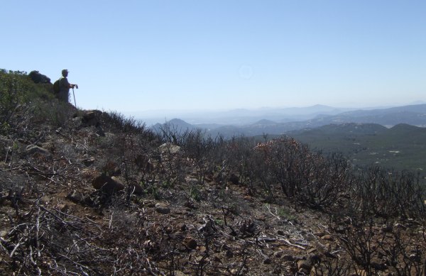
Near the top of the peak, I took this picture of Auld Pro looking out toward Lake Morena.
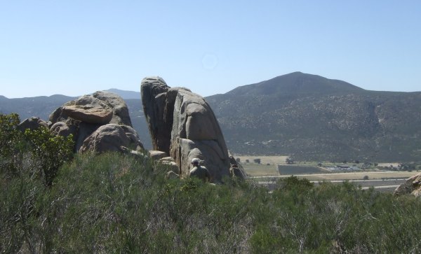
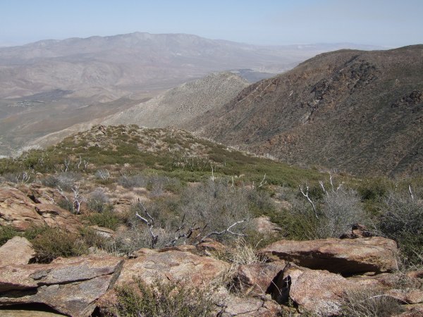
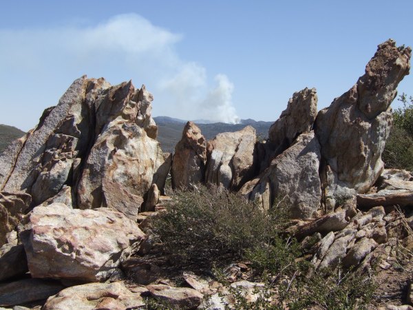
At the top of the peak I took several more pictures in different directions.


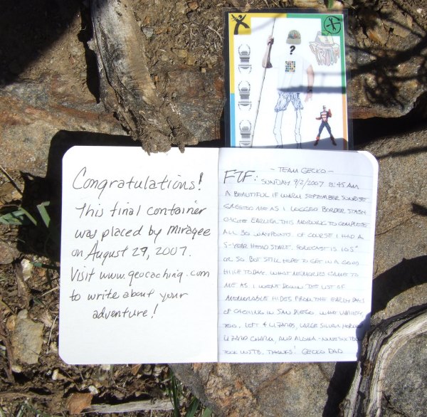
On the top of the peak, the first thing I noticed was the Benchmark and I stopped to take a picture of it while Auld Pro looked for the Terracache.

Once I got back to the business of looking for the cache, I wandered a bit futher north and spotted the container, an unusual occurrence because Auld Pro usually finds the caches first . . .
The container had some great swag, including a small bottle of Jack Daniels Auld Pro and I shared. It also contained a nice pocket knife, and some other useful items. After we took more pictures of the other two Benchmarks, we headed down the hill towards the Geocache. The Jack Daniels already hit me, because I sort of forgot there was another cache up there to find . . . Consequently, as I stumbled along in a daze, Auld Pro was the first to spot the hiding place and was the official FTF.
Lunch seemed like a good idea, but the breeze was cool there, so we moved back to the lee side of the peak to sit down and have some lunch before heading back down to the Jeep.
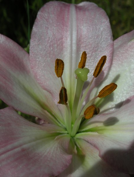
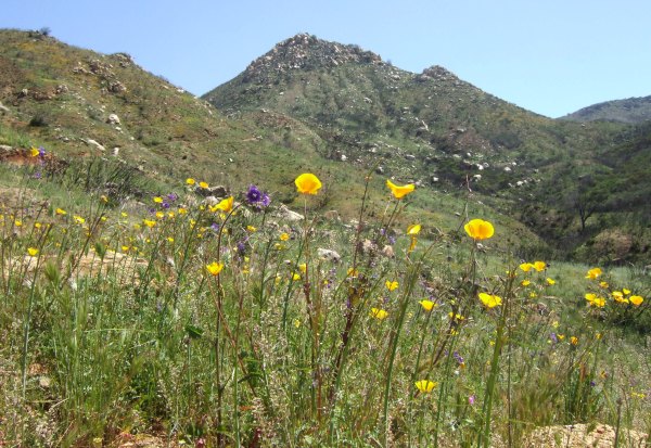
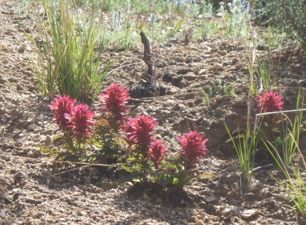
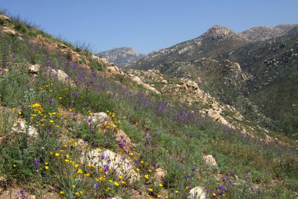
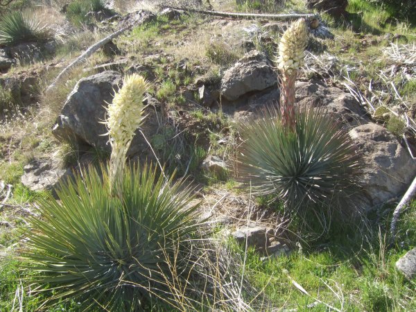
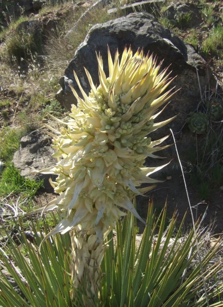
Because the elevation is quite a bit higher in the Bear Valley area, the temperatures haven't been warm enough to urge the wildflowers out yet, however we did see these flowers on the way back. The wind really picked up just as I was trying to take the picture, so I was surprised the picture came out as sharp as it did.
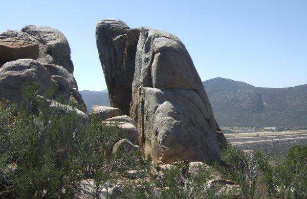
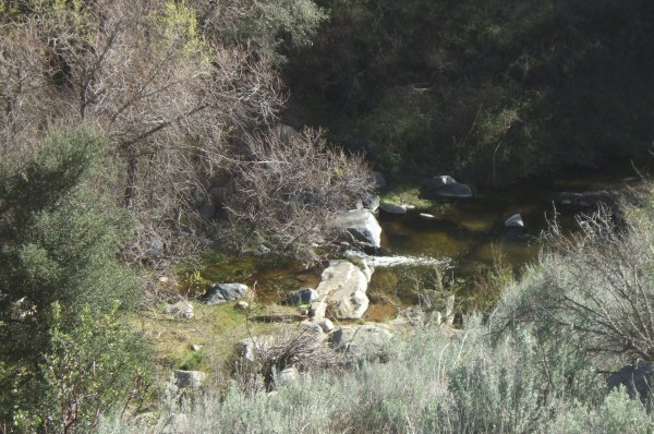
After stopping at the Buckman Springs cache to drop off a couple of Travel Bugs, we drove up the hill towards Sheephead Split Rock. This was the first time in four visits I took time to really enjoy the view from there and take some pictures.
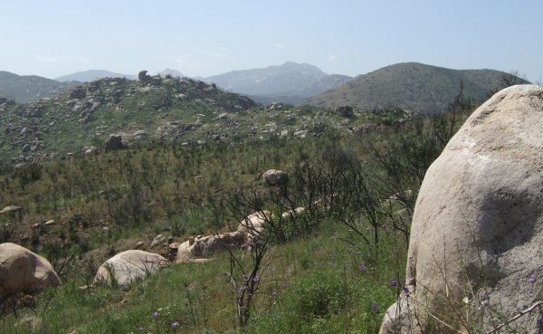
That big mountain in the background is the one Auld Pro and I hiked up in the morning.
From there we drove further up the rough and rocky road to CTYankee9's "Freeway Free Flight." Cuyamaca Mountain is in the far distance.
I got a picture of the two of us near the "edge" where that cache is hidden.

This would have been a good time to have had my walking stick with me, the one that doubles as a monopod for a camera, since it was hard to frame the picture from that low an angle. From "eye level," you can see Buckman Mountain in the picture. At "ankle level," I am blocking the view of the peak . . .
After Auld Pro signed the log and I rehid the container, we found the path back to where the Jeep was waiting and we continued up, up, up some more. I was glad the Jeep was taking us up that steep road. The ammo can cache at the top is an easy find. There were a couple more caches further up the Jeep road, but it was time to call it a day and head back to civilization.
Once again I am very grateful to Auld Pro for providing the transportation, and the wonderful company, for another fun day of caching.
From that location, Auld Pro and I walked up the road to the parking coords Akop&Fam gave for the cache. From there, we walked up the obstacle-laden firebreak, or through the area of burned vegetation scorched in the Pine Valley fire that occurred in the summer of 2007.
This is what the Profile of our hike looked like:
As we climbed up the peak, I took several pictures of the amazing Long Valley Peak.
Near the top of the peak, I took this picture of Auld Pro looking out toward Lake Morena.
At the top of the peak I took several more pictures in different directions.
On the top of the peak, the first thing I noticed was the Benchmark and I stopped to take a picture of it while Auld Pro looked for the Terracache.
Once I got back to the business of looking for the cache, I wandered a bit futher north and spotted the container, an unusual occurrence because Auld Pro usually finds the caches first . . .
The container had some great swag, including a small bottle of Jack Daniels Auld Pro and I shared. It also contained a nice pocket knife, and some other useful items. After we took more pictures of the other two Benchmarks, we headed down the hill towards the Geocache. The Jack Daniels already hit me, because I sort of forgot there was another cache up there to find . . . Consequently, as I stumbled along in a daze, Auld Pro was the first to spot the hiding place and was the official FTF.
Lunch seemed like a good idea, but the breeze was cool there, so we moved back to the lee side of the peak to sit down and have some lunch before heading back down to the Jeep.
Because the elevation is quite a bit higher in the Bear Valley area, the temperatures haven't been warm enough to urge the wildflowers out yet, however we did see these flowers on the way back. The wind really picked up just as I was trying to take the picture, so I was surprised the picture came out as sharp as it did.

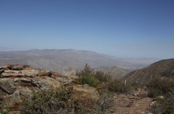
After stopping at the Buckman Springs cache to drop off a couple of Travel Bugs, we drove up the hill towards Sheephead Split Rock. This was the first time in four visits I took time to really enjoy the view from there and take some pictures.
That big mountain in the background is the one Auld Pro and I hiked up in the morning.

From there we drove further up the rough and rocky road to CTYankee9's "Freeway Free Flight." Cuyamaca Mountain is in the far distance.
I got a picture of the two of us near the "edge" where that cache is hidden.
This would have been a good time to have had my walking stick with me, the one that doubles as a monopod for a camera, since it was hard to frame the picture from that low an angle. From "eye level," you can see Buckman Mountain in the picture. At "ankle level," I am blocking the view of the peak . . .
After Auld Pro signed the log and I rehid the container, we found the path back to where the Jeep was waiting and we continued up, up, up some more. I was glad the Jeep was taking us up that steep road. The ammo can cache at the top is an easy find. There were a couple more caches further up the Jeep road, but it was time to call it a day and head back to civilization.
Once again I am very grateful to Auld Pro for providing the transportation, and the wonderful company, for another fun day of caching.
posted by Miragee at
7:59:00 PM
|
0 comments
![]()
![]()


 10-Day Forecast


