Wheeeeuu! What a challenge! What a bushwhack! It was less than four miles, but it took almost six hours to make the hike to the south, and then the north, peaks of Long Valley Peak.
We started out on the adventure at about 9:00 in the morning, first following a dirt track that dead ended at very dense brush. Chuy! had looked at the mountain in Google Earth and had pur a few waypoints for us to follow in his GPSr. These were open areas that, from the satellite image, looked passable . . . So, from the dead end trail, we set out for the first waypoint. There was almost a track along the bottom of the slope, but once we started up, there was no trail . . . we just made our way though the path of least resistance.
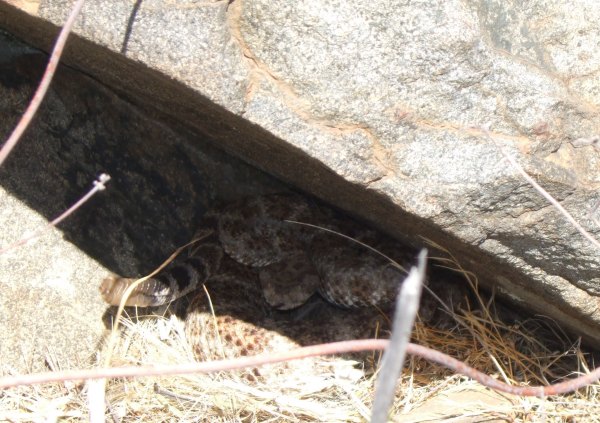
On the south slope, the bushes were small, and we weren't thinking about rattlesnakes. We should have been . . . Chuy! walked past a small bush under which a rattlesnake was resting. That unmistakable sound of the vibrating tail got our attention. As the snake moved away from Chuy!, it moved towards me . . . Then it retreated into this hidey hole.
After that, we continued up, following another waypoint Chuy! had on his GPSr. After struggling through thick brush, we found this long line of huge tumbled boulders. We started up. They were easier to climb than crawling through the chaparral, but some traverses from boulder to boulder were challenging, and scary, for me to navigate.
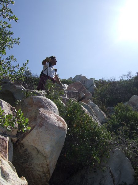
This is an example of what we were up against when we got away from the rocks. Can you see the Geocacher in this picture?
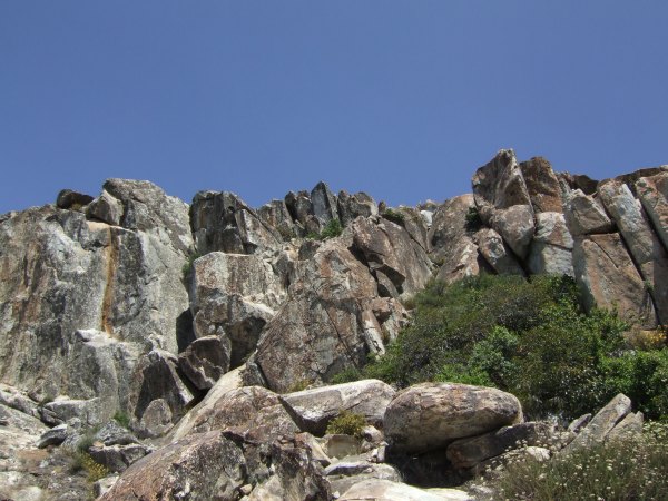
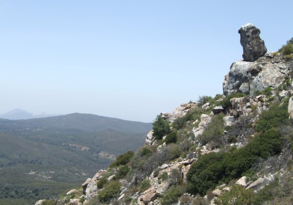
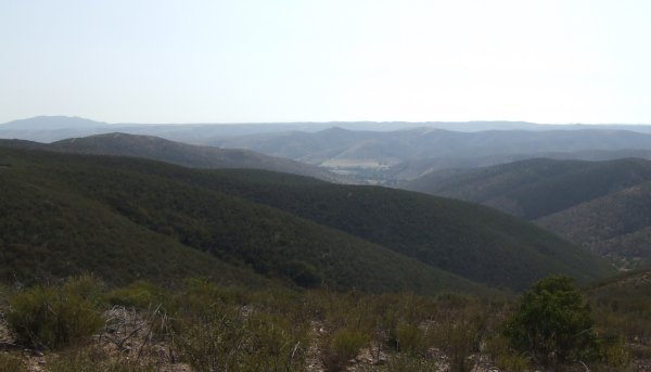
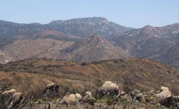
As we climbed higher, I took this picture of our goal.
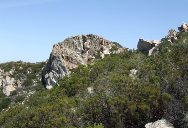
This incredible picture of the peak was taken by T.R. Violin.

I don't know why I never looked over there from the south peak to see the north peak like that. Not having my own photograph makes me want to go back up there again to take a picture from that location.
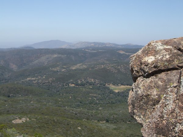
This was another view of the formidable goal we had in front of us.
I had T.R. Violin's "
Long Valley Peak" Terracache in my GPSr, and that is what we aimed for. We were just 400 feet away, then 230 feet away, and then finally, we reached the ridge and only had 100 feet to go to get to the small, easy-to-locate Lock 'n Lock container hidden under a few out-of-place-looking rocks. The log had been signed by two other determined and intrepid cachers, Akop&Fam and SlabyMom. I signed the log, but, forgot to check the first page for the Confimation code, which T.R. Violin shared with me later. It was an apt word . . .
The ridge continued to the south from that cache, so Chuy! and I went down there. Actually, he went first and placed a cache and then hollered the coordinates over to me so I could be a true Beta Tester. For some reason, my GPSr and his were not agreeing. GZ for me was almost 50 feet away to the southwest. Once I got to GZ, I could see the hiding place. We took several more readings with both GPSrs, but my Vista C and his new Venture Cx never did agree . . .
Finally, we had to make our way over to the north peak. The chapparal in the saddle was over six feet tall, but there was a faint trail through the vegetation, so it wasn't nearly as bad to make our way through that 400 feet of chapparal as it had been to make our way through 100 feet of the thickets we traversed on the way up the mountain.
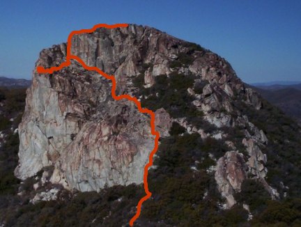
Once we got to the rocks of the north peak, the climb to the top was fun, and easy, relative to what we had been through. This is the approximate route we took to the top. The little spur on the bottom is where I walked to so Chuy! could take a picture of me with a balanced rock in the background.
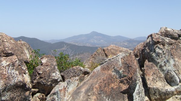
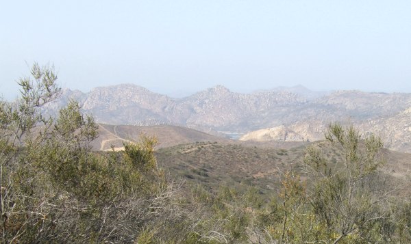
This is one of the pictures I took while making me way to the top. Cuyamaca Peak was nicely-framed by the rocks I was navigating.
Once we got to the top, we commenced our search for the cache. I used the "Match the Coordinates" trick and got to GZ, but we couldn't find the cache. There was no hint, and we didn't know what kind of container we were looking for . . . only that we were looking for a "Small," according to the waypoint name on my GPSr.
After what we thought was a thorough search in that pile of rocks on the top, we made a lifeline call to bradybunchboys. He described the area we had just scoured . . . Following his directions, we found the tin container. We traded a few mememtos of the climb and signed the log. Then, we rehid the container with a few more rocks on it to make it look at bit more like a Geopile. That fits with my motto, "Hard Hike, Easy Find."
I asked Chuy! if he had ordered the helicopter that was to pick us up at the top. He said "No." . . .
Before we began our descent, I took a picture of these two ravens resting on an amazing balanced rock.
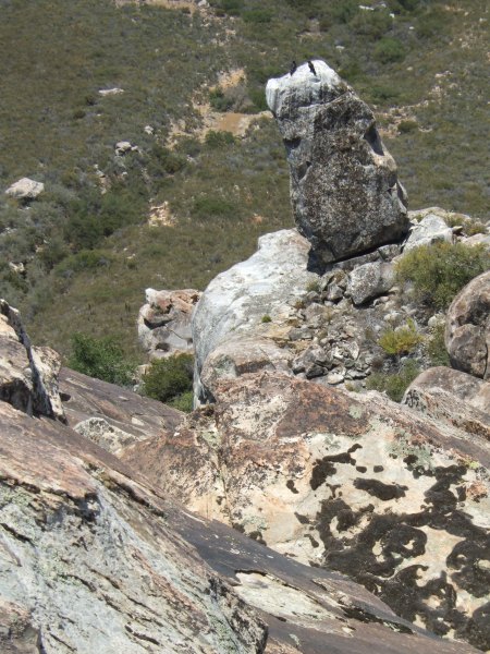
Here is another view of that rock as seen from a location a bit further down the mountain. In the faint background you can barely see Lawson Peak.
The rocks on the peak drop vertically for more than 100 feet, something I discovered after climbing over to an edge for Chuy! to take my picture. I sat there while he took a few pictures, and then when I was getting up, looked over the edge . . . Wow!! Unbelievable. In fact, I couldn't even get Chuy! to look over the edge there . . .
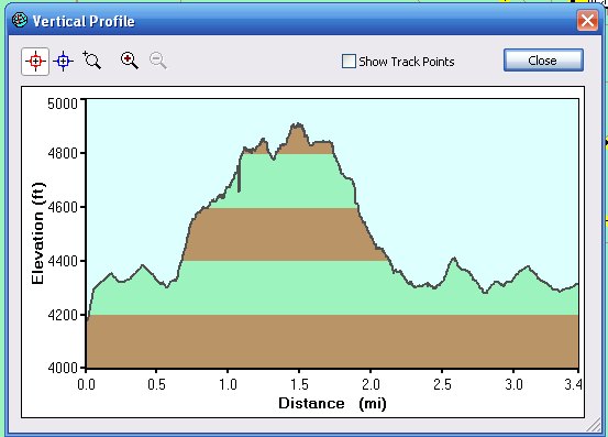
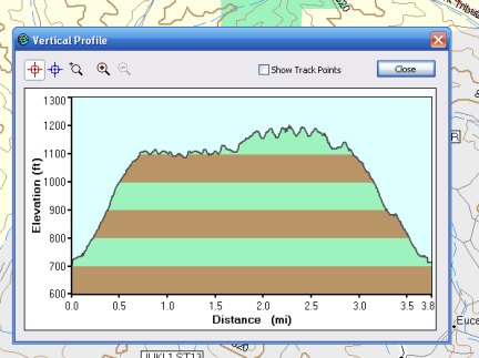
We went back down a different way than we went up as evidenced by the Profile of our hike.
As we were making our way down, including traversing through huge California laurel bushes that looked completely impassible, I commented to Chuy! that I wished I had the writing talent of Tom Wolfe, or Stephen King, so I could describe the experience in a way that a reader would get an idea of what our ordeal was really like.
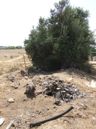
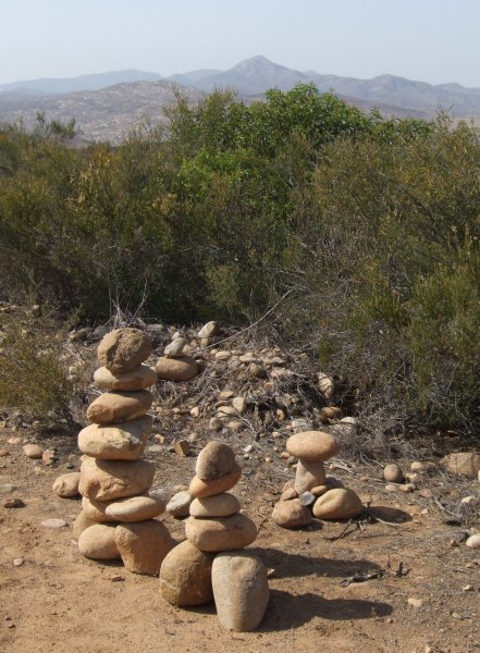
At one point, we stumbled out from the tangled thicket into a small clearing where we found this benchmark.
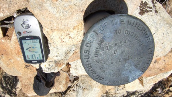
If I had tried to find that benchmark on purpose . . . well, let's just say I would have given up trying. It turned out I couldn't log it on GC.com, but could log it on Terracaching.
We traversed the lower slope and had to bushwhack some on the way back to the vehicle, but that was nothing compared to what we did on the way up the mountain. I kept saying, "We've been through worse than this before." It made me think of how life itself is. By the time many people have reached my age, they have had some really bad experiences in their life. We have to keep hoping the worst is behind us and it won't ever be that bad, ever again. That is the way the return bushwhack was. It was bad, but not as bad as the bushwhack on the way up the peak.
It was a great experience. I loved every minute of it. Embarking on, and completing such a challenge makes me feel alive. When you are trying to grasp little finger holds on huge rocks and find safe places to put your toes to climb over some boulders that span a 30' dropoff, you don't have any other worries to clutter your mind . . .
Taking on a challenge like "
Long Valley Peak 4,906'" is what Geocaching is about for me . . .

 10-Day Forecast


