Some great views along a trail east of Mt. Miguel
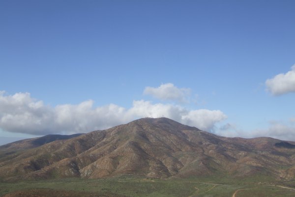
A new cacher placed several caches on a trail off Proctor Valley Road, so I met fisnjack there to make the short hike. On the way up, we stopped and got this view of Mt. Miguel.
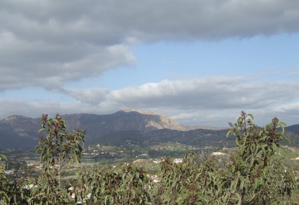
There was a great view of El Cajon Mountain from a point midway up the hill.
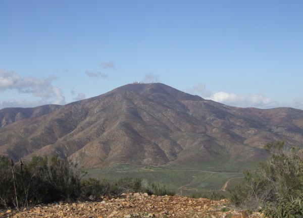
At the very top, this was the view of Mt. Miguel.
As with several of the other caches, the cache at the top was off from GZ by more than 20'. By that time, we had figured out how far, and in which direction, the coordinates were off, so making the find wasn't difficult.
As we hiked from cache to cache, we picked up cans and bottles discarded by the people that have been up these hills ahead of us. In the background of this picture of some pretty flowers I saw after we returned to our vehicles, you might be able to see the two large white plastic bags that were bursting with reclyables.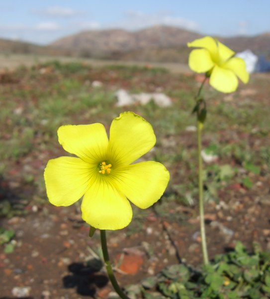
It was a perfect day for this short hike. Some of the caches were a bit further off the trail than I was comfortable with, especially since this area is recovering from the devastating fires that raged over these hills in October 2007. I thought it would have been better for the cache owner, who is a new cacher, to put the caches closer to the trail to prevent "Geotrails" from developing across the new green vegetation.
I guess I shouldn't have written to the cache owner, because he took offense and either Disabled or Archived all his caches, not just the ones that I found on this hill.
In light of what happened out in ABDSP, I think all cache hiders should be more aware of the impact Geocachers might have as they look for their caches. In this area, placing a cache within 30 feet of the trail would not have changed the nature of the hunt or the hike at all.
There was a great view of El Cajon Mountain from a point midway up the hill.
At the very top, this was the view of Mt. Miguel.
As with several of the other caches, the cache at the top was off from GZ by more than 20'. By that time, we had figured out how far, and in which direction, the coordinates were off, so making the find wasn't difficult.
As we hiked from cache to cache, we picked up cans and bottles discarded by the people that have been up these hills ahead of us. In the background of this picture of some pretty flowers I saw after we returned to our vehicles, you might be able to see the two large white plastic bags that were bursting with reclyables.
It was a perfect day for this short hike. Some of the caches were a bit further off the trail than I was comfortable with, especially since this area is recovering from the devastating fires that raged over these hills in October 2007. I thought it would have been better for the cache owner, who is a new cacher, to put the caches closer to the trail to prevent "Geotrails" from developing across the new green vegetation.
I guess I shouldn't have written to the cache owner, because he took offense and either Disabled or Archived all his caches, not just the ones that I found on this hill.
In light of what happened out in ABDSP, I think all cache hiders should be more aware of the impact Geocachers might have as they look for their caches. In this area, placing a cache within 30 feet of the trail would not have changed the nature of the hunt or the hike at all.
posted by Miragee at
4:34:00 PM
|
3 comments
![]()
![]()

 10-Day Forecast


