Two more days of caching and I passed number 700
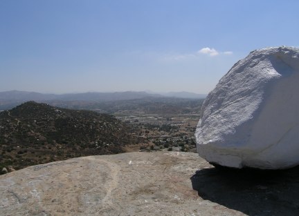
The weather finally cooled off in the East County area so we were able to tackle the steep trail where Harmon hid Nick's Grafitti cache, which has been renamed Nick's White Rock cache, now that the rock has been painted. When we were up there a couple of months ago, we looked and looked for the cache, but since it was nearly dark and we were using our flashlights, we didn't see the little rabbit trail around the back of the rock outcropping where our GPSrs zeroed out.
This time it wasn't hard to find the cache, although a pack rat has certainly decided to camouflage it and cover it up quite thoroughly. Before moving on to the next cache, I took some pictures from the huge rock just above the cache location.
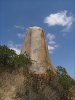
The second of Harmon's new caches is near this fantastic rock monolith.
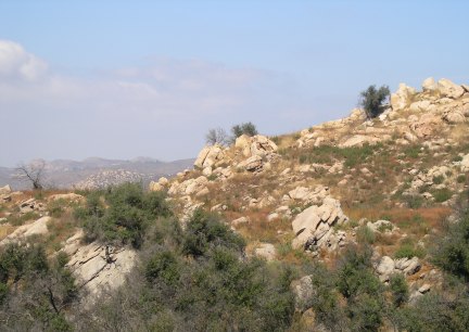
We finally found the last cache on that rocky hill, one placed by T.R. Violin. I bushwacked down to it, but on the way collected quite a few cans and bottles left behind by all the people who go up there to party. The route we took went down the steep south slope and the trail we were on joined up with the trail we started on right next to a sign that said "No Trespassing." Whoops. Too bad they don't have signs up at the top of the obviously well-trailed trail . . .
The last place we went Tuesday was the Mission Trails Regional Park (MTRP). There were three caches placed fairly close together, if you find the right trail. This is what our track looked like. We walked about half a mile, and up several hundred feet of elevation, to get to a cache we were only 300 feet away from when we were at "North."

- - - - - - - - - - - - - -
Wednesday we started out at Oakoasis, a wonderful set of trails we hiked a couple of months ago.
There were three caches placed there after we found the other series. All the caches show up, along with our most recent track through the park on this image.

After the couple hour hike we made our way to the east county where we found a few more caches, including my #700 . . . which just happened to be a somewhat lame parking lot micro. Oh well . . .
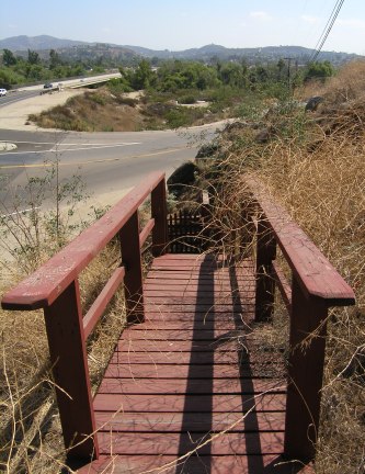
Stairway to Nowhere cache location
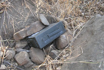
This is how we found one cache in a large park. The cache owner hadn't even painted over the markings on the can. When we rehid it, we covered it completely with rocks so it couldn't be seen as easily by a casual hiker.

This was a really cool waterfall in the Flinn Springs County park where the All-Star baseball cache was located.
This time it wasn't hard to find the cache, although a pack rat has certainly decided to camouflage it and cover it up quite thoroughly. Before moving on to the next cache, I took some pictures from the huge rock just above the cache location.
The second of Harmon's new caches is near this fantastic rock monolith.
We finally found the last cache on that rocky hill, one placed by T.R. Violin. I bushwacked down to it, but on the way collected quite a few cans and bottles left behind by all the people who go up there to party. The route we took went down the steep south slope and the trail we were on joined up with the trail we started on right next to a sign that said "No Trespassing." Whoops. Too bad they don't have signs up at the top of the obviously well-trailed trail . . .
The last place we went Tuesday was the Mission Trails Regional Park (MTRP). There were three caches placed fairly close together, if you find the right trail. This is what our track looked like. We walked about half a mile, and up several hundred feet of elevation, to get to a cache we were only 300 feet away from when we were at "North."
- - - - - - - - - - - - - -
Wednesday we started out at Oakoasis, a wonderful set of trails we hiked a couple of months ago.
There were three caches placed there after we found the other series. All the caches show up, along with our most recent track through the park on this image.
After the couple hour hike we made our way to the east county where we found a few more caches, including my #700 . . . which just happened to be a somewhat lame parking lot micro. Oh well . . .
Stairway to Nowhere cache location
This is how we found one cache in a large park. The cache owner hadn't even painted over the markings on the can. When we rehid it, we covered it completely with rocks so it couldn't be seen as easily by a casual hiker.
This was a really cool waterfall in the Flinn Springs County park where the All-Star baseball cache was located.
posted by Miragee at
11:59:00 AM
|
0 comments
![]()
![]()


 10-Day Forecast


